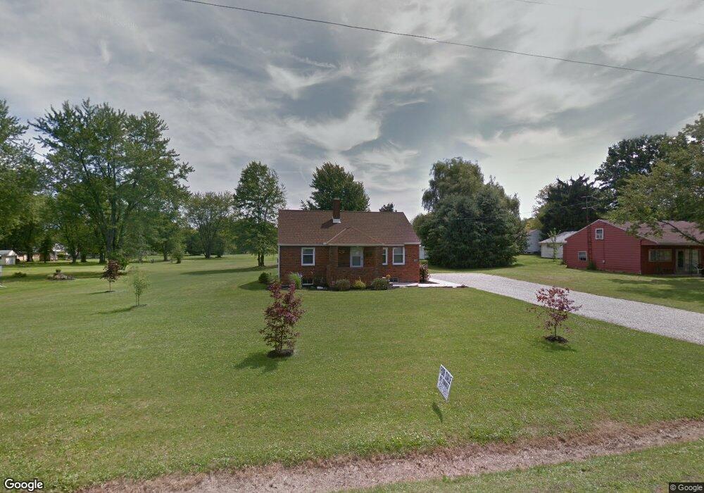
822 Unity Dr Mansfield, OH 44905
Estimated Value: $128,920 - $151,000
2
Beds
1
Bath
945
Sq Ft
$149/Sq Ft
Est. Value
About This Home
This home is located at 822 Unity Dr, Mansfield, OH 44905 and is currently estimated at $140,980, approximately $149 per square foot. 822 Unity Dr is a home located in Richland County with nearby schools including Madison High School, St. Mary Catholic School, and Temple-Christian School.
Ownership History
Date
Name
Owned For
Owner Type
Purchase Details
Closed on
Nov 12, 2004
Sold by
Schmidt Stephen
Bought by
Schmidt Robert James
Current Estimated Value
Home Financials for this Owner
Home Financials are based on the most recent Mortgage that was taken out on this home.
Original Mortgage
$50,000
Outstanding Balance
$27,750
Interest Rate
7.5%
Mortgage Type
Purchase Money Mortgage
Estimated Equity
$113,230
Purchase Details
Closed on
Jun 4, 1998
Sold by
Schmidt Lucille
Bought by
Schmidt Stephen
Create a Home Valuation Report for This Property
The Home Valuation Report is an in-depth analysis detailing your home's value as well as a comparison with similar homes in the area
Home Values in the Area
Average Home Value in this Area
Purchase History
| Date | Buyer | Sale Price | Title Company |
|---|---|---|---|
| Schmidt Robert James | $66,000 | Christopher Land Title Inc | |
| Schmidt Stephen | $43,900 | -- |
Source: Public Records
Mortgage History
| Date | Status | Borrower | Loan Amount |
|---|---|---|---|
| Open | Schmidt Robert James | $50,000 |
Source: Public Records
Tax History
| Year | Tax Paid | Tax Assessment Tax Assessment Total Assessment is a certain percentage of the fair market value that is determined by local assessors to be the total taxable value of land and additions on the property. | Land | Improvement |
|---|---|---|---|---|
| 2024 | $1,595 | $32,900 | $8,310 | $24,590 |
| 2023 | $1,626 | $32,900 | $8,310 | $24,590 |
| 2022 | $1,281 | $22,880 | $7,420 | $15,460 |
| 2021 | $1,278 | $22,880 | $7,420 | $15,460 |
| 2020 | $1,288 | $22,880 | $7,420 | $15,460 |
| 2019 | $1,229 | $19,390 | $6,290 | $13,100 |
| 2018 | $1,698 | $19,390 | $6,290 | $13,100 |
| 2017 | $1,166 | $19,390 | $6,290 | $13,100 |
| 2016 | $1,011 | $16,670 | $8,740 | $7,930 |
| 2015 | $965 | $16,670 | $8,740 | $7,930 |
| 2014 | $962 | $16,670 | $8,740 | $7,930 |
| 2012 | $478 | $17,540 | $9,190 | $8,350 |
Source: Public Records
Map
Nearby Homes
- 811 Mayflower Ave
- 888 Beal Rd
- 683 Coachman Rd
- 632 Coachman Rd
- 1226 Evergreen Ave W
- 602 Champion Rd
- 690 Ashland Rd
- 1217 Evergreen Ave W
- 1674 Honeysuckle Dr
- 644 Skyline Rd
- 615 Champion Rd
- 646 Fleetwood Rd
- 1168 ConcheMcO St
- 607 Skyline Rd
- 0 Lenox Ave
- 943 Yale Ave
- 1476 Park Ave E
- 620 Running Brook Way
- 1359 N Stewart Rd
- 1990 Woodmont Rd
- 812 Unity Dr
- 814 Unity Dr
- 836 Unity Dr
- 813 Unity Dr
- 0 812 Unit y Dr 9054567
- 821 Unity Dr
- 1489 Timber Rd
- 831 Unity Dr
- 843 Unity Dr
- 1505 Timber Rd
- 801 Unity Dr
- 0 Ashland Rd Grace St Unit 9040757
- 1484 Victory St
- 1494 Victory St
- 853 Unity Dr
- 1502 Victory St
- 861 Unity Dr
- 1511 Timber Rd
- 1500 Timber Rd
- 0 Timber Rd
Your Personal Tour Guide
Ask me questions while you tour the home.