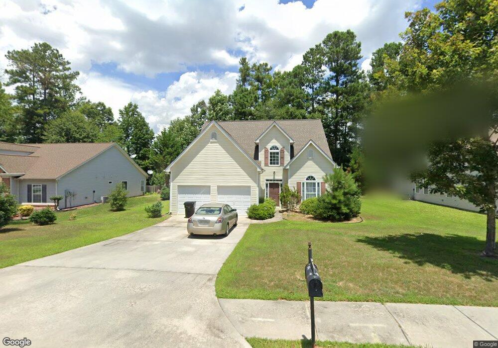
8220 Mayfern Dr Fairburn, GA 30213
Estimated Value: $281,000 - $307,000
3
Beds
3
Baths
2,237
Sq Ft
$133/Sq Ft
Est. Value
About This Home
This home is located at 8220 Mayfern Dr, Fairburn, GA 30213 and is currently estimated at $297,754, approximately $133 per square foot. 8220 Mayfern Dr is a home located in Fulton County with nearby schools including Oakley Elementary School, Bear Creek Middle School, and Creekside High School.
Ownership History
Date
Name
Owned For
Owner Type
Purchase Details
Closed on
Mar 6, 2012
Sold by
Associated Partners Llc
Bought by
Childs Frederick A
Current Estimated Value
Purchase Details
Closed on
Nov 12, 2010
Sold by
Levying Officer Of Fulton Cnty
Bought by
Associated Partners
Purchase Details
Closed on
Mar 24, 2004
Sold by
Dr Horton Inc
Bought by
Childs Frederick A
Home Financials for this Owner
Home Financials are based on the most recent Mortgage that was taken out on this home.
Original Mortgage
$144,541
Interest Rate
5.53%
Mortgage Type
VA
Create a Home Valuation Report for This Property
The Home Valuation Report is an in-depth analysis detailing your home's value as well as a comparison with similar homes in the area
Home Values in the Area
Average Home Value in this Area
Purchase History
| Date | Buyer | Sale Price | Title Company |
|---|---|---|---|
| Childs Frederick A | $70,000 | -- | |
| Associated Partners | $41,000 | -- | |
| Childs Frederick A | $149,900 | -- |
Source: Public Records
Mortgage History
| Date | Status | Borrower | Loan Amount |
|---|---|---|---|
| Previous Owner | Childs Frederick A | $144,541 |
Source: Public Records
Tax History Compared to Growth
Tax History
| Year | Tax Paid | Tax Assessment Tax Assessment Total Assessment is a certain percentage of the fair market value that is determined by local assessors to be the total taxable value of land and additions on the property. | Land | Improvement |
|---|---|---|---|---|
| 2025 | $1,017 | $106,480 | $31,120 | $75,360 |
| 2023 | $3,006 | $106,480 | $31,120 | $75,360 |
| 2022 | $2,351 | $89,360 | $18,200 | $71,160 |
| 2021 | $1,960 | $72,240 | $11,560 | $60,680 |
| 2020 | $1,603 | $57,680 | $8,560 | $49,120 |
| 2019 | $541 | $56,640 | $8,400 | $48,240 |
| 2018 | $1,313 | $46,520 | $6,200 | $40,320 |
| 2017 | $817 | $27,992 | $1,632 | $26,360 |
| 2016 | $817 | $27,990 | $1,630 | $26,360 |
| 2015 | $820 | $27,990 | $1,630 | $26,360 |
| 2014 | $858 | $27,990 | $1,630 | $26,360 |
Source: Public Records
Map
Nearby Homes
- 8210 Mayfern Dr
- 8230 Mayfern Dr
- 113 Meadow Ct
- 0 Camp Hill Ct Unit 8690996
- 0 Camp Hill Ct
- 115 Meadow Ct
- 8200 Mayfern Dr
- 8240 Mayfern Dr
- 109 Meadow Ct
- 117 Meadow Ct
- 8225 Mayfern Dr
- 107 Meadow Ct
- 8235 Mayfern Dr
- 0 Mayfern Dr Unit 8788920
- 0 Mayfern Dr Unit 8011829
- 0 Mayfern Dr Unit 8777049
- 0 Mayfern Dr Unit 8551802
- 0 Mayfern Dr Unit 7332050
- 0 Mayfern Dr Unit 2652761