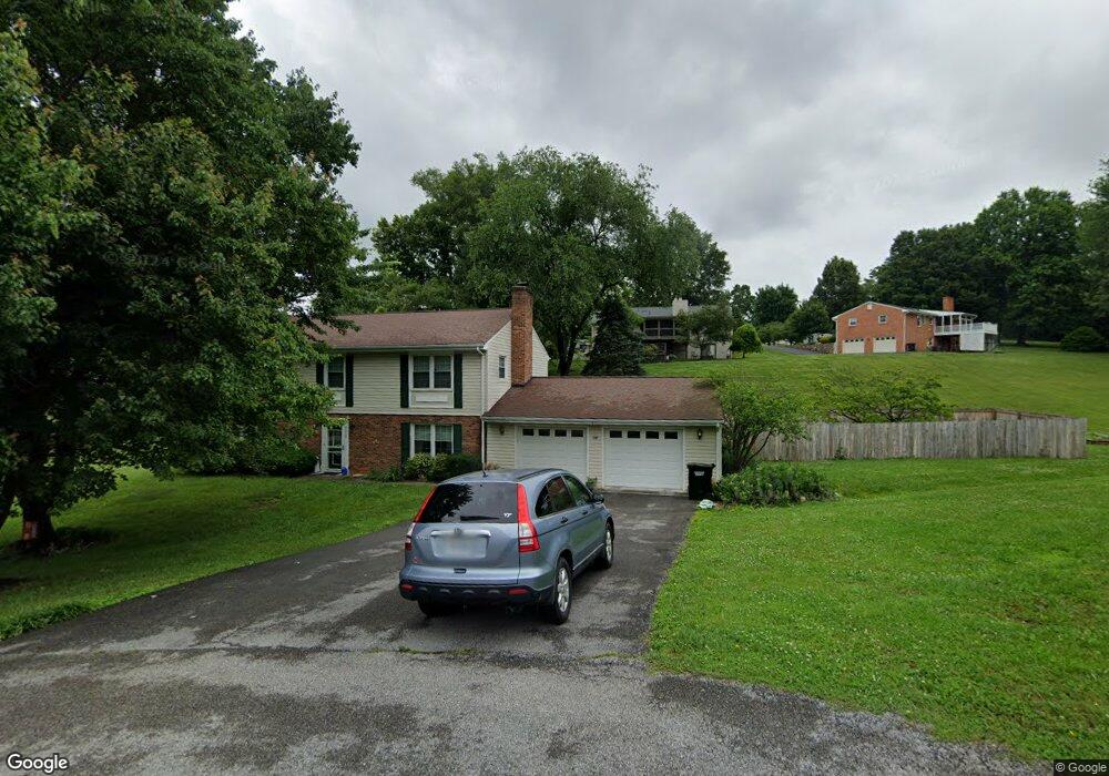
8220 Sundance Cir Roanoke, VA 24019
Estimated Value: $318,194 - $400,000
4
Beds
3
Baths
1,800
Sq Ft
$197/Sq Ft
Est. Value
About This Home
This home is located at 8220 Sundance Cir, Roanoke, VA 24019 and is currently estimated at $353,799, approximately $196 per square foot. 8220 Sundance Cir is a home located in Roanoke County with nearby schools including Mountain View Elementary School, Northside Middle School, and Northside High School.
Ownership History
Date
Name
Owned For
Owner Type
Purchase Details
Closed on
Jul 18, 2006
Sold by
Lane Robert P and Lane Patricia A
Bought by
Mcdonald Pamela H and Mcdonald Christopher D
Current Estimated Value
Home Financials for this Owner
Home Financials are based on the most recent Mortgage that was taken out on this home.
Original Mortgage
$152,000
Outstanding Balance
$90,488
Interest Rate
6.7%
Mortgage Type
New Conventional
Estimated Equity
$263,311
Create a Home Valuation Report for This Property
The Home Valuation Report is an in-depth analysis detailing your home's value as well as a comparison with similar homes in the area
Home Values in the Area
Average Home Value in this Area
Purchase History
| Date | Buyer | Sale Price | Title Company |
|---|---|---|---|
| Mcdonald Pamela H | $190,000 | None Available |
Source: Public Records
Mortgage History
| Date | Status | Borrower | Loan Amount |
|---|---|---|---|
| Open | Mcdonald Pamela H | $152,000 |
Source: Public Records
Tax History Compared to Growth
Tax History
| Year | Tax Paid | Tax Assessment Tax Assessment Total Assessment is a certain percentage of the fair market value that is determined by local assessors to be the total taxable value of land and additions on the property. | Land | Improvement |
|---|---|---|---|---|
| 2025 | $2,569 | $249,400 | $41,000 | $208,400 |
| 2024 | $2,451 | $235,700 | $41,000 | $194,700 |
| 2023 | $2,438 | $230,000 | $41,000 | $189,000 |
| 2022 | $2,340 | $214,700 | $41,000 | $173,700 |
| 2021 | $2,251 | $206,500 | $40,000 | $166,500 |
| 2020 | $2,171 | $199,200 | $39,000 | $160,200 |
| 2019 | $2,134 | $195,800 | $39,000 | $156,800 |
| 2018 | $2,047 | $190,400 | $37,000 | $153,400 |
| 2017 | $2,047 | $187,800 | $36,000 | $151,800 |
| 2016 | $2,047 | $187,800 | $36,000 | $151,800 |
| 2015 | $2,027 | $186,000 | $36,000 | $150,000 |
| 2014 | $2,027 | $186,000 | $36,000 | $150,000 |
Source: Public Records
Map
Nearby Homes
- 8199 Ashton Ln
- 0 Sanderson Dr
- 1429 Crutchfield St
- 1336 Crutchfield St
- 39 Ventura Ct
- 8525 Muirfield Cir
- 8416 Stoney Corner Ln
- 8531 Muirfield Cir
- 8146 Williamson Rd
- 310 Stoneledge Dr
- 7002 Brookview Rd
- 8602 Sanderson Dr
- 839 Clearwater Ave
- 415 Stoneledge Dr
- 110 Barbara Ln
- 735 Goodland Ave
- 270 Tinkerview Dr
- 168 Tinkerview Dr Unit 904
- 111 Tinkerview Dr Unit 605
- 10 Tinkerview Dr Unit C2
- 8228 Sundance Cir
- 8215 Waterfall Dr
- 8208 Sundance Cir
- 8225 Waterfall Dr
- 8245 Waterfall Dr
- 8221 Sundance Cir
- 8213 Sundance Cir
- 8227 Sundance Cir
- 8210 Waterfall Dr
- 8202 Waterfall Dr
- 8226 Waterfall Dr
- 8171 Waterfall Dr
- 8218 Waterfall Dr
- 8174 Waterfall Dr
- 8244 Waterfall Dr
- 8234 Waterfall Dr
- 8240 Waterfall Dr
- 8168 Waterfall Dr
- 8163 Waterfall Dr
- 8160 Waterfall Dr