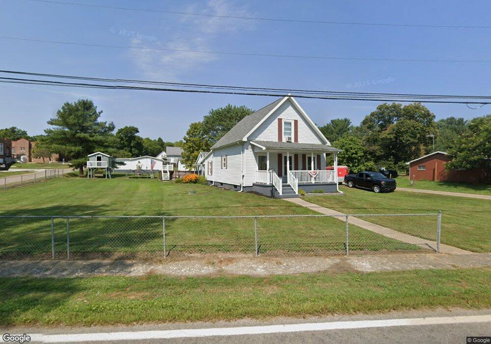
8221 State Route 329 Stewart, OH 45778
Estimated Value: $84,841 - $159,000
3
Beds
1
Bath
1,229
Sq Ft
$96/Sq Ft
Est. Value
About This Home
This home is located at 8221 State Route 329, Stewart, OH 45778 and is currently estimated at $118,460, approximately $96 per square foot. 8221 State Route 329 is a home with nearby schools including Coolville Elementary School, Amesville Elementary School, and Federal Hocking Middle School.
Ownership History
Date
Name
Owned For
Owner Type
Purchase Details
Closed on
Aug 27, 2022
Sold by
Buck Larry A and Buck Kecia D
Bought by
King Greg and King Lisa
Current Estimated Value
Purchase Details
Closed on
Jul 12, 2012
Sold by
Buck Larry A and Buck Kecia D
Bought by
King Greg
Home Financials for this Owner
Home Financials are based on the most recent Mortgage that was taken out on this home.
Original Mortgage
$36,000
Interest Rate
3.64%
Mortgage Type
Seller Take Back
Purchase Details
Closed on
Apr 4, 2007
Sold by
Tabler Lana L and Citifinancial Inc
Bought by
Buck Larry A and Buck Kecia D
Purchase Details
Closed on
May 1, 1989
Create a Home Valuation Report for This Property
The Home Valuation Report is an in-depth analysis detailing your home's value as well as a comparison with similar homes in the area
Home Values in the Area
Average Home Value in this Area
Purchase History
| Date | Buyer | Sale Price | Title Company |
|---|---|---|---|
| King Greg | $41,000 | None Listed On Document | |
| King Greg | $41,000 | Attorney | |
| Buck Larry A | $6,218 | None Available | |
| -- | $26,000 | -- |
Source: Public Records
Mortgage History
| Date | Status | Borrower | Loan Amount |
|---|---|---|---|
| Previous Owner | King Greg | $36,000 |
Source: Public Records
Tax History Compared to Growth
Tax History
| Year | Tax Paid | Tax Assessment Tax Assessment Total Assessment is a certain percentage of the fair market value that is determined by local assessors to be the total taxable value of land and additions on the property. | Land | Improvement |
|---|---|---|---|---|
| 2024 | $1,159 | $20,680 | $1,250 | $19,430 |
| 2023 | $1,115 | $20,680 | $1,250 | $19,430 |
| 2022 | $1,136 | $19,920 | $1,000 | $18,920 |
| 2021 | $1,126 | $19,920 | $1,000 | $18,920 |
| 2020 | $1,090 | $19,920 | $1,000 | $18,920 |
| 2019 | $1,053 | $18,430 | $940 | $17,490 |
| 2018 | $1,033 | $18,430 | $940 | $17,490 |
| 2017 | $1,348 | $18,430 | $940 | $17,490 |
| 2016 | $963 | $17,150 | $860 | $16,290 |
| 2015 | $1,201 | $17,150 | $860 | $16,290 |
| 2014 | $1,201 | $17,150 | $860 | $16,290 |
| 2013 | $924 | $13,820 | $860 | $12,960 |
Source: Public Records
Map
Nearby Homes
- 0 E Copeland Rd Unit 2434030
- 5232 Bethany Ridge Rd
- 6104 Boyer Rd
- 17777 Mush Run Rd
- 23170 Jordan Run Rd
- 0 Mountain Bell Rd Unit 2434025
- 3200 Lottridge Rd
- 2500 Robert Kelly Rd
- 22775 Mayle Ridge Rd
- State Route 550
- 14300 Coolville Ridge Rd
- 0 Ohio 550
- 0 Ohio 329
- 6750 O'Neil Rd
- 14240 Della Dr
- 14300 N Coolville Ridge Rd
- 1105 Dutch Ridge Rd
- 1022 Tullis Rd
- 15901 Lathrop Rd
- 25960 Rock St
- 8241 State Route 329
- 8200 State Route 329
- 8248 Ohio 329
- 20874 Jefferson St
- 329 Sr
- 11081 Ohio 329
- 20865 Jefferson St
- 8184 State Route 329
- 20855 Jefferson St
- 8209 Main St
- 8235 Main St
- 8163 State Route 329
- 8249 Main St
- 8276 State Route 329
- 20954 Elm St
- 8153 State Route 329
- 20844 Fairfax St
- 11800 Ohio 329
- 0 Ohio 329
- 20925 Elm St