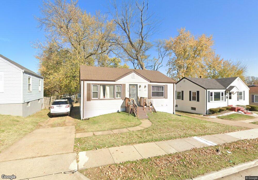
8223 Airport Rd Saint Louis, MO 63134
Estimated Value: $84,000 - $93,000
2
Beds
2
Baths
792
Sq Ft
$112/Sq Ft
Est. Value
About This Home
This home is located at 8223 Airport Rd, Saint Louis, MO 63134 and is currently estimated at $88,947, approximately $112 per square foot. 8223 Airport Rd is a home located in St. Louis County with nearby schools including Berkeley Elementary School, STEAM Academy at McCluer South-Berkeley High School, and Blessed Teresa of Calcutta Catholic School.
Ownership History
Date
Name
Owned For
Owner Type
Purchase Details
Closed on
Feb 8, 2019
Sold by
Bronson Read Estate Llc
Bought by
Moses Nita
Current Estimated Value
Purchase Details
Closed on
Dec 30, 2008
Sold by
Tmk Real Estate Llc
Bought by
Bronson Real Estate Llc
Purchase Details
Closed on
May 10, 2005
Sold by
Kiely Thomas
Bought by
Tmk Real Estate Llc
Purchase Details
Closed on
Mar 14, 2002
Sold by
Mccafferty Hemphill Marilyn D
Bought by
Kiely Thomas
Purchase Details
Closed on
Sep 16, 2000
Sold by
Mccafferty John L
Bought by
Mccafferty Hemphill Marilyn D
Create a Home Valuation Report for This Property
The Home Valuation Report is an in-depth analysis detailing your home's value as well as a comparison with similar homes in the area
Home Values in the Area
Average Home Value in this Area
Purchase History
| Date | Buyer | Sale Price | Title Company |
|---|---|---|---|
| Moses Nita | -- | None Available | |
| Bronson Real Estate Llc | -- | It | |
| Tmk Real Estate Llc | -- | -- | |
| Kiely Thomas | $20,000 | -- | |
| Mccafferty Hemphill Marilyn D | -- | -- |
Source: Public Records
Tax History Compared to Growth
Tax History
| Year | Tax Paid | Tax Assessment Tax Assessment Total Assessment is a certain percentage of the fair market value that is determined by local assessors to be the total taxable value of land and additions on the property. | Land | Improvement |
|---|---|---|---|---|
| 2025 | $733 | $11,390 | $1,050 | $10,340 |
| 2024 | $733 | $9,390 | $1,390 | $8,000 |
| 2023 | $724 | $9,390 | $1,390 | $8,000 |
| 2022 | $574 | $6,430 | $1,050 | $5,380 |
| 2021 | $570 | $6,430 | $1,050 | $5,380 |
| 2020 | $640 | $6,760 | $1,060 | $5,700 |
| 2019 | $613 | $6,760 | $1,060 | $5,700 |
| 2018 | $571 | $5,660 | $1,060 | $4,600 |
| 2017 | $568 | $5,660 | $1,060 | $4,600 |
| 2016 | $917 | $8,990 | $1,410 | $7,580 |
| 2015 | $890 | $8,990 | $1,410 | $7,580 |
| 2014 | $837 | $8,420 | $910 | $7,510 |
Source: Public Records
Map
Nearby Homes
- 8306 Whitewater Dr
- 8219 Davenport Dr
- 8235 Zoe Dr
- 8042 Patterson Dr
- 6106 Jackson Ave
- 8140 Packard Ave
- 6135 Shillington Dr
- 6315 Washington Ave
- 6029 Washington Ave
- 8027 Aline Ave
- 6315 Jackson Ave
- 6153 Hancock Ave
- 6005 Shillington Dr
- 6016 Shillington Dr
- 6029 Evergreen Blvd
- 117 Henquin Dr
- 324 Newell Dr
- 213 Henquin Dr
- 116 Henquin Dr
- 5948 Madison Ave
- 8227 Airport Rd
- 8219 Airport Rd
- 8215 Airport Rd
- 8244 Canyon Dr
- 8240 Canyon Dr
- 8211 Airport Rd
- 8220 Airport Rd
- 6301 Abbott Dr
- 8236 Canyon Dr
- 8230 Airport Rd
- 8234 Airport Rd
- 8207 Airport Rd
- 8232 Canyon Dr
- 8309 Fairbanks Dr
- 6303 Abbott Dr
- 8201 Airport Rd
- 8306 Fairbanks Dr
- 8301 Whitewater Dr
- 6207 Fay Dr
- 8315 Fairbanks Dr