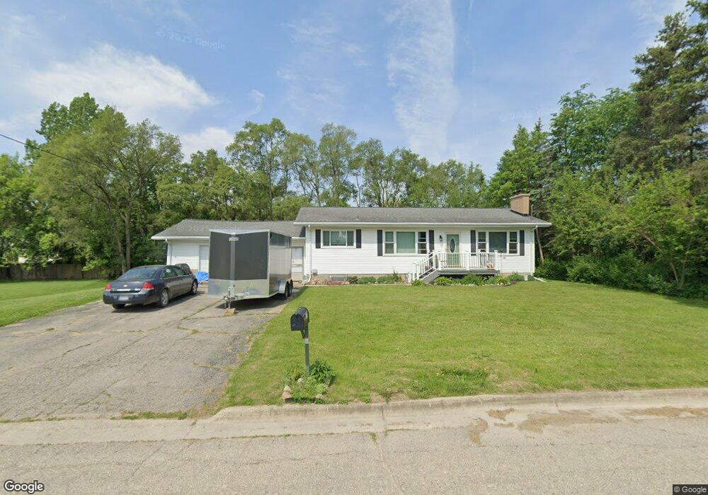
8225 Benson Rd Mount Morris, MI 48458
Estimated Value: $112,000 - $165,736
Studio
--
Bath
--
Sq Ft
15,682
Sq Ft Lot
About This Home
This home is located at 8225 Benson Rd, Mount Morris, MI 48458 and is currently estimated at $142,684. 8225 Benson Rd is a home located in Genesee County with nearby schools including Elisabeth Ann Johnson High School and St. Mary's School.
Ownership History
Date
Name
Owned For
Owner Type
Purchase Details
Closed on
Feb 24, 2023
Sold by
Patricia L Weir Living Trust
Bought by
Gilbert Steven R
Current Estimated Value
Purchase Details
Closed on
Jul 11, 2018
Sold by
Gilbert Kevin and Weir Patrica
Bought by
Weir Patricia L
Purchase Details
Closed on
Jul 13, 2006
Sold by
Brown Rosalie and Brown Hairell
Bought by
Weir Patricia and Gilbert Kevin
Home Financials for this Owner
Home Financials are based on the most recent Mortgage that was taken out on this home.
Original Mortgage
$67,840
Interest Rate
6.83%
Mortgage Type
New Conventional
Create a Home Valuation Report for This Property
The Home Valuation Report is an in-depth analysis detailing your home's value as well as a comparison with similar homes in the area
Home Values in the Area
Average Home Value in this Area
Purchase History
| Date | Buyer | Sale Price | Title Company |
|---|---|---|---|
| Gilbert Steven R | $33,144 | Select Title | |
| Weir Patricia L | -- | None Available | |
| Weir Patricia | $84,800 | Commonwe |
Source: Public Records
Mortgage History
| Date | Status | Borrower | Loan Amount |
|---|---|---|---|
| Previous Owner | Weir Patricia | $67,840 |
Source: Public Records
Tax History
| Year | Tax Paid | Tax Assessment Tax Assessment Total Assessment is a certain percentage of the fair market value that is determined by local assessors to be the total taxable value of land and additions on the property. | Land | Improvement |
|---|---|---|---|---|
| 2025 | $2,027 | $78,000 | $0 | $0 |
| 2024 | $471 | $75,400 | $0 | $0 |
| 2023 | $450 | $58,300 | $0 | $0 |
| 2022 | $1,838 | $50,800 | $0 | $0 |
| 2021 | $1,825 | $50,000 | $0 | $0 |
| 2020 | $408 | $50,200 | $0 | $0 |
| 2019 | $402 | $45,300 | $0 | $0 |
| 2018 | $1,584 | $43,900 | $0 | $0 |
| 2017 | $1,523 | $42,700 | $0 | $0 |
| 2016 | $1,511 | $36,300 | $0 | $0 |
| 2015 | $1,324 | $32,700 | $0 | $0 |
| 2014 | $380 | $33,000 | $0 | $0 |
| 2012 | -- | $37,700 | $37,700 | $0 |
Source: Public Records
Map
Nearby Homes
- 8250 Rockwood Ave
- 8151 Benson Rd
- 8190 Roosevelt Ave
- 12210 W Washington Ave
- 1095 Pine St
- 1063 W Pine Ave
- 1051 Pinehurst Blvd
- 643 Roosevelt Ave
- V/L Washington Ave
- 328 W Mount Morris St
- 5372 W Mount Morris Rd
- 1477 W Mt Morris Rd
- 1501 Mount Morris Rd
- 1053 Wisner St
- 4181 E Mount Morris Rd
- 11916 Saginaw St
- 335 Beach St
- V/L Saginaw St
- 1032 Maginn Ct
- 5045 Nadie Dr
- 12316 Benson Rd
- 12316 Benson Rd
- 8239 Benson Rd
- 8208 Rockwood Ave
- 8202 Rockwood Ave
- 12322 Benson Rd
- 337 Wilson Ave
- 1336 Lincoln Ave
- 8253 Benson Rd
- 8225 Rockwood Ave
- 8215 Rockwood Ave
- 8190 Rockwood Ave
- 8205 Rockwood Ave
- 8254 Rockwood Ave
- 8231 Rockwood Ave
- 318 Wilson Ave
- 318 Wilson Ave
- 324 Wilson Ave
- 1344 Lincoln Ave
- 1331 Lincoln Ave
Your Personal Tour Guide
Ask me questions while you tour the home.