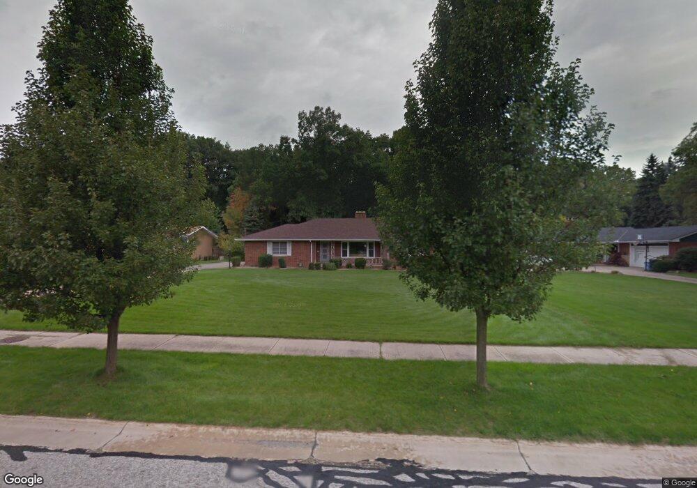
8225 Dalebrook Rd Independence, OH 44131
Estimated Value: $359,000 - $457,000
2
Beds
3
Baths
1,848
Sq Ft
$212/Sq Ft
Est. Value
About This Home
This home is located at 8225 Dalebrook Rd, Independence, OH 44131 and is currently estimated at $392,293, approximately $212 per square foot. 8225 Dalebrook Rd is a home located in Cuyahoga County with nearby schools including Independence Primary School, Independence Middle School, and Independence High School.
Ownership History
Date
Name
Owned For
Owner Type
Purchase Details
Closed on
Jul 19, 1985
Sold by
Farkas Anna
Bought by
Edward M Lekan
Current Estimated Value
Purchase Details
Closed on
Dec 7, 1982
Sold by
Farkas David D and Farkas Anna
Bought by
Farkas Anna
Purchase Details
Closed on
Jan 1, 1975
Bought by
Farkas David D and Farkas Anna
Create a Home Valuation Report for This Property
The Home Valuation Report is an in-depth analysis detailing your home's value as well as a comparison with similar homes in the area
Home Values in the Area
Average Home Value in this Area
Purchase History
| Date | Buyer | Sale Price | Title Company |
|---|---|---|---|
| Edward M Lekan | $120,000 | -- | |
| Farkas Anna | -- | -- | |
| Farkas David D | -- | -- |
Source: Public Records
Tax History Compared to Growth
Tax History
| Year | Tax Paid | Tax Assessment Tax Assessment Total Assessment is a certain percentage of the fair market value that is determined by local assessors to be the total taxable value of land and additions on the property. | Land | Improvement |
|---|---|---|---|---|
| 2024 | $5,507 | $115,150 | $30,240 | $84,910 |
| 2023 | $4,528 | $86,030 | $21,140 | $64,890 |
| 2022 | $4,503 | $86,030 | $21,140 | $64,890 |
| 2021 | $4,438 | $86,030 | $21,140 | $64,890 |
| 2020 | $4,339 | $78,930 | $19,390 | $59,540 |
| 2019 | $4,189 | $225,500 | $55,400 | $170,100 |
| 2018 | $4,286 | $78,930 | $19,390 | $59,540 |
| 2017 | $4,436 | $79,840 | $17,640 | $62,200 |
| 2016 | $4,391 | $79,840 | $17,640 | $62,200 |
| 2015 | $4,063 | $79,840 | $17,640 | $62,200 |
| 2014 | $4,063 | $73,930 | $16,350 | $57,580 |
Source: Public Records
Map
Nearby Homes
- 8223 Montello Rd
- 7608 Dalebrook Rd
- 6752 Rivercrest Dr
- 7963 Seth Payne St
- 10612 Cardinal Ln
- 10303 Tanager Trail
- 7972 Brecksville Rd
- 8001 Robin Ln
- 6835 E Pleasant Valley Rd
- 6865 W Fitzwater Rd Unit 63
- 6850 Carriage Hill Dr Unit D54
- 6713 Farview Rd
- 7160 Brecksville Rd
- 10585 Whitewood Rd
- 6216 Ranchview Dr
- 6312 E Pleasant Valley Rd
- 7030 Carriage Hill Dr Unit 202
- 6920 Carriage Hill Dr
- 11004 Greenhaven Pkwy
- 7572 Scenicview Dr
- 8173 Dalebrook Rd
- 8275 Dalebrook Rd
- 8303 Dalebrook Rd
- 8119 Dalebrook Rd
- 8226 Dalebrook Rd
- 8304 Montello Rd
- 8180 Dalebrook Rd
- 8274 Dalebrook Rd
- 8130 Dalebrook Rd
- 8284 Dalebrook Rd
- 8355 Dalebrook Rd
- 8117 Dalebrook Rd
- 8324 Dalebrook Rd
- 8117 Dalepoint Rd
- 8385 Dalebrook Rd
- 8252 Montello Rd
- 8155 Dalepoint Rd
- 8354 Dalebrook Rd
- 8265 Dalepoint Rd