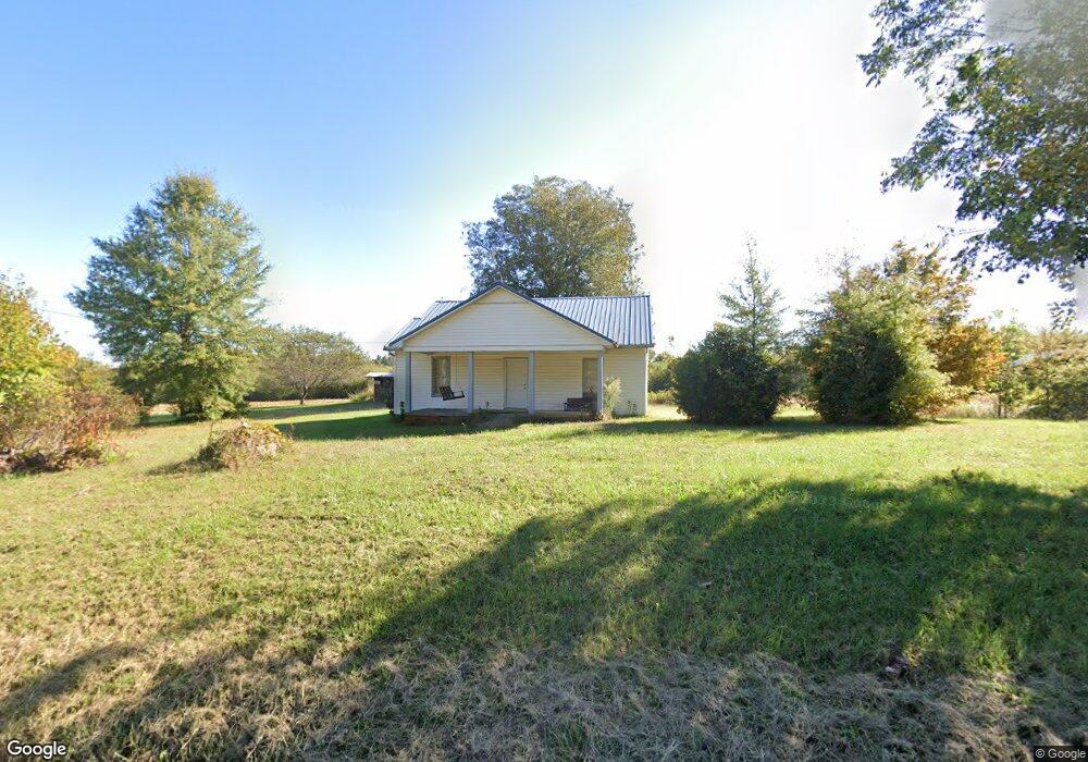
8225 Nc Highway 801 Mount Ulla, NC 28125
Estimated Value: $194,000 - $308,000
--
Bed
2
Baths
2,065
Sq Ft
$128/Sq Ft
Est. Value
About This Home
This home is located at 8225 Nc Highway 801, Mount Ulla, NC 28125 and is currently estimated at $264,805, approximately $128 per square foot. 8225 Nc Highway 801 is a home located in Rowan County with nearby schools including Mount Ulla Elementary School, West Rowan Middle School, and West Rowan High School.
Ownership History
Date
Name
Owned For
Owner Type
Purchase Details
Closed on
Jun 6, 2016
Sold by
Hamby Paul Wesley and Hamby Vanonda C
Bought by
Hamby Paul Wesley and Hamby Vanonda C
Current Estimated Value
Purchase Details
Closed on
Aug 24, 2012
Sold by
Hamby Charlie Rufus and Hamby Vanonda C
Bought by
Hamby Charlie Rufus
Create a Home Valuation Report for This Property
The Home Valuation Report is an in-depth analysis detailing your home's value as well as a comparison with similar homes in the area
Home Values in the Area
Average Home Value in this Area
Purchase History
| Date | Buyer | Sale Price | Title Company |
|---|---|---|---|
| Hamby Paul Wesley | -- | None Available | |
| Hamby Paul Wesley | -- | None Available | |
| Hamby Vanonda C | $115,000 | None Available | |
| Hamby Charlie Rufus | -- | None Available |
Source: Public Records
Tax History Compared to Growth
Tax History
| Year | Tax Paid | Tax Assessment Tax Assessment Total Assessment is a certain percentage of the fair market value that is determined by local assessors to be the total taxable value of land and additions on the property. | Land | Improvement |
|---|---|---|---|---|
| 2025 | $1,412 | $210,694 | $42,500 | $168,194 |
| 2024 | $1,412 | $210,694 | $42,500 | $168,194 |
| 2023 | $1,412 | $210,694 | $42,500 | $168,194 |
| 2022 | $1,042 | $139,420 | $32,500 | $106,920 |
| 2021 | $1,014 | $139,420 | $32,500 | $106,920 |
| 2020 | $1,014 | $139,420 | $32,500 | $106,920 |
| 2019 | $1,014 | $139,420 | $32,500 | $106,920 |
| 2018 | $827 | $114,581 | $32,500 | $82,081 |
| 2017 | $827 | $114,581 | $32,500 | $82,081 |
| 2016 | $827 | $114,581 | $32,500 | $82,081 |
| 2015 | $839 | $114,581 | $32,500 | $82,081 |
| 2014 | $831 | $117,227 | $32,500 | $84,727 |
Source: Public Records
Map
Nearby Homes
- 8340 N Carolina 801
- 00 Barber Junction Rd
- 2300 Hildebrand Rd
- 2635 Old Us 70 Hwy
- 2635 Old Us Highway 70
- 425 Old Us Highway 70
- 170 Saint James Way
- 0 Lowder Rd
- TBD Mount Hall Rd
- 00 Kesler Rd
- 6122 Lowder Rd
- 6133 Long Branch Rd
- 6155 Long Branch Rd
- 6169 Long Branch Rd
- 6147 Long Branch Rd
- 6187 Long Branch Rd
- 000 Long Branch Rd
- 114 Graham Acres Rd
- 502 E Main St
- 595 Parks Rd
- 8350 Nc Highway 801
- 8710 Nc Highway 801
- 9585 Sherrills Ford Rd
- 8690 Nc Highway 801
- 8720 Nc Highway 801
- 00000 Nc 801 Hwy Hwy
- 0 Hwy 801 Hwy Unit 2058207
- 8340 Nc Highway 801
- 3120 White Rd
- 8975 Sherrills Ford Rd
- 9075 Sherrills Ford Rd
- 8965 Sherrills Ford Rd
- 8850 Sherrills Ford Rd
- 7655 Nc Highway 801
- 9085 Sherrills Ford Rd
- 196 Royal Indian Dr
- 140 Royal Indian Dr
- 8955 Sherrills Ford Rd
- 8895 Sherrills Ford Rd
- 8865 Sherrills Ford Rd