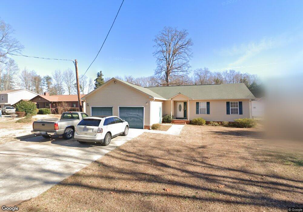
823 Ford Dr Lowell, NC 28098
Estimated Value: $239,000 - $259,939
3
Beds
2
Baths
1,220
Sq Ft
$204/Sq Ft
Est. Value
About This Home
This home is located at 823 Ford Dr, Lowell, NC 28098 and is currently estimated at $249,235, approximately $204 per square foot. 823 Ford Dr is a home located in Gaston County with nearby schools including McAdenville Elementary School, Holbrook Middle School, and Stuart W. Cramer High School.
Ownership History
Date
Name
Owned For
Owner Type
Purchase Details
Closed on
Jun 30, 2006
Sold by
Brown Bobby Perry and Brown Tammy Walker
Bought by
Turner Roy and Turner Anita
Current Estimated Value
Home Financials for this Owner
Home Financials are based on the most recent Mortgage that was taken out on this home.
Original Mortgage
$111,900
Outstanding Balance
$66,138
Interest Rate
6.57%
Mortgage Type
Purchase Money Mortgage
Estimated Equity
$183,097
Create a Home Valuation Report for This Property
The Home Valuation Report is an in-depth analysis detailing your home's value as well as a comparison with similar homes in the area
Home Values in the Area
Average Home Value in this Area
Purchase History
| Date | Buyer | Sale Price | Title Company |
|---|---|---|---|
| Turner Roy | $112,000 | None Available |
Source: Public Records
Mortgage History
| Date | Status | Borrower | Loan Amount |
|---|---|---|---|
| Open | Turner Roy | $111,900 |
Source: Public Records
Tax History
| Year | Tax Paid | Tax Assessment Tax Assessment Total Assessment is a certain percentage of the fair market value that is determined by local assessors to be the total taxable value of land and additions on the property. | Land | Improvement |
|---|---|---|---|---|
| 2025 | $2,537 | $237,360 | $18,000 | $219,360 |
| 2024 | $2,537 | $237,360 | $18,000 | $219,360 |
| 2023 | $2,813 | $237,360 | $18,000 | $219,360 |
| 2022 | $1,855 | $131,540 | $18,000 | $113,540 |
| 2021 | $1,736 | $131,540 | $18,000 | $113,540 |
| 2019 | $1,671 | $131,540 | $18,000 | $113,540 |
| 2018 | $1,472 | $113,263 | $14,400 | $98,863 |
| 2017 | $1,472 | $113,263 | $14,400 | $98,863 |
| 2016 | $1,297 | $99,763 | $0 | $0 |
| 2014 | -- | $99,097 | $18,000 | $81,097 |
Source: Public Records
Map
Nearby Homes
- 704 McAdenville Rd
- 356 Main St
- 503 Caroline Ave
- 500 Gann St Unit 51-56
- 211 Seigle St Unit 37-38
- 188 Main St
- 116 Kenworthy Ave
- 308 Rankin Ave
- 506 Academy St
- 160 Wesleyan Dr
- 209 Wesleyan Dr
- 131 Church St
- 4636 Lenden Hall Ct
- 118 Fir St
- 148 Forest Heights Dr
- 00 W 1st St
- 205 Church St
- 2073 Pin Oak Place
- 448 17th St
- 4218 Patriots Way
- 823 Ford Dr
- 829 Ford Rd
- 1023 Avondale Rd
- 104 Ford Dr
- 100 Ford Dr
- 822 Ford Dr
- 818 Ford Dr
- 821 Ford Dr
- 828 Ford Dr
- 1025 Avondale Dr
- 1024 Avondale Rd
- 1024 Avondale Rd Unit 5
- 1024 Avondale Rd Unit 4
- 1024 Avondale Rd Unit 8
- 1024 Avondale Rd Unit 6
- 1024 Avondale Rd
- 1024 Avondale Rd Unit 2
- 1024 Avondale Rd Unit 3
- 1024 Avondale Rd Unit 7
- 1024 Avondale Rd Unit 1
Your Personal Tour Guide
Ask me questions while you tour the home.