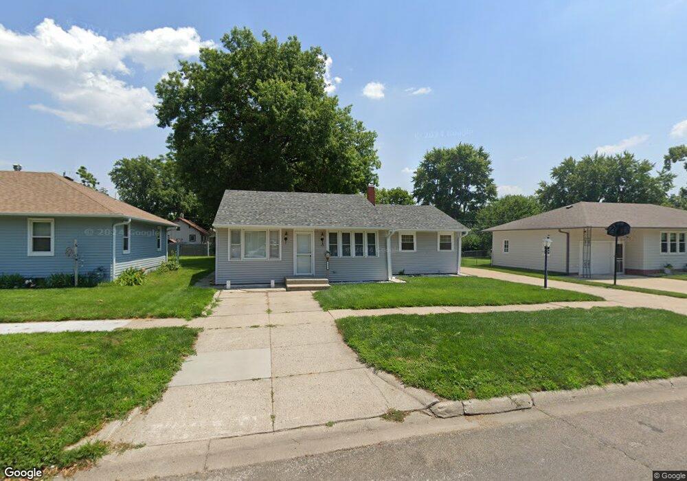
823 S 10th St Norfolk, NE 68701
Estimated Value: $176,000 - $204,152
2
Beds
2
Baths
1,481
Sq Ft
$133/Sq Ft
Est. Value
About This Home
This home is located at 823 S 10th St, Norfolk, NE 68701 and is currently estimated at $196,538, approximately $132 per square foot. 823 S 10th St is a home located in Madison County with nearby schools including Norfolk Senior High School, Keystone Christian Academy, and Christ Lutheran School.
Ownership History
Date
Name
Owned For
Owner Type
Purchase Details
Closed on
Jan 9, 2020
Sold by
Book Paul A and Book Patricia
Bought by
Miller Joseph Paul
Current Estimated Value
Purchase Details
Closed on
Dec 29, 2011
Sold by
Wells Fargo Bank Na
Bought by
Book Paul A and Book Patricia
Home Financials for this Owner
Home Financials are based on the most recent Mortgage that was taken out on this home.
Original Mortgage
$48,960
Interest Rate
4.02%
Mortgage Type
New Conventional
Purchase Details
Closed on
Dec 8, 2004
Sold by
Swedburg Loren T
Bought by
Key Robert J and Key Pamela S
Create a Home Valuation Report for This Property
The Home Valuation Report is an in-depth analysis detailing your home's value as well as a comparison with similar homes in the area
Home Values in the Area
Average Home Value in this Area
Purchase History
| Date | Buyer | Sale Price | Title Company |
|---|---|---|---|
| Miller Joseph Paul | $115,000 | Stewart Title Company | |
| Book Paul A | $62,000 | Insight Title | |
| Key Robert J | $71,900 | -- |
Source: Public Records
Mortgage History
| Date | Status | Borrower | Loan Amount |
|---|---|---|---|
| Previous Owner | Book Paul A | $48,960 |
Source: Public Records
Tax History Compared to Growth
Tax History
| Year | Tax Paid | Tax Assessment Tax Assessment Total Assessment is a certain percentage of the fair market value that is determined by local assessors to be the total taxable value of land and additions on the property. | Land | Improvement |
|---|---|---|---|---|
| 2024 | $2,220 | $178,780 | $10,981 | $167,799 |
| 2023 | $3,049 | $164,925 | $10,981 | $153,944 |
| 2022 | $2,751 | $148,431 | $10,981 | $137,450 |
| 2021 | $2,536 | $137,082 | $10,981 | $126,101 |
| 2020 | $2,336 | $126,670 | $10,981 | $115,689 |
| 2019 | $2,237 | $117,118 | $10,981 | $106,137 |
| 2018 | $1,945 | $103,550 | $8,785 | $94,765 |
| 2017 | $1,757 | $93,397 | $8,785 | $84,612 |
| 2016 | $1,630 | $86,478 | $8,134 | $78,344 |
| 2015 | $1,630 | $86,478 | $8,134 | $78,344 |
| 2014 | $1,606 | $82,747 | $8,134 | $74,613 |
| 2013 | $1,560 | $77,866 | $8,134 | $69,732 |
Source: Public Records
Map
Nearby Homes
- 705 S 10th St
- 602 S 10th St
- 706 Columbia St
- 918 S 5th St
- 3306 W Michigan Ave
- 3206 W Michigan Ave
- 3205 W Michigan Ave
- 3307 W Michigan Ave
- 805 S 5th St
- 410 W Michigan Ave
- 404 S 12th St
- 1217 Hayes Ave
- 906 S 4th St
- 103 S 13th Place
- 809 S 14th St
- 603 S 4th St
- 1312 Hayes Ave
- 1208 W Phillip Ave
- 1313 W Park Ave
- 922 S 2nd St