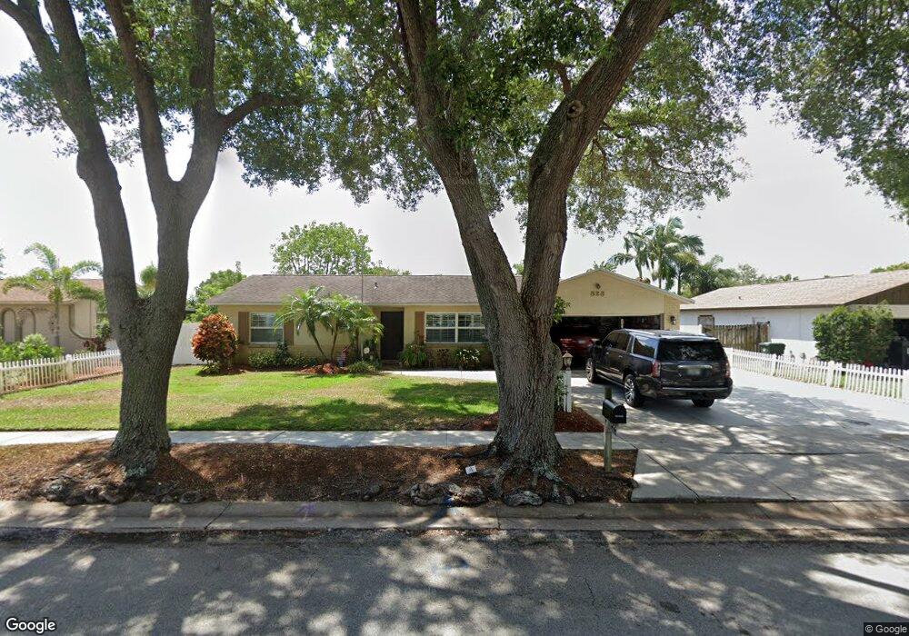
823 Westport Dr Rockledge, FL 32955
Estimated Value: $322,217 - $338,000
3
Beds
2
Baths
1,375
Sq Ft
$240/Sq Ft
Est. Value
About This Home
This home is located at 823 Westport Dr, Rockledge, FL 32955 and is currently estimated at $329,554, approximately $239 per square foot. 823 Westport Dr is a home located in Brevard County with nearby schools including Golfview Elementary School, John F. Kennedy Middle School, and Rockledge Senior High School.
Ownership History
Date
Name
Owned For
Owner Type
Purchase Details
Closed on
Nov 4, 2005
Sold by
Moody Warren E and Moody Mable Davis
Bought by
Moody Warren E and Moody Mable Davis
Current Estimated Value
Purchase Details
Closed on
Oct 29, 1997
Sold by
Ames Mahlon H and Ames Florence R
Bought by
Moody Warren E and Moody Carol A
Home Financials for this Owner
Home Financials are based on the most recent Mortgage that was taken out on this home.
Original Mortgage
$39,000
Interest Rate
7.39%
Create a Home Valuation Report for This Property
The Home Valuation Report is an in-depth analysis detailing your home's value as well as a comparison with similar homes in the area
Home Values in the Area
Average Home Value in this Area
Purchase History
| Date | Buyer | Sale Price | Title Company |
|---|---|---|---|
| Moody Warren E | -- | -- | |
| Moody Warren E | $79,000 | -- |
Source: Public Records
Mortgage History
| Date | Status | Borrower | Loan Amount |
|---|---|---|---|
| Previous Owner | Moody Warren E | $39,000 |
Source: Public Records
Tax History Compared to Growth
Tax History
| Year | Tax Paid | Tax Assessment Tax Assessment Total Assessment is a certain percentage of the fair market value that is determined by local assessors to be the total taxable value of land and additions on the property. | Land | Improvement |
|---|---|---|---|---|
| 2025 | $70 | $120,500 | -- | -- |
| 2024 | $66 | $117,110 | -- | -- |
| 2023 | $66 | $113,700 | $0 | $0 |
| 2022 | $62 | $110,390 | $0 | $0 |
| 2021 | $57 | $107,180 | $0 | $0 |
| 2020 | $57 | $105,710 | $0 | $0 |
| 2019 | $57 | $103,340 | $0 | $0 |
| 2018 | $57 | $101,420 | $0 | $0 |
| 2017 | $57 | $99,340 | $0 | $0 |
| 2016 | $57 | $97,300 | $27,500 | $69,800 |
| 2015 | $57 | $96,630 | $27,500 | $69,130 |
| 2014 | $57 | $95,870 | $23,000 | $72,870 |
Source: Public Records
Map
Nearby Homes
- 842 Berkshire Dr
- 802 Poinciana St
- 807 Poinciana St
- 834 Pine Shadows Ave
- 811 Poinciana St
- 900 Jamestown Dr
- 813 Pine Shadows Ave
- 848 Brookview Ln
- 886 Westport Dr
- 0 Doctor Joe Lee Smith Dr
- 851 Juniper Cir
- 151 Eyster Blvd
- 0 Unknown Unit 1047712
- 919 Brookview Ln
- 1882 Murrell Rd Unit J36
- 993 Riviera Point Dr
- 64 Knollwood Dr
- 967 Sabal Grove Dr
- 948 Pelican Ln
- 971 Sabal Grove Dr
- 825 Westport Dr
- 821 Westport Dr
- 827 Westport Dr
- 822 Westport Dr
- 826 Westport Dr
- 829 Westport Dr
- 824 Hanover Ct
- 823 Hanover Ct
- 828 Westport Dr
- 822 Hanover Ct
- 831 Westport Dr
- 824 Berkshire Dr
- 833 Westport Dr
- 821 Berkshire Dr
- 820 Hanover Ct
- 819 Hanover Ct
- 818 Hanover Ct
- 829 Berkshire Dr
- 835 Westport Dr
- 826 Berkshire Dr