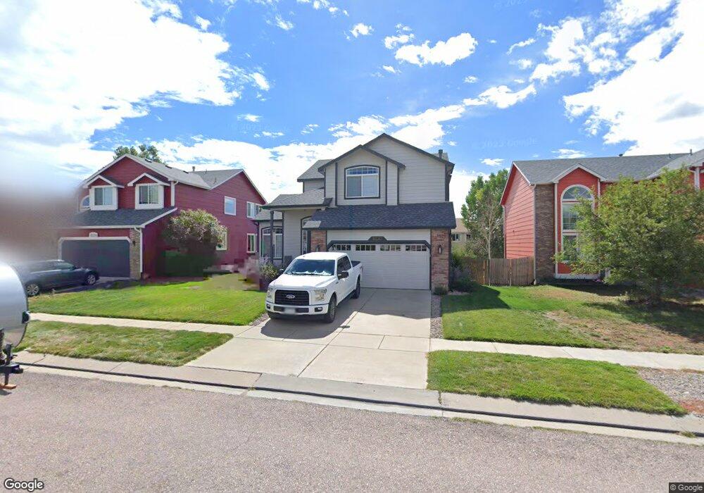
8232 Andrus Dr Colorado Springs, CO 80920
Briargate NeighborhoodEstimated Value: $525,784 - $550,000
4
Beds
4
Baths
1,841
Sq Ft
$294/Sq Ft
Est. Value
About This Home
This home is located at 8232 Andrus Dr, Colorado Springs, CO 80920 and is currently estimated at $540,446, approximately $293 per square foot. 8232 Andrus Dr is a home located in El Paso County with nearby schools including Prairie Hills Elementary School, Timberview Middle School, and Liberty High School.
Ownership History
Date
Name
Owned For
Owner Type
Purchase Details
Closed on
Jun 30, 2022
Sold by
Brown Wade T and Brown Deborah A
Bought by
Brown Family Living Trust
Current Estimated Value
Purchase Details
Closed on
Jun 14, 2000
Sold by
Campbell Corp
Bought by
Brown Wade T and Brown Deborah A
Home Financials for this Owner
Home Financials are based on the most recent Mortgage that was taken out on this home.
Original Mortgage
$194,177
Interest Rate
8.3%
Mortgage Type
VA
Create a Home Valuation Report for This Property
The Home Valuation Report is an in-depth analysis detailing your home's value as well as a comparison with similar homes in the area
Home Values in the Area
Average Home Value in this Area
Purchase History
| Date | Buyer | Sale Price | Title Company |
|---|---|---|---|
| Brown Family Living Trust | -- | -- | |
| Brown Wade T | $190,370 | First American |
Source: Public Records
Mortgage History
| Date | Status | Borrower | Loan Amount |
|---|---|---|---|
| Previous Owner | Brown Wade T | $194,177 |
Source: Public Records
Tax History Compared to Growth
Tax History
| Year | Tax Paid | Tax Assessment Tax Assessment Total Assessment is a certain percentage of the fair market value that is determined by local assessors to be the total taxable value of land and additions on the property. | Land | Improvement |
|---|---|---|---|---|
| 2025 | $2,202 | $36,650 | -- | -- |
| 2024 | $2,168 | $38,050 | $5,360 | $32,690 |
| 2023 | $2,168 | $38,050 | $5,360 | $32,690 |
| 2022 | $1,812 | $25,670 | $4,340 | $21,330 |
| 2021 | $2,003 | $26,400 | $4,460 | $21,940 |
| 2020 | $1,976 | $24,280 | $3,720 | $20,560 |
| 2019 | $1,956 | $24,280 | $3,720 | $20,560 |
| 2018 | $1,673 | $20,420 | $2,880 | $17,540 |
| 2017 | $1,667 | $20,420 | $2,880 | $17,540 |
| 2016 | $1,710 | $20,930 | $2,930 | $18,000 |
| 2015 | $1,707 | $20,930 | $2,930 | $18,000 |
| 2014 | $1,627 | $19,930 | $2,930 | $17,000 |
Source: Public Records
Map
Nearby Homes
- 8077 Radcliff Dr
- 8017 Radcliff Dr
- 7543 Potomac Dr
- 8352 James Creek Dr
- 8405 Andrus Dr
- 5305 Plumstead Dr
- 5408 Cushing Grove
- 5414 Cushing Grove
- 5426 Cushing Grove
- 8688 Eckberg Heights
- 8728 Eckberg Heights
- 8760 Eckberg Heights
- 8313 Scarborough Dr
- 5947 Cumbre Vista Way
- 5026 Plumstead Dr
- 8372 Wilmington Dr
- 7975 Manston Dr
- 8044 Hunter Peak Trail
- 5002 Herndon Cir
- 5109 Oyster Bay Dr
- 8236 Andrus Dr
- 8224 Andrus Dr
- 8240 Andrus Dr
- 8222 Andrus Dr
- 8053 Radcliff Dr
- 8059 Radcliff Dr
- 8041 Radcliff Dr
- 8216 Andrus Dr
- 8229 Andrus Dr
- 8065 Radcliff Dr
- 8250 Andrus Dr
- 8223 Andrus Dr
- 8035 Radcliff Dr
- 8235 Andrus Dr
- 8219 Andrus Dr
- 8071 Radcliff Dr
- 8029 Radcliff Dr
- 8212 Andrus Dr
- 8213 Andrus Dr
- 8254 Andrus Dr