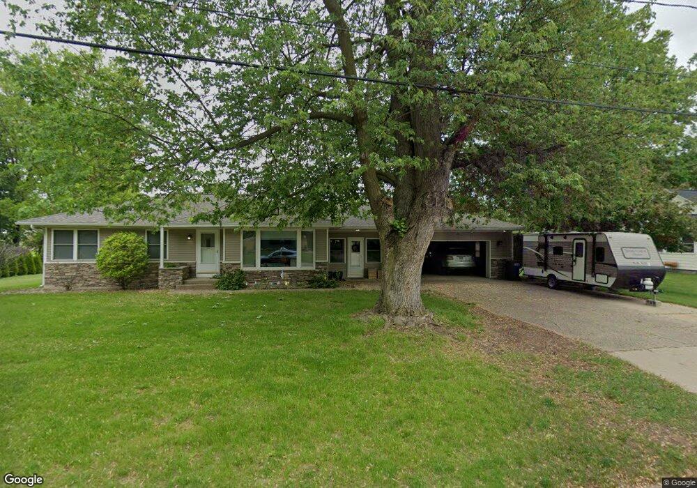
8232 Harlow Ave SW Byron Center, MI 49315
Estimated Value: $284,000 - $382,000
--
Bed
--
Bath
1,070
Sq Ft
$303/Sq Ft
Est. Value
About This Home
This home is located at 8232 Harlow Ave SW, Byron Center, MI 49315 and is currently estimated at $324,102, approximately $302 per square foot. 8232 Harlow Ave SW is a home located in Kent County with nearby schools including Brown Elementary School, Robert L. Nickels Intermediate School, and Byron Center West Middle School.
Ownership History
Date
Name
Owned For
Owner Type
Purchase Details
Closed on
Nov 21, 2019
Sold by
Karbowski Dean T and Karbowski Linda J
Bought by
Morren Grant and Morren Bridget
Current Estimated Value
Home Financials for this Owner
Home Financials are based on the most recent Mortgage that was taken out on this home.
Original Mortgage
$175,500
Outstanding Balance
$154,853
Interest Rate
3.75%
Mortgage Type
New Conventional
Estimated Equity
$169,249
Create a Home Valuation Report for This Property
The Home Valuation Report is an in-depth analysis detailing your home's value as well as a comparison with similar homes in the area
Home Values in the Area
Average Home Value in this Area
Purchase History
| Date | Buyer | Sale Price | Title Company |
|---|---|---|---|
| Morren Grant | $195,000 | First American Title Ins Co |
Source: Public Records
Mortgage History
| Date | Status | Borrower | Loan Amount |
|---|---|---|---|
| Open | Morren Grant | $175,500 |
Source: Public Records
Tax History Compared to Growth
Tax History
| Year | Tax Paid | Tax Assessment Tax Assessment Total Assessment is a certain percentage of the fair market value that is determined by local assessors to be the total taxable value of land and additions on the property. | Land | Improvement |
|---|---|---|---|---|
| 2025 | $2,150 | $122,300 | $0 | $0 |
| 2024 | $2,150 | $118,000 | $0 | $0 |
| 2023 | $2,056 | $108,700 | $0 | $0 |
| 2022 | $2,866 | $94,600 | $0 | $0 |
| 2021 | $2,789 | $89,500 | $0 | $0 |
| 2020 | $1,893 | $87,900 | $0 | $0 |
| 2019 | $2,025 | $82,800 | $0 | $0 |
| 2018 | $1,983 | $72,800 | $15,000 | $57,800 |
| 2017 | $1,925 | $67,600 | $0 | $0 |
| 2016 | $1,852 | $67,200 | $0 | $0 |
| 2015 | $1,829 | $67,200 | $0 | $0 |
| 2013 | -- | $60,300 | $0 | $0 |
Source: Public Records
Map
Nearby Homes
- 8138 Boardwalk Dr SW
- 670 84th St SW
- 2740 Woodhaven Ct SW Unit 2
- 8393 Woodhaven Dr SW Unit 1
- 8090 Country Rail Ct SW
- 8330 Rockledge Way SW Unit 92
- 8581 Troy St SW
- 8541 Woodhaven Dr SW
- 8564 Elkwood Dr SW
- 1942 Creekside Dr SW
- 1912 Creekside Dr SW
- 2267 Aimie Ave SW
- 2599 Ridge Top Dr SW
- 8030 Lionel Dr
- 8750 Lindsey Ln SW Unit 23
- 8549 Eldora Dr SW
- 1828 Gloryfield Dr
- 3152 84th St SW
- 1832 Kingsland Dr SW
- 8608 Woodruff Dr SW
- 8206 Harlow Ave SW
- 8246 Harlow Ave SW
- 8221 Freeland Ave SW
- 8221 Harlow Ave SW
- 8260 Harlow Ave SW
- 8255 Freeland Ave SW
- 8253 Harlow Ave SW
- 8278 Harlow Ave SW
- 8265 Freeland Ave SW
- 8206 Merton Ave SW
- 8220 Merton Ave SW
- 8210 Freeland Ave SW
- 8267 Harlow Ave SW
- 8234 Merton Ave SW
- 8208 Freeland Ave SW
- 8220 Freeland Ave SW
- 8275 Freeland Ave SW
- 8286 Harlow Ave SW
- 8242 Freeland Ave SW
- 8248 Merton Ave SW