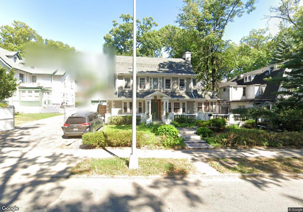
8237 Austin St Kew Gardens, NY 11415
Kew Gardens NeighborhoodEstimated Value: $1,354,000 - $1,439,000
--
Bed
--
Bath
2,364
Sq Ft
$591/Sq Ft
Est. Value
About This Home
This home is located at 8237 Austin St, Kew Gardens, NY 11415 and is currently estimated at $1,397,422, approximately $591 per square foot. 8237 Austin St is a home located in Queens County with nearby schools including P.S. 99 - Kew Gardens, J.H.S. 190 Russell Sage, and Hillcrest High School.
Ownership History
Date
Name
Owned For
Owner Type
Purchase Details
Closed on
Apr 16, 2004
Sold by
Macia Antonio J
Bought by
Ymrk Llc
Current Estimated Value
Purchase Details
Closed on
Sep 25, 1999
Sold by
Gusmorino Joseph D
Bought by
Macia Antonio J
Home Financials for this Owner
Home Financials are based on the most recent Mortgage that was taken out on this home.
Original Mortgage
$329,400
Interest Rate
7.78%
Create a Home Valuation Report for This Property
The Home Valuation Report is an in-depth analysis detailing your home's value as well as a comparison with similar homes in the area
Home Values in the Area
Average Home Value in this Area
Purchase History
| Date | Buyer | Sale Price | Title Company |
|---|---|---|---|
| Ymrk Llc | $857,500 | -- | |
| Macia Antonio J | $366,000 | Commonwealth Land Title Ins |
Source: Public Records
Mortgage History
| Date | Status | Borrower | Loan Amount |
|---|---|---|---|
| Previous Owner | Macia Antonio J | $329,400 |
Source: Public Records
Tax History Compared to Growth
Tax History
| Year | Tax Paid | Tax Assessment Tax Assessment Total Assessment is a certain percentage of the fair market value that is determined by local assessors to be the total taxable value of land and additions on the property. | Land | Improvement |
|---|---|---|---|---|
| 2025 | $13,000 | $68,484 | $21,955 | $46,529 |
| 2024 | $13,000 | $64,726 | $22,452 | $42,274 |
| 2023 | $12,425 | $61,182 | $20,528 | $40,654 |
| 2022 | $10,924 | $68,700 | $27,660 | $41,040 |
| 2021 | $12,172 | $67,440 | $27,660 | $39,780 |
| 2020 | $12,080 | $71,040 | $27,660 | $43,380 |
| 2019 | $11,283 | $78,240 | $27,660 | $50,580 |
| 2018 | $10,393 | $50,985 | $16,946 | $34,039 |
| 2017 | $9,825 | $48,199 | $18,563 | $29,636 |
| 2016 | $9,635 | $48,199 | $18,563 | $29,636 |
| 2015 | $5,484 | $47,558 | $24,374 | $23,184 |
| 2014 | $5,484 | $44,949 | $22,279 | $22,670 |
Source: Public Records
Map
Nearby Homes
- 82-37 Austin St
- 83-00 Talbot St Unit 6F
- 83-09 Talbot St Unit 6L
- 83-33 Austin St Unit 2N
- 83-33 Austin St Unit 6T
- 83-33 Austin St Unit 2C
- 83-40 Austin St Unit 4L
- 83-40 Austin St Unit 1T
- 83-31 Talbot St
- 125-16 83rd Dr Unit 6H
- 83-52 Talbot St Unit 3-J
- 83-52 Talbot St Unit 5C
- 83-52 Talbot St Unit 2H
- 84-51 Beverly Rd Unit 2V
- 84-51 Beverly Rd Unit 2-S
- 84-51 Beverly Rd Unit 2W
- 84-51 Beverly Rd Unit 5P
- 84-51 Beverly Rd Unit 4P
- 84-51 Beverly Rd Unit 2N
- 83-36 Beverly Rd Unit 5A
- 122 82nd Ave Unit 1
- 122 82nd Ave
- 122 82nd Ave
- 122 82nd Ave
- 122 82nd Ave Unit 1
- 120 Austin St
- 8231 Austin St
- 82-31 Austin St
- 118 Mowbray Dr
- 135 Mowbray Dr
- 0 Austin St Unit B5 3182411
- 0 Austin St Unit B5
- 116 Mowbray Dr
- 90 82nd Rd Unit 1Fl
- 113 82nd Rd
- 82-40 Austin St Unit 4J
- 82-40 Austin St Unit 3C
- 8240 Austin St
- 82-40 Austin St Unit 4F
- 82-40 Austin St Unit 3E