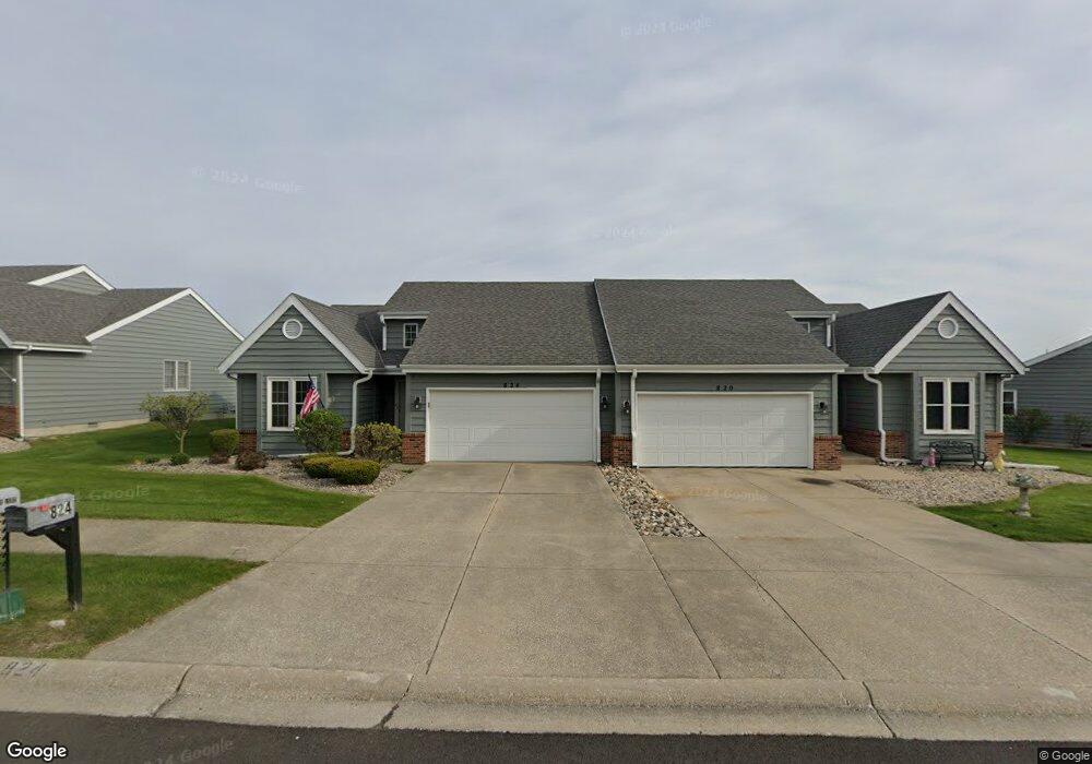
824 Pheasant Dr Crown Point, IN 46307
Estimated Value: $245,040 - $279,000
2
Beds
2
Baths
1,305
Sq Ft
$197/Sq Ft
Est. Value
About This Home
This home is located at 824 Pheasant Dr, Crown Point, IN 46307 and is currently estimated at $256,760, approximately $196 per square foot. 824 Pheasant Dr is a home located in Lake County with nearby schools including Timothy Ball Elementary School, Robert Taft Middle School, and Crown Point High School.
Ownership History
Date
Name
Owned For
Owner Type
Purchase Details
Closed on
Jan 17, 2025
Sold by
Odrobinak John M
Bought by
Mager Katherine L
Current Estimated Value
Purchase Details
Closed on
Oct 25, 2024
Sold by
Trust Number Ltrjo-101 and Odrobinak James P
Bought by
Odrobinak John M
Purchase Details
Closed on
Jun 8, 2005
Sold by
Odrobinak Rita L
Bought by
Odrobinak Rita L and Trust #Ltrjo-101
Create a Home Valuation Report for This Property
The Home Valuation Report is an in-depth analysis detailing your home's value as well as a comparison with similar homes in the area
Home Values in the Area
Average Home Value in this Area
Purchase History
| Date | Buyer | Sale Price | Title Company |
|---|---|---|---|
| Mager Katherine L | -- | Northwest Indiana Title | |
| Odrobinak John M | -- | None Listed On Document | |
| Odrobinak Rita L | -- | -- |
Source: Public Records
Tax History
| Year | Tax Paid | Tax Assessment Tax Assessment Total Assessment is a certain percentage of the fair market value that is determined by local assessors to be the total taxable value of land and additions on the property. | Land | Improvement |
|---|---|---|---|---|
| 2025 | $2,093 | $217,400 | $24,900 | $192,500 |
| 2024 | $5,354 | $207,700 | $24,900 | $182,800 |
| 2023 | $2,048 | $194,800 | $24,900 | $169,900 |
| 2022 | $2,000 | $181,400 | $24,900 | $156,500 |
| 2021 | $1,759 | $162,400 | $12,500 | $149,900 |
| 2020 | $1,681 | $153,300 | $12,500 | $140,800 |
| 2019 | $1,649 | $147,000 | $12,500 | $134,500 |
| 2018 | $1,630 | $140,700 | $12,500 | $128,200 |
| 2017 | $1,455 | $129,100 | $12,500 | $116,600 |
| 2016 | $1,477 | $128,900 | $12,500 | $116,400 |
| 2014 | $1,213 | $120,100 | $12,500 | $107,600 |
| 2013 | $1,161 | $116,000 | $12,500 | $103,500 |
Source: Public Records
Map
Nearby Homes
- 767 Kenmare Pkwy
- 771 Kenmare Pkwy
- 772 Kenmare Pkwy
- 900 Easy St
- 7770 W 106th Ln
- 1065 Easy St Unit C
- 619 W North St
- 11200 Oak Ridge Ct
- 600 W North St
- 301 Hoffman St
- 10607 Lane St
- 10705 Lane St
- 511 N West St
- 114 S Chase Dr
- 10813 Lane St
- 306 Holton Ridge
- 324 Maple St
- 10611 Baker St
- 332 Maple St
- 138 S Chase Dr
- 820 Pheasant Dr
- 832 Pheasant Dr
- 836 Pheasant Dr
- 810 Pheasant Dr
- 806 Pheasant Dr
- 756 Rosslare Place
- 821 Kenmare Terrace
- 751 Clover Ln
- 762 Rosslare Place
- 817 Kenmare Terrace
- 825 Kenmare Terrace
- 750 Meadow Ln
- 766 Rosslare Place
- 827 Kenmare Terrace
- 770 Rosslare Place
- 741 Clover Ln
- 761 Kenmare Pkwy
- 763 Kenmare Pkwy
- 765 Kenmare Pkwy
- 780 Rosslare Place Unit 11-1
Your Personal Tour Guide
Ask me questions while you tour the home.