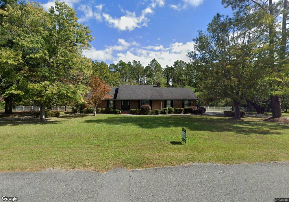
824 Russton Dr Waycross, GA 31503
Estimated Value: $269,000 - $364,000
3
Beds
2
Baths
1,984
Sq Ft
$160/Sq Ft
Est. Value
About This Home
This home is located at 824 Russton Dr, Waycross, GA 31503 and is currently estimated at $316,690, approximately $159 per square foot. 824 Russton Dr is a home located in Ware County with nearby schools including Memorial Drive Elementary School, Waycross Middle School, and Ware County High School.
Ownership History
Date
Name
Owned For
Owner Type
Purchase Details
Closed on
Jan 24, 2005
Sold by
Lewczyk Lawrence M
Bought by
Wrobel Peter M and Wrobel Lori B
Current Estimated Value
Home Financials for this Owner
Home Financials are based on the most recent Mortgage that was taken out on this home.
Original Mortgage
$155,622
Interest Rate
5.66%
Mortgage Type
New Conventional
Purchase Details
Closed on
Dec 4, 2002
Sold by
Morrison John A and Morrison Cy
Bought by
Lewczyk Lawrence M and Elizabeth Gath
Purchase Details
Closed on
Sep 4, 1998
Sold by
Brown Cullen and Brown Wanda
Bought by
Morrison John A and Morrison Cy
Purchase Details
Closed on
Oct 4, 1985
Create a Home Valuation Report for This Property
The Home Valuation Report is an in-depth analysis detailing your home's value as well as a comparison with similar homes in the area
Home Values in the Area
Average Home Value in this Area
Purchase History
| Date | Buyer | Sale Price | Title Company |
|---|---|---|---|
| Wrobel Peter M | $155,000 | -- | |
| Lewczyk Lawrence M | $145,000 | -- | |
| Morrison John A | $112,000 | -- | |
| -- | -- | -- |
Source: Public Records
Mortgage History
| Date | Status | Borrower | Loan Amount |
|---|---|---|---|
| Closed | Wrobel Peter M | $155,622 |
Source: Public Records
Tax History Compared to Growth
Tax History
| Year | Tax Paid | Tax Assessment Tax Assessment Total Assessment is a certain percentage of the fair market value that is determined by local assessors to be the total taxable value of land and additions on the property. | Land | Improvement |
|---|---|---|---|---|
| 2024 | $3,057 | $123,145 | $13,320 | $109,825 |
| 2023 | $3,169 | $107,747 | $14,640 | $93,107 |
| 2022 | $3,111 | $107,747 | $14,640 | $93,107 |
| 2021 | $2,759 | $87,971 | $14,640 | $73,331 |
| 2020 | $2,717 | $85,699 | $14,640 | $71,059 |
| 2019 | $2,503 | $77,427 | $14,640 | $62,787 |
| 2018 | $2,434 | $74,587 | $14,640 | $59,947 |
| 2017 | $2,432 | $74,587 | $14,640 | $59,947 |
| 2016 | $2,432 | $74,587 | $14,640 | $59,947 |
| 2015 | $2,455 | $74,587 | $14,640 | $59,947 |
| 2014 | $2,451 | $74,587 | $14,640 | $59,947 |
| 2013 | -- | $74,587 | $14,640 | $59,947 |
Source: Public Records
Map
Nearby Homes
- 1132 Hilltop Rd
- 3070 Central Ave
- 3817 Central Ave
- 867 Kentland Dr
- 763 Kentland Dr
- 3153 Southwood Dr
- 2775 Seminole Trail
- 723 St Bernard Trail
- 4155 Pinecrest Rd
- 1049 Riverdale Dr
- 606 Stonewall Jackson Place
- 630 Saddle Cir
- 664 Saddle Cir
- 627 Saddle Cir
- 1072 Lawhorne Dr
- 851 Carriage Ln
- 955 Lynn Dr
- 291 Sawdust Trail
- 914 Barkley St
- 0 Brunswick Hwy Unit 1648370
- LOT 10 Russton Dr
- 794 Russton Dr
- 3426 Central Ave
- 823 Russton Dr
- 857 Russton Dr
- 795 Russton Dr
- 769 Russton Dr
- 3324 Sherry Ln
- 3378 Central Ave
- 3419 Central Ave
- 3427 Central Ave
- 3407 Central Ave
- 3437 Central Ave
- 3317 Sherry Ln
- 3320 Sherry Ln
- 3321 Plantation Ln
- 3445 Central Ave
- 3418 Meadow Ln
- 3428 Meadow Ln
- 910 Saint Ila Rd