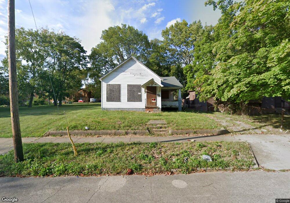
824 W Macon St Decatur, IL 62522
Near West NeighborhoodEstimated Value: $51,000 - $76,000
3
Beds
1
Bath
1,662
Sq Ft
$36/Sq Ft
Est. Value
About This Home
This home is located at 824 W Macon St, Decatur, IL 62522 and is currently estimated at $59,933, approximately $36 per square foot. 824 W Macon St is a home located in Macon County with nearby schools including Dennis Lab School, St. Patrick School, and Teen Challenge-Home For Girls.
Ownership History
Date
Name
Owned For
Owner Type
Purchase Details
Closed on
Sep 26, 2024
Sold by
Upper Room Missionary Pentecostal Church
Bought by
Five Star Management
Current Estimated Value
Purchase Details
Closed on
Apr 28, 2008
Sold by
Bt Investments Llc
Bought by
Aragon Ernest C
Purchase Details
Closed on
Aug 23, 2006
Sold by
Fannie Mae
Bought by
Tirado Robert
Purchase Details
Closed on
May 16, 2006
Sold by
Lewis Nashebebo S
Bought by
Federal National Mortgage Association
Purchase Details
Closed on
Mar 3, 2005
Sold by
Hickory Point Bank
Bought by
Lewis Nashebebo S
Home Financials for this Owner
Home Financials are based on the most recent Mortgage that was taken out on this home.
Original Mortgage
$59,500
Interest Rate
5.71%
Mortgage Type
New Conventional
Purchase Details
Closed on
Oct 1, 2001
Create a Home Valuation Report for This Property
The Home Valuation Report is an in-depth analysis detailing your home's value as well as a comparison with similar homes in the area
Home Values in the Area
Average Home Value in this Area
Purchase History
| Date | Buyer | Sale Price | Title Company |
|---|---|---|---|
| Five Star Management | -- | None Listed On Document | |
| Aragon Ernest C | $35,000 | None Available | |
| Tirado Robert | -- | Macon County Title Llc | |
| Federal National Mortgage Association | -- | None Available | |
| Lewis Nashebebo S | $60,000 | None Available | |
| Hickory Point Bank | -- | None Available | |
| -- | $7,000 | -- |
Source: Public Records
Mortgage History
| Date | Status | Borrower | Loan Amount |
|---|---|---|---|
| Previous Owner | Lewis Nashebebo S | $59,500 |
Source: Public Records
Tax History Compared to Growth
Tax History
| Year | Tax Paid | Tax Assessment Tax Assessment Total Assessment is a certain percentage of the fair market value that is determined by local assessors to be the total taxable value of land and additions on the property. | Land | Improvement |
|---|---|---|---|---|
| 2024 | $1,410 | $14,565 | $2,368 | $12,197 |
| 2023 | $1,398 | $14,049 | $2,284 | $11,765 |
| 2022 | $1,262 | $12,342 | $2,007 | $10,335 |
| 2021 | $1,186 | $11,526 | $1,874 | $9,652 |
| 2020 | $1,162 | $10,927 | $225 | $10,702 |
| 2019 | $1,162 | $10,927 | $225 | $10,702 |
| 2018 | $1,152 | $10,963 | $226 | $10,737 |
| 2017 | $1,179 | $11,256 | $232 | $11,024 |
| 2016 | $1,201 | $11,370 | $234 | $11,136 |
| 2015 | $1,142 | $11,169 | $230 | $10,939 |
| 2014 | $1,060 | $11,059 | $228 | $10,831 |
| 2013 | $1,095 | $11,475 | $237 | $11,238 |
Source: Public Records
Map
Nearby Homes
- 899 W Main St
- 441 S Seigel St
- 657 W Wood St
- 612 W Macon St
- 1005 W Main St
- 617 W Decatur St
- 628 W Forest Ave
- 717 W Prairie Ave Unit 2
- 650 S Crea St
- 254 N Pine St
- 437 Powers Ln
- 450 W Macon St
- 440 W Macon St
- 958 W William St
- 609 W William St
- 530 Powers Ln
- 452 W Prairie Ave
- 442 W Prairie Ave
- 580 Powers Ln
- 233 N Edward St