Estimated Value: $345,949 - $390,000
3
Beds
3
Baths
1,932
Sq Ft
$192/Sq Ft
Est. Value
About This Home
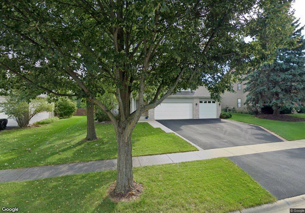
This home is located at 825 Crest Dr, Cary, IL 60013 and is currently estimated at $370,737, approximately $191 per square foot. 825 Crest Dr is a home located in McHenry County with nearby schools including Three Oaks Elementary School, Cary Jr High School, and Cary Grove High School.
Ownership History
Date
Name
Owned For
Owner Type
Purchase Details
Closed on
Jul 10, 2018
Sold by
Worsley Michael F and Worsley Karen J
Bought by
Michael F Worsley Revocable Living Trust and Karen J Worsley Revocable Living Trust
Current Estimated Value
Purchase Details
Closed on
Aug 27, 2003
Sold by
Calhoun William P
Bought by
Worsley Michael F and Worsley Karen J
Home Financials for this Owner
Home Financials are based on the most recent Mortgage that was taken out on this home.
Original Mortgage
$138,000
Interest Rate
5.69%
Mortgage Type
Purchase Money Mortgage
Purchase Details
Closed on
Apr 12, 1999
Sold by
Wiwczaryk Gene and Wiwczaryk Irene
Bought by
Calhoun William P
Purchase Details
Closed on
Jan 22, 1996
Sold by
Cole Taylor Bank and Barnard Joanne N
Bought by
Wiwczaryk Gene and Wiwczaryk Irene
Create a Home Valuation Report for This Property
The Home Valuation Report is an in-depth analysis detailing your home's value as well as a comparison with similar homes in the area
Home Values in the Area
Average Home Value in this Area
Purchase History
| Date | Buyer | Sale Price | Title Company |
|---|---|---|---|
| Michael F Worsley Revocable Living Trust | -- | None Listed On Document | |
| Worsley Michael F | $248,000 | Ticor | |
| Calhoun William P | $32,000 | -- | |
| Wiwczaryk Gene | $39,500 | Chicago Title Insurance Co |
Source: Public Records
Mortgage History
| Date | Status | Borrower | Loan Amount |
|---|---|---|---|
| Previous Owner | Worsley Michael F | $138,000 |
Source: Public Records
Tax History Compared to Growth
Tax History
| Year | Tax Paid | Tax Assessment Tax Assessment Total Assessment is a certain percentage of the fair market value that is determined by local assessors to be the total taxable value of land and additions on the property. | Land | Improvement |
|---|---|---|---|---|
| 2024 | $7,572 | $105,918 | $20,074 | $85,844 |
| 2023 | $7,288 | $94,731 | $17,954 | $76,777 |
| 2022 | $8,084 | $97,331 | $25,620 | $71,711 |
| 2021 | $7,666 | $90,675 | $23,868 | $66,807 |
| 2020 | $7,419 | $87,465 | $23,023 | $64,442 |
| 2019 | $7,248 | $83,715 | $22,036 | $61,679 |
| 2018 | $6,787 | $77,335 | $20,357 | $56,978 |
| 2017 | $6,620 | $72,855 | $19,178 | $53,677 |
| 2016 | $6,527 | $68,331 | $17,987 | $50,344 |
| 2013 | -- | $61,134 | $16,779 | $44,355 |
Source: Public Records
Map
Nearby Homes
- 515 Crest Dr
- 50 Erin Dr
- LOT 02 Three Oaks Rd
- 312 Wooded Knoll Dr
- 1712 Squirrel Trail
- 26 Wagner Dr
- 336 W Margaret Terrace
- 0 Three Oaks Dr Unit MRD12417647
- 340 W Margaret Terrace
- 324 Alma Terrace
- 305 Bell Dr
- 305 Pearl St
- 129 Weaver Dr
- 124 E Main St Unit 2-3
- 406 Catkins Way
- 326 Alicia Dr
- 1055 White Pine Dr
- 411 Park Ave
- Lots 2,3,4 Northwest Hwy
- 296 Foxford Dr Unit 1