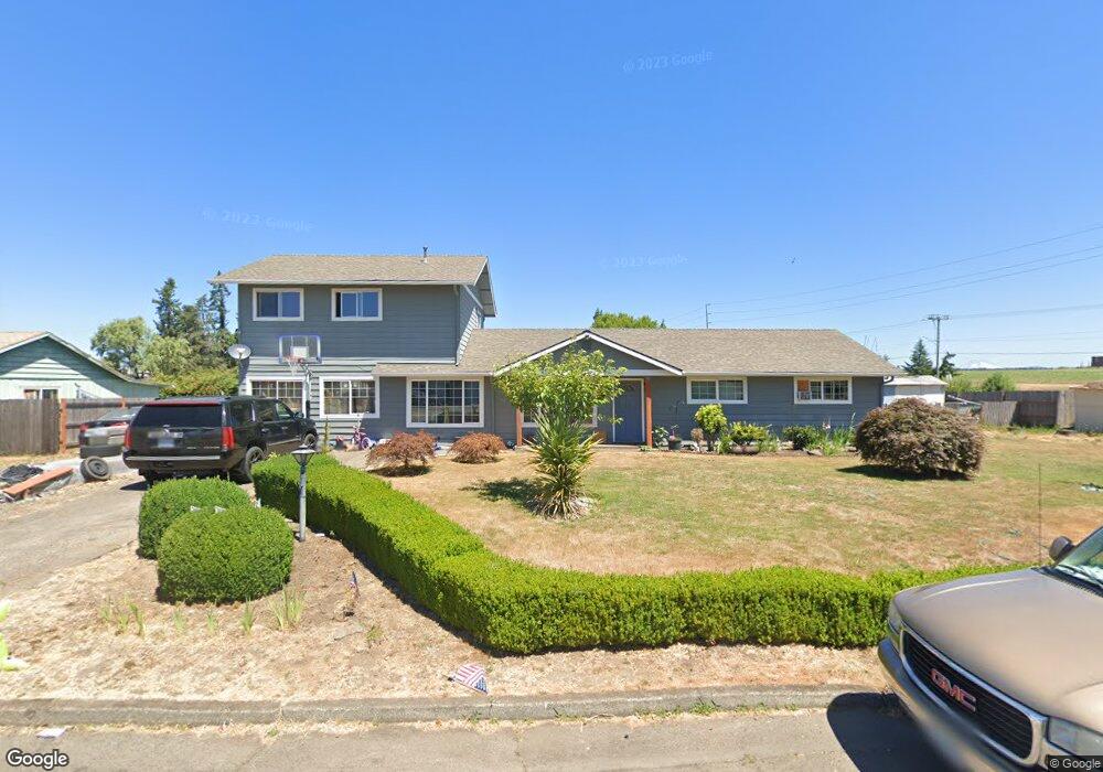
825 E 3rd St Molalla, OR 97038
Estimated Value: $470,440 - $544,000
5
Beds
2
Baths
2,256
Sq Ft
$229/Sq Ft
Est. Value
About This Home
This home is located at 825 E 3rd St, Molalla, OR 97038 and is currently estimated at $517,610, approximately $229 per square foot. 825 E 3rd St is a home located in Clackamas County with nearby schools including Molalla River Academy, Country Christian School, and Oregon Outreach - Molalla Pride.
Ownership History
Date
Name
Owned For
Owner Type
Purchase Details
Closed on
Aug 2, 2000
Sold by
Herderson Dean F
Bought by
Henderson Dean F and The Dean F Henderson Revocable Living Tr
Current Estimated Value
Purchase Details
Closed on
May 27, 1999
Sold by
Dye Lorrie Ann and Dye James Herman
Bought by
Maldonado Isaul and Giron Rosalinda
Home Financials for this Owner
Home Financials are based on the most recent Mortgage that was taken out on this home.
Original Mortgage
$146,984
Outstanding Balance
$36,662
Interest Rate
6.86%
Mortgage Type
FHA
Estimated Equity
$480,948
Purchase Details
Closed on
Feb 5, 1997
Sold by
Smith Lorrie Ann and Dye Lorrie Ann
Bought by
Dye James Herman and Dye Lorrie Ann
Create a Home Valuation Report for This Property
The Home Valuation Report is an in-depth analysis detailing your home's value as well as a comparison with similar homes in the area
Purchase History
| Date | Buyer | Sale Price | Title Company |
|---|---|---|---|
| Henderson Dean F | -- | -- | |
| Maldonado Isaul | $148,000 | Ticor Title Insurance | |
| Dye James Herman | -- | -- |
Source: Public Records
Mortgage History
| Date | Status | Borrower | Loan Amount |
|---|---|---|---|
| Open | Maldonado Isaul | $146,984 |
Source: Public Records
Tax History
| Year | Tax Paid | Tax Assessment Tax Assessment Total Assessment is a certain percentage of the fair market value that is determined by local assessors to be the total taxable value of land and additions on the property. | Land | Improvement |
|---|---|---|---|---|
| 2025 | $4,554 | $237,755 | -- | -- |
| 2024 | $4,402 | $230,831 | -- | -- |
| 2023 | $4,402 | $224,108 | $0 | $0 |
| 2022 | $3,630 | $217,581 | $0 | $0 |
| 2021 | $3,481 | $211,244 | $0 | $0 |
| 2020 | $3,384 | $205,092 | $0 | $0 |
| 2019 | $3,286 | $199,119 | $0 | $0 |
| 2018 | $3,194 | $193,319 | $0 | $0 |
| 2017 | $3,062 | $187,688 | $0 | $0 |
| 2016 | $2,903 | $182,221 | $0 | $0 |
Source: Public Records
Map
Nearby Homes
- 821 E 7th St
- 735 Garden Ct
- 128 Finneys Ave
- 708 E Heintz St
- 800 Mathias Ct
- 218 Finneys Ave
- 319 Berkley Ave
- 162 Fenton Ave Unit C
- 208 S Swiegle Ave
- 515 May St
- 206 S Molalla Ave
- 121 W Ross St
- 416 Kennel Ave
- 205 W Heintz St Unit 708
- 660 Creamery Creek Ln
- 588 West Ln
- 13595 S Warrick Rd
- 641 Mary Dr
- 704 Toliver Rd
- 13434 S Lowe Rd
Your Personal Tour Guide
Ask me questions while you tour the home.