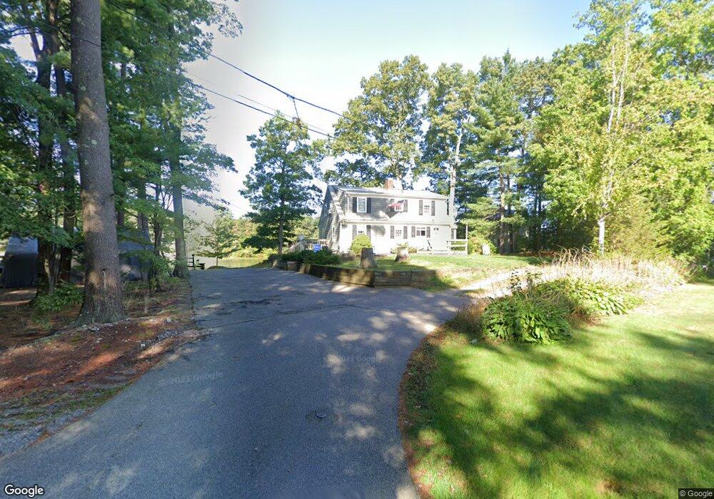
825 Eastside Rd Wrentham, MA 02093
Estimated Value: $667,000 - $736,000
3
Beds
2
Baths
1,547
Sq Ft
$448/Sq Ft
Est. Value
About This Home
This home is located at 825 Eastside Rd, Wrentham, MA 02093 and is currently estimated at $692,680, approximately $447 per square foot. 825 Eastside Rd is a home located in Norfolk County with nearby schools including Delaney Elementary School and Charles E Roderick.
Ownership History
Date
Name
Owned For
Owner Type
Purchase Details
Closed on
Sep 18, 1989
Sold by
Durant Dean W
Bought by
Duffey Steven W
Current Estimated Value
Create a Home Valuation Report for This Property
The Home Valuation Report is an in-depth analysis detailing your home's value as well as a comparison with similar homes in the area
Home Values in the Area
Average Home Value in this Area
Purchase History
| Date | Buyer | Sale Price | Title Company |
|---|---|---|---|
| Duffey Steven W | $164,500 | -- |
Source: Public Records
Mortgage History
| Date | Status | Borrower | Loan Amount |
|---|---|---|---|
| Open | Duffey Steven W | $243,000 | |
| Closed | Duffey Steven W | $167,000 | |
| Closed | Duffey Steven W | $160,000 |
Source: Public Records
Tax History Compared to Growth
Tax History
| Year | Tax Paid | Tax Assessment Tax Assessment Total Assessment is a certain percentage of the fair market value that is determined by local assessors to be the total taxable value of land and additions on the property. | Land | Improvement |
|---|---|---|---|---|
| 2025 | $7,761 | $669,600 | $419,200 | $250,400 |
| 2024 | $7,582 | $631,800 | $419,200 | $212,600 |
| 2023 | $7,147 | $566,300 | $375,800 | $190,500 |
| 2022 | $6,387 | $467,200 | $309,100 | $158,100 |
| 2021 | $6,922 | $492,000 | $341,700 | $150,300 |
| 2020 | $7,230 | $507,400 | $347,800 | $159,600 |
| 2019 | $7,225 | $511,700 | $360,200 | $151,500 |
| 2018 | $7,403 | $519,900 | $361,700 | $158,200 |
| 2017 | $7,074 | $496,400 | $354,700 | $141,700 |
| 2016 | $6,930 | $485,300 | $344,500 | $140,800 |
| 2015 | $6,816 | $455,000 | $331,200 | $123,800 |
| 2014 | $6,701 | $437,700 | $318,500 | $119,200 |
Source: Public Records
Map
Nearby Homes
- Lot 3 - 14 Earle Stewart Ln
- Lot 1 - Blueberry 2 Car Plan at King Philip Estates
- Lot 8 - Blueberry 2 Car Plan at King Philip Estates
- Lot 5 - Hughes 2 car Plan at King Philip Estates
- Lot 6 - Blueberry 3 Car Plan at King Philip Estates
- Lot 2 - Camden 2 Car Plan at King Philip Estates
- Lot 7 - Cedar Plan at King Philip Estates
- Lot 4 - Hemingway 2 Car Plan at King Philip Estates
- Lot 3 - Blueberry 2 Car Plan at King Philip Estates
- 131 Creek St Unit 7
- 11 Earle Stewart Ln
- 570 Franklin St
- 791 South St Unit 5
- 10 Nature View Dr
- 15 Nature View Dr
- 319 Taunton St
- 440 Chestnut St
- 80 Carriage House Ln
- 50 Green St
- 50 Reed Fulton Ave Unit Lot 61
- 823 Eastside Rd
- 815 Eastside Rd
- 810 Eastside Rd
- 820 Eastside Rd
- 800 Eastside Rd
- 770 Eastside Rd
- 780 Eastside Rd
- 760 Eastside Rd
- 790 Eastside Rd
- 790 Eastside Rd
- 750 Eastside Rd
- 740 Eastside Rd
- 730 Eastside Rd
- 720 Eastside Rd
- 710 Eastside Rd
- 700 Eastside Rd
- 690 Eastside Rd
- 680 Eastside Rd
- 735 Eastside Rd
- 835 Eastside Rd