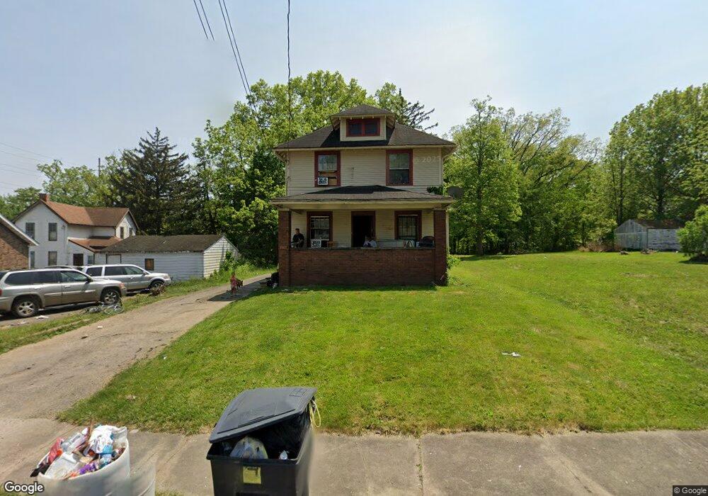
825 Mason St NW Warren, OH 44485
Amvets NeighborhoodEstimated Value: $45,000 - $101,000
3
Beds
1
Bath
1,380
Sq Ft
$50/Sq Ft
Est. Value
About This Home
This home is located at 825 Mason St NW, Warren, OH 44485 and is currently estimated at $68,388, approximately $49 per square foot. 825 Mason St NW is a home located in Trumbull County with nearby schools including Warren G. Harding High School, Willard PK-8 School, and Steam Academy of Warren.
Ownership History
Date
Name
Owned For
Owner Type
Purchase Details
Closed on
May 14, 2025
Sold by
Washington Faith and Washington Angel T
Bought by
Washington Freddie L and Washington Samantha
Current Estimated Value
Purchase Details
Closed on
Jun 1, 2016
Sold by
Team Sanders Inc
Bought by
Washington Freddie D
Purchase Details
Closed on
Feb 23, 2016
Sold by
Trumbull County Land Reutilization Corp
Bought by
Team Sanders Inc
Purchase Details
Closed on
Aug 18, 2000
Sold by
Spencer Jeannette and Wesley David E
Bought by
Taninecz William S
Purchase Details
Closed on
Jan 1, 1990
Bought by
David E Wesley
Create a Home Valuation Report for This Property
The Home Valuation Report is an in-depth analysis detailing your home's value as well as a comparison with similar homes in the area
Home Values in the Area
Average Home Value in this Area
Purchase History
We collect this data history from publicly available records. To have your information removed, we recommend requesting removal directly through your county’s website.
| Date | Buyer | Sale Price | Title Company |
|---|---|---|---|
| Washington Freddie L | $3,400 | None Listed On Document | |
| Washington Freddie D | -- | None Available | |
| Team Sanders Inc | -- | None Available | |
| Taninecz William S | $40,900 | -- | |
| David E Wesley | -- | -- |
Source: Public Records
Mortgage History
We collect this data history from publicly available records. To have your information removed, we recommend requesting removal directly through your county’s website.
| Date | Status | Borrower | Loan Amount |
|---|---|---|---|
| Closed | Taninecz William S | -- |
Source: Public Records
Tax History
| Year | Tax Paid | Tax Assessment Tax Assessment Total Assessment is a certain percentage of the fair market value that is determined by local assessors to be the total taxable value of land and additions on the property. | Land | Improvement |
|---|---|---|---|---|
| 2025 | $591 | $11,450 | $1,090 | $10,360 |
| 2024 | $591 | $11,450 | $1,090 | $10,360 |
| 2023 | $580 | $11,450 | $1,090 | $10,360 |
| 2022 | $640 | $9,880 | $1,090 | $8,790 |
| 2021 | $641 | $9,880 | $1,090 | $8,790 |
| 2020 | $642 | $9,880 | $1,090 | $8,790 |
| 2019 | $648 | $9,460 | $1,090 | $8,370 |
| 2018 | $628 | $9,460 | $1,090 | $8,370 |
| 2017 | $618 | $9,460 | $1,090 | $8,370 |
| 2016 | $529 | $8,160 | $1,470 | $6,690 |
| 2015 | $526 | $8,160 | $1,470 | $6,690 |
| 2014 | $523 | $8,160 | $1,470 | $6,690 |
| 2013 | $536 | $8,820 | $1,470 | $7,350 |
Source: Public Records
Map
Nearby Homes
- 642 Parkman Rd NW
- 983 Garden St NW
- 1145 Stiles St NW
- 1175 Robert Ave NW
- 1056 Raymond St NW
- 141 Austin Ave NW
- 404 York Ave NW
- 1166 Raymond St NW
- 1130 Riverview St NW
- 555 NW Hall St NW
- 322-324 North St NW
- 1479 Hamilton St SW
- 1718 Hamilton St SW
- 1581 Drexel Ave NW
- 1525 Denison Ave NW
- 433 Olive Ave NE Unit 435
- 2134 Estabrook Ave NW
- 1892 Drexel Ave NW
- 1033 Olive Ave NE
- 572 Comstock St NW
- 835 Mason St NW
- 649 Tod Ave NW
- 631 Tod Ave NW
- 647 Tod Ave NW
- 849 Mason St NW
- 607 Tod Ave NW
- 859 Mason St NW
- 807 Tod Ave NW
- 869 Mason St NW
- 817 Tod Ave NW
- 597 Tod Ave NW
- 834 Mason St NW
- 825 Tod Ave NW
- 542 Hillsdale Dr NW
- 589 Tod Ave NW
- 802 Tod Ave NW
- 833 Tod Ave NW
- 534 Hillsdale Dr NW
- 526 Hillsdale Dr NW
- 860 Mason St NW
Your Personal Tour Guide
Ask me questions while you tour the home.