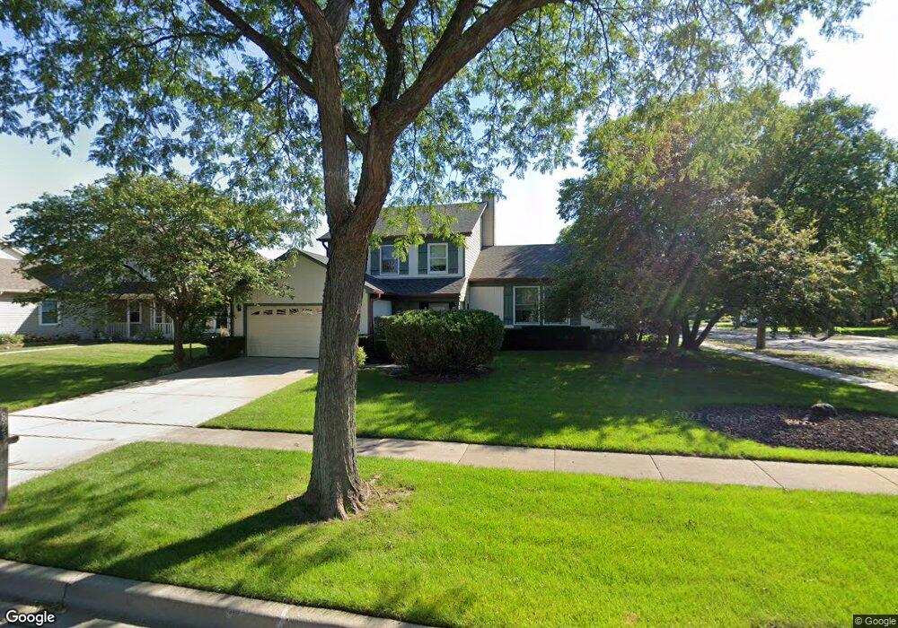
825 N Dexter Ln Hoffman Estates, IL 60169
South Hoffman Estates NeighborhoodEstimated Value: $478,000 - $525,000
3
Beds
2
Baths
1,782
Sq Ft
$278/Sq Ft
Est. Value
About This Home
This home is located at 825 N Dexter Ln, Hoffman Estates, IL 60169 and is currently estimated at $494,606, approximately $277 per square foot. 825 N Dexter Ln is a home located in Cook County with nearby schools including Hoover Math And Science Academy, Dwight D Eisenhower Junior High School, and Hoffman Estates High School.
Ownership History
Date
Name
Owned For
Owner Type
Purchase Details
Closed on
Apr 27, 2001
Sold by
Braniff James T and Braniff Christine M
Bought by
Gibbs David M and Gibbs Virginia E
Current Estimated Value
Home Financials for this Owner
Home Financials are based on the most recent Mortgage that was taken out on this home.
Original Mortgage
$195,000
Interest Rate
7.15%
Purchase Details
Closed on
Jun 30, 1997
Sold by
Damico David A and Damico Kelly A
Bought by
Braniff James T and Braniff Christine M
Home Financials for this Owner
Home Financials are based on the most recent Mortgage that was taken out on this home.
Original Mortgage
$187,050
Interest Rate
7.71%
Create a Home Valuation Report for This Property
The Home Valuation Report is an in-depth analysis detailing your home's value as well as a comparison with similar homes in the area
Home Values in the Area
Average Home Value in this Area
Purchase History
| Date | Buyer | Sale Price | Title Company |
|---|---|---|---|
| Gibbs David M | $254,000 | -- | |
| Braniff James T | $198,000 | -- |
Source: Public Records
Mortgage History
| Date | Status | Borrower | Loan Amount |
|---|---|---|---|
| Previous Owner | Gibbs David M | $195,000 | |
| Previous Owner | Braniff James T | $187,050 |
Source: Public Records
Tax History
| Year | Tax Paid | Tax Assessment Tax Assessment Total Assessment is a certain percentage of the fair market value that is determined by local assessors to be the total taxable value of land and additions on the property. | Land | Improvement |
|---|---|---|---|---|
| 2025 | $9,216 | $46,000 | $10,656 | $35,344 |
| 2024 | $9,216 | $36,000 | $8,880 | $27,120 |
| 2023 | $9,676 | $36,000 | $8,880 | $27,120 |
| 2022 | $9,676 | $36,000 | $8,880 | $27,120 |
| 2021 | $8,612 | $29,036 | $6,216 | $22,820 |
| 2020 | $8,424 | $29,036 | $6,216 | $22,820 |
| 2019 | $8,442 | $32,263 | $6,216 | $26,047 |
| 2018 | $8,424 | $29,271 | $5,328 | $23,943 |
| 2017 | $8,294 | $29,271 | $5,328 | $23,943 |
| 2016 | $7,977 | $29,271 | $5,328 | $23,943 |
| 2015 | $8,155 | $28,015 | $4,662 | $23,353 |
| 2014 | $8,029 | $28,015 | $4,662 | $23,353 |
| 2013 | $7,805 | $28,015 | $4,662 | $23,353 |
Source: Public Records
Map
Nearby Homes
- 1300 Chatsworth Ln
- 607 Wainsford Dr
- 712 Scarbrough Cir Unit 126
- 658 Claridge Cir Unit 99
- 1033 Warwick Cir S
- 775 Harmon Blvd
- 845 Harmon Blvd
- 1190 Woodcreek Ln
- 426 Argyll Ln
- 1365 Newcastle Ln
- 1975 Leiter Way Unit 12002
- 1982 Leiter Way Unit 13004
- 1985 Leiter Way Unit 1102
- 1988 Leiter Way Unit 13001
- 1979 Leiter Way Unit 12004
- 1981 Leiter Way Unit 12005
- 1994 Leiter Way Unit 14003
- 1977 Leiter Way Unit 12003
- 1986 Leiter Way Unit 13002
- 1989 Leiter Way Unit 11004
- 835 N Dexter Ln
- 1310 Chatsworth Ln
- 845 N Dexter Ln
- 1335 Chatsworth Ln
- 840 N Dovington Dr
- 1325 Chatsworth Ln
- 830 N Dexter Ln
- 840 N Dexter Ln
- 810 N Dexter Ln
- 1315 Chatsworth Ln
- 855 N Dexter Ln
- 850 N Dovington Dr
- 850 N Dexter Ln
- 800 N Dexter Ln
- 1305 Chatsworth Ln
- 795 N Dexter Ln
- 860 N Dovington Dr
- 865 N Dexter Ln
- 860 N Dexter Ln
- 651 Wainsford Dr