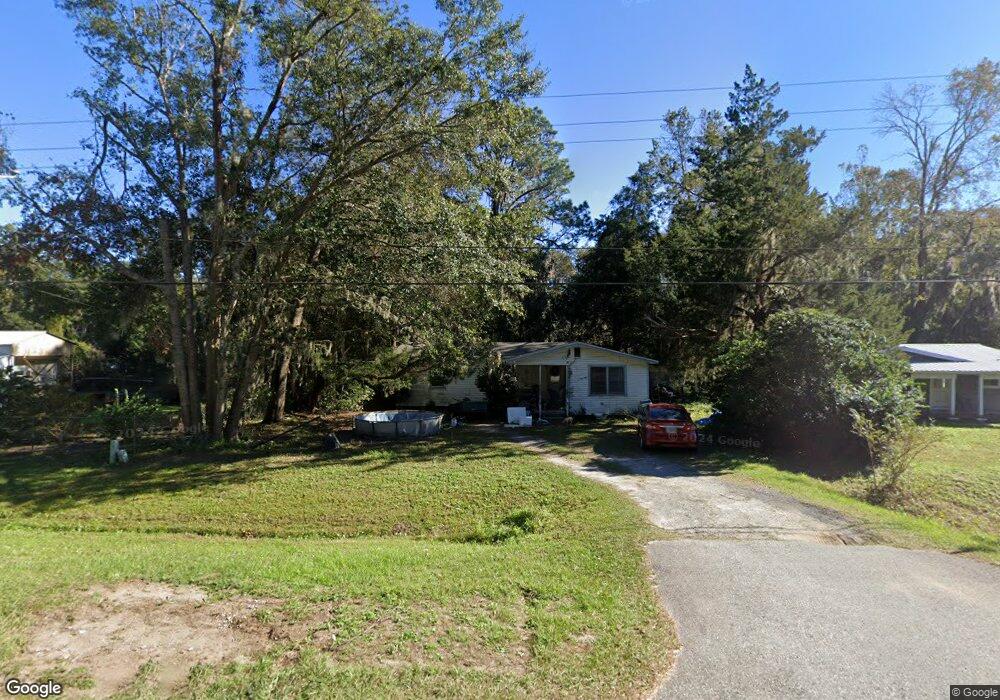
825 Ridge Rd Darien, GA 31305
Estimated Value: $99,000 - $220,000
Studio
--
Bath
1,088
Sq Ft
$146/Sq Ft
Est. Value
About This Home
This home is located at 825 Ridge Rd, Darien, GA 31305 and is currently estimated at $158,951, approximately $146 per square foot. 825 Ridge Rd is a home with nearby schools including Todd Grant Elementary School, McIntosh County Middle School, and McIntosh County Academy.
Ownership History
Date
Name
Owned For
Owner Type
Purchase Details
Closed on
Sep 7, 2021
Sold by
Wortham Dennis
Bought by
Weaver Wesley Daniel
Current Estimated Value
Home Financials for this Owner
Home Financials are based on the most recent Mortgage that was taken out on this home.
Original Mortgage
$27,000
Outstanding Balance
$15,217
Interest Rate
2.8%
Mortgage Type
Commercial
Estimated Equity
$143,734
Purchase Details
Closed on
Jun 29, 2005
Sold by
Tillman Paul E
Bought by
Wortham Dennis
Purchase Details
Closed on
Jun 24, 2005
Sold by
Tillman Paul E
Bought by
Wortham Dennis
Create a Home Valuation Report for This Property
The Home Valuation Report is an in-depth analysis detailing your home's value as well as a comparison with similar homes in the area
Purchase History
| Date | Buyer | Sale Price | Title Company |
|---|---|---|---|
| Weaver Wesley Daniel | $30,000 | -- | |
| Wortham Dennis | $29,800 | -- | |
| Wortham Dennis | $29,778 | -- |
Source: Public Records
Mortgage History
| Date | Status | Borrower | Loan Amount |
|---|---|---|---|
| Open | Weaver Wesley Daniel | $27,000 |
Source: Public Records
Tax History
| Year | Tax Paid | Tax Assessment Tax Assessment Total Assessment is a certain percentage of the fair market value that is determined by local assessors to be the total taxable value of land and additions on the property. | Land | Improvement |
|---|---|---|---|---|
| 2024 | $1,458 | $37,032 | $12,000 | $25,032 |
| 2023 | $1,450 | $36,712 | $12,000 | $24,712 |
| 2022 | $865 | $25,592 | $5,000 | $20,592 |
| 2021 | $724 | $20,520 | $5,000 | $15,520 |
| 2020 | $713 | $19,920 | $5,000 | $14,920 |
| 2019 | $687 | $20,120 | $5,000 | $15,120 |
| 2018 | $611 | $20,120 | $5,000 | $15,120 |
| 2017 | $669 | $19,440 | $5,000 | $14,440 |
| 2016 | $669 | $19,440 | $5,000 | $14,440 |
| 2015 | $570 | $16,582 | $1,500 | $15,082 |
| 2014 | $571 | $16,582 | $1,500 | $15,082 |
Source: Public Records
Map
Nearby Homes
- 711 Adams St
- 709 Adams St
- 1103 E Broad St
- 905 SE Wayne Street None Unit 40-B
- 902 Martin Luther King jr Blvd
- 410 Munro St
- 1401 Wayne St
- 1106 Alabama St
- 1001 Poppell Dr
- 452 Adams St
- 508 Fort King George Dr
- 15914 Hwy 99
- 601 Fort King George Dr
- 2101 Black Rd
- 211 Trumbull St
- 1202 Market St
- Tract B 38 Acres
- 0 Georgia 99 Unit 1648162
- 0 Georgia 99 Unit 1647831
- 227 Fort King George Dr
- 829 Ridge Rd
- 823 Ridge Rd
- 833 Ridge Rd
- 819 Ridge Rd
- 610 Kellsie Cir
- 600 Kellsie Cir
- 618 Kellsie Cir
- 608 Kellsie Cir
- 607 Kellsie Cir
- 813 Ridge Rd
- 620 Kellsie Cir
- 606 Kellsie Cir
- 0 Ga Highway 99 Unit 20123297
- E Ga Highway 99 Unit 1010
- 820 Ridge Rd
- 604 Kellsie Cir
- 812 Ridge Rd
- 809 Ridge Rd
- 602 Kellsie Cir
- 211 Oak St SE
Your Personal Tour Guide
Ask me questions while you tour the home.