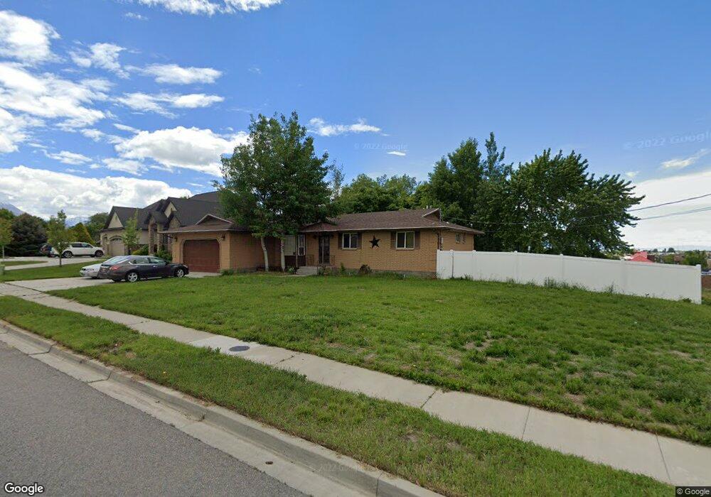
825 W 700 N American Fork, UT 84003
Estimated Value: $681,000 - $763,000
3
Beds
3
Baths
2,152
Sq Ft
$339/Sq Ft
Est. Value
About This Home
This home is located at 825 W 700 N, American Fork, UT 84003 and is currently estimated at $729,699, approximately $339 per square foot. 825 W 700 N is a home located in Utah County with nearby schools including Shelley Elementary School, American Fork Junior High School, and American Fork High School.
Ownership History
Date
Name
Owned For
Owner Type
Purchase Details
Closed on
Mar 15, 2021
Sold by
Mcguire Elisa Beth and Mcguire Steven Michael
Bought by
Mcguire Elisa and Mcguire Steven
Current Estimated Value
Home Financials for this Owner
Home Financials are based on the most recent Mortgage that was taken out on this home.
Original Mortgage
$310,000
Outstanding Balance
$277,893
Interest Rate
2.7%
Mortgage Type
New Conventional
Estimated Equity
$451,806
Purchase Details
Closed on
Jun 18, 2020
Sold by
Mcguire Elisa B and Mcguire Steven M
Bought by
Mcguire Elisa Beth and Mcguire Steven Michael
Home Financials for this Owner
Home Financials are based on the most recent Mortgage that was taken out on this home.
Original Mortgage
$249,541
Interest Rate
3.2%
Mortgage Type
VA
Purchase Details
Closed on
Jun 25, 2015
Sold by
Rode Francis and Rode Rebecca
Bought by
Meguire Elisa B and Meguire Steven M
Home Financials for this Owner
Home Financials are based on the most recent Mortgage that was taken out on this home.
Original Mortgage
$270,697
Interest Rate
3.83%
Mortgage Type
VA
Purchase Details
Closed on
Apr 10, 2008
Sold by
Rode Rebecca
Bought by
Rode Francis and Rode Rebecca
Home Financials for this Owner
Home Financials are based on the most recent Mortgage that was taken out on this home.
Original Mortgage
$228,000
Interest Rate
6.22%
Mortgage Type
New Conventional
Purchase Details
Closed on
Dec 28, 2006
Sold by
Myler Bradford
Bought by
Myler Bradford D and Myler Lisa R
Purchase Details
Closed on
Dec 27, 2006
Sold by
Welch C Scott and Welch Marci
Bought by
Myler Bradford
Purchase Details
Closed on
Apr 25, 1997
Sold by
Curtis S Rand and Curtis Leslie R
Bought by
Welch C Scott and Welch Marci Kay
Home Financials for this Owner
Home Financials are based on the most recent Mortgage that was taken out on this home.
Original Mortgage
$201,400
Interest Rate
7.86%
Create a Home Valuation Report for This Property
The Home Valuation Report is an in-depth analysis detailing your home's value as well as a comparison with similar homes in the area
Home Values in the Area
Average Home Value in this Area
Purchase History
| Date | Buyer | Sale Price | Title Company |
|---|---|---|---|
| Mcguire Elisa | -- | Vanguard Title Ins Agency | |
| Mcguire Elisa Beth | -- | Vanguard Title Ins Agcy | |
| Meguire Elisa B | -- | United West Title | |
| Rode Francis | -- | Inwest Title Services Inc | |
| Myler Bradford D | -- | First American Title Agency | |
| Myler Bradford | -- | First American Title Agency | |
| Welch C Scott | -- | -- |
Source: Public Records
Mortgage History
| Date | Status | Borrower | Loan Amount |
|---|---|---|---|
| Open | Mcguire Elisa | $310,000 | |
| Closed | Mcguire Elisa Beth | $249,541 | |
| Closed | Meguire Elisa B | $270,697 | |
| Previous Owner | Rode Francis | $228,000 | |
| Previous Owner | Welch C Scott | $201,400 |
Source: Public Records
Tax History Compared to Growth
Tax History
| Year | Tax Paid | Tax Assessment Tax Assessment Total Assessment is a certain percentage of the fair market value that is determined by local assessors to be the total taxable value of land and additions on the property. | Land | Improvement |
|---|---|---|---|---|
| 2025 | $3,046 | $375,155 | $355,100 | $327,000 |
| 2024 | $3,046 | $338,470 | $0 | $0 |
| 2023 | $2,775 | $326,920 | $0 | $0 |
| 2022 | $2,896 | $336,655 | $0 | $0 |
| 2021 | $2,556 | $464,200 | $248,700 | $215,500 |
| 2020 | $2,473 | $435,500 | $230,300 | $205,200 |
| 2019 | $2,353 | $428,600 | $230,300 | $198,300 |
| 2018 | $2,029 | $353,300 | $155,000 | $198,300 |
| 2017 | $1,938 | $182,160 | $0 | $0 |
| 2016 | $1,845 | $161,095 | $0 | $0 |
| 2015 | $1,944 | $161,095 | $0 | $0 |
| 2014 | $1,913 | $156,365 | $0 | $0 |
Source: Public Records
Map
Nearby Homes
- 962 N 780 St W Unit 508
- 974 N 780 St W Unit 509
- 916 N 780 St W Unit 501
- 822 W 800 St N Unit LOT319
- 822 N 860 W Unit 317
- 777 W State Rd
- 901 N Lakota Rd
- 602 W 860 N
- 3935 W 1000 N Unit 438
- 3983 W 1000 N Unit 442
- 4007 W 1000 N
- 3947 W 1000 N Unit 439
- 3959 W 1000 N
- 418 N 1322 E
- 328 N 1270 E
- 641 N 420 W
- 356 N 480 W
- 893 N 1580 E
- 458 N 1100 E Unit 3
- 595 N 1200 E
- 819 W 700 N
- 821 W 700 N Unit 291
- 829 W 700 N Unit 293
- 829 W 700 N
- 833 W 700 N Unit 294
- 809 W 700 N Unit 288
- 873 W 700 N
- 807 W 700 N Unit 287
- 803 W 700 N Unit 285
- 805 W 700 N Unit 286
- 757 W 700 N
- 811 W 600 N Unit 26
- 802 W 700 N
- 793 W 700 N Unit 283
- 796 W 600 N
- 826 W 700 N Unit A110
- 826 W 700 N Unit A1102
- 785 W 700 N Unit 282
- 812 W 700 N Unit A1104
- 781 W 700 N Unit 281