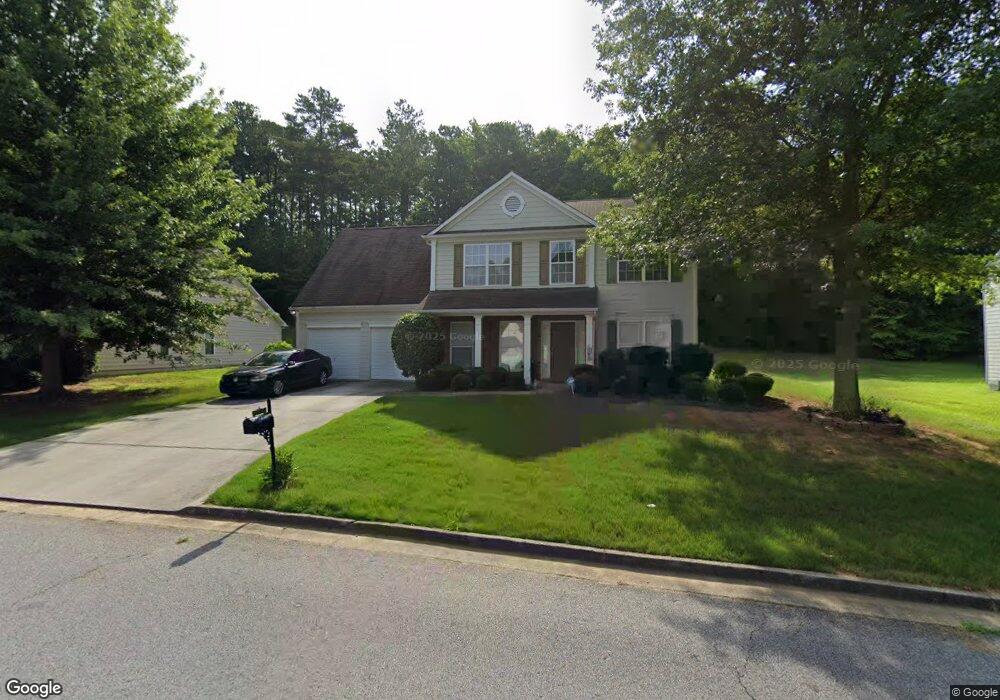
8250 Eastshore Dr Union City, GA 30291
Estimated Value: $277,066 - $302,000
4
Beds
3
Baths
2,064
Sq Ft
$140/Sq Ft
Est. Value
About This Home
This home is located at 8250 Eastshore Dr, Union City, GA 30291 and is currently estimated at $288,767, approximately $139 per square foot. 8250 Eastshore Dr is a home located in Fulton County with nearby schools including Liberty Point Elementary School, Camp Creek Middle School, and Langston Hughes High School.
Ownership History
Date
Name
Owned For
Owner Type
Purchase Details
Closed on
Apr 30, 2004
Sold by
Inc-Torrey D R Horton
Bought by
Malik Leila
Current Estimated Value
Home Financials for this Owner
Home Financials are based on the most recent Mortgage that was taken out on this home.
Original Mortgage
$144,652
Interest Rate
8.38%
Mortgage Type
New Conventional
Purchase Details
Closed on
Oct 30, 2002
Sold by
Inc-Torrey D R Horton
Bought by
Malik Leila
Home Financials for this Owner
Home Financials are based on the most recent Mortgage that was taken out on this home.
Original Mortgage
$144,652
Interest Rate
8.38%
Mortgage Type
New Conventional
Create a Home Valuation Report for This Property
The Home Valuation Report is an in-depth analysis detailing your home's value as well as a comparison with similar homes in the area
Home Values in the Area
Average Home Value in this Area
Purchase History
| Date | Buyer | Sale Price | Title Company |
|---|---|---|---|
| Malik Leila | $160,800 | -- | |
| Malik Leila | $160,800 | -- |
Source: Public Records
Mortgage History
| Date | Status | Borrower | Loan Amount |
|---|---|---|---|
| Previous Owner | Malik Leila | $144,652 | |
| Previous Owner | Malik Leila | $144,652 |
Source: Public Records
Tax History Compared to Growth
Tax History
| Year | Tax Paid | Tax Assessment Tax Assessment Total Assessment is a certain percentage of the fair market value that is determined by local assessors to be the total taxable value of land and additions on the property. | Land | Improvement |
|---|---|---|---|---|
| 2025 | $1,294 | $108,840 | $24,120 | $84,720 |
| 2023 | $2,593 | $91,880 | $15,840 | $76,040 |
| 2022 | $1,389 | $91,880 | $15,840 | $76,040 |
| 2021 | $1,327 | $75,640 | $12,200 | $63,440 |
| 2020 | $1,220 | $62,920 | $9,840 | $53,080 |
| 2019 | $2,082 | $61,800 | $9,640 | $52,160 |
| 2018 | $1,204 | $54,760 | $8,880 | $45,880 |
| 2017 | $1,073 | $48,720 | $11,520 | $37,200 |
| 2016 | $1,071 | $48,720 | $11,520 | $37,200 |
| 2015 | $1,840 | $48,720 | $11,520 | $37,200 |
| 2014 | $633 | $33,400 | $7,680 | $25,720 |
Source: Public Records
Map
Nearby Homes
- 6320 Littleton Dr
- 0 Highpoint Rd Unit 10553938
- 000 Highpoint Rd
- 99 Highpoint Rd
- 4812 Station Dr Unit 2
- 4811 Station Dr Unit 35
- 3227 Diamond Bluff
- 4818 Sandstone Ln Unit 5
- 3317 Stonewall Ln Unit 71
- 9515 Lakeview Rd
- 4837 Station Ln
- 4811 Station Ln
- 3318 Stonewall Ln
- 4813 Station Ln
- 4855 Station Ln
- 4817 Station Ln Unit 32
- 3426 Newgold Trace
- 4838 Station Lane-Lot 15
- Beaufort Plan at Stonewall Station
- Cecil Plan at The Enclave at Stonewall Station
- 8252 Eastshore Dr
- 8248 Eastshore Dr
- 8254 Eastshore Dr
- 8246 Eastshore Dr Unit 22
- 8246 Eastshore Dr Unit 1
- 8246 Eastshore Dr
- 8249 Eastshore Dr
- 8251 Eastshore Dr Unit I
- 8247 Eastshore Dr
- 8256 Eastshore Dr Unit 1
- 8255 Eastshore Dr Unit I
- 8244 Eastshore Dr
- 8245 Eastshore Dr
- 8258 Eastshore Dr
- 6250 Littleton Dr
- 8243 Eastshore Dr
- 8242 Eastshore Dr
- 8260 E Shore Dr
- 8257 Eastshore Dr
- 8260 Eastshore Dr