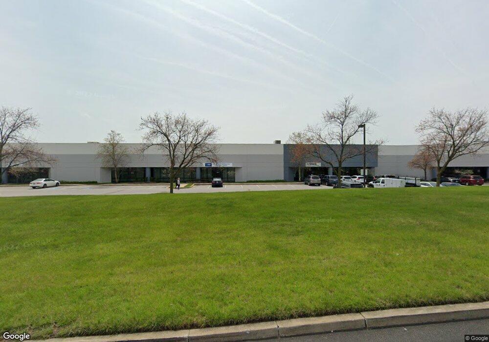
8255 Patuxent Range Rd Jessup, MD 20794
Estimated Value: $26,259,555
--
Bed
--
Bath
58,225
Sq Ft
$451/Sq Ft
Est. Value
About This Home
This home is located at 8255 Patuxent Range Rd, Jessup, MD 20794 and is currently estimated at $26,259,555, approximately $451 per square foot. 8255 Patuxent Range Rd is a home located in Howard County with nearby schools including Hanover Hills Elementary, Thomas Viaduct Middle School, and Bethel Christian Academy.
Ownership History
Date
Name
Owned For
Owner Type
Purchase Details
Closed on
Nov 14, 2017
Sold by
Colfin 2016 1 Industrial Owner Llc
Bought by
Ci Baltimore I Pru Llc
Current Estimated Value
Home Financials for this Owner
Home Financials are based on the most recent Mortgage that was taken out on this home.
Original Mortgage
$104,400,000
Outstanding Balance
$87,482,229
Interest Rate
3.85%
Mortgage Type
Commercial
Estimated Equity
-$61,222,674
Purchase Details
Closed on
Feb 19, 2016
Sold by
Gateway Brentwood Inc
Bought by
Colfin 2016-1 Industrial Owner Llc
Purchase Details
Closed on
Oct 15, 1998
Sold by
Abra Atlantic Coast
Bought by
Gateway Brentwood Inc and Real Etate Fund
Purchase Details
Closed on
Jan 22, 1992
Sold by
Patuxent Range Road
Bought by
Abra Atlantic Coast
Create a Home Valuation Report for This Property
The Home Valuation Report is an in-depth analysis detailing your home's value as well as a comparison with similar homes in the area
Home Values in the Area
Average Home Value in this Area
Purchase History
| Date | Buyer | Sale Price | Title Company |
|---|---|---|---|
| Ci Baltimore I Pru Llc | -- | Republic Title Of Tecxas Inc | |
| Colfin 2016-1 Industrial Owner Llc | $17,625,000 | First American Title Ins Co | |
| Gateway Brentwood Inc | $7,358,000 | -- | |
| Abra Atlantic Coast | $7,585,000 | -- |
Source: Public Records
Mortgage History
| Date | Status | Borrower | Loan Amount |
|---|---|---|---|
| Open | Ci Baltimore I Pru Llc | $104,400,000 |
Source: Public Records
Tax History Compared to Growth
Tax History
| Year | Tax Paid | Tax Assessment Tax Assessment Total Assessment is a certain percentage of the fair market value that is determined by local assessors to be the total taxable value of land and additions on the property. | Land | Improvement |
|---|---|---|---|---|
| 2025 | $260,306 | $17,652,300 | $2,663,600 | $14,988,700 |
| 2024 | $260,306 | $16,564,133 | $0 | $0 |
| 2023 | $232,294 | $15,475,967 | $0 | $0 |
| 2022 | $216,643 | $14,387,800 | $2,663,600 | $11,724,200 |
| 2021 | $216,643 | $14,387,800 | $2,663,600 | $11,724,200 |
| 2020 | $216,658 | $14,387,800 | $2,663,600 | $11,724,200 |
| 2019 | $251,756 | $16,830,400 | $2,663,600 | $14,166,800 |
| 2018 | $209,498 | $14,441,633 | $0 | $0 |
| 2017 | $175,875 | $16,830,400 | $0 | $0 |
| 2016 | -- | $9,664,100 | $0 | $0 |
| 2015 | -- | $9,590,733 | $0 | $0 |
| 2014 | -- | $9,791,333 | $0 | $0 |
Source: Public Records
Map
Nearby Homes
- 8304 Firewood Ct
- 8353 Ashwood Rd Unit 8353
- 8281 Washington Blvd
- 8252 Glen Ct
- 2357 Terrapin Crossing
- 2384 Terrapin Crossing
- 10075 Guilford Rd
- 8790 Lincoln St
- 8449 Oak Meade Way
- 8230 Wellington Place
- 8861 Mission Rd
- 8314 Wades Way
- 7911 Burkard Ln
- Lot 7 Cedar Ave
- Lot 6 Cedar Ave
- 7370 Cedar Ave
- 7368 Cedar Ave
- 8334 Woodward St
- 2044 Orchard Ave
- 8911 Josephs Coat Ct
- 8215 Dorsey Run Rd
- 8200 Preston Ct
- 8260 Patuxent Range Rd
- 8263 Patuxent Range Rd
- 8236 Patuxent Range Rd
- 8245 Dorsey Run Rd
- 8375 Dorsey Run Rd
- 8221 Preston Ct
- 8139 Dorsey Run Rd
- 8235 Patuxent Range Rd
- 8230 Preston Ct
- 8155 Stayton Dr
- 8280 Patuxent Range Rd Unit SUITE E-2
- 8280 Patuxent Range Rd Unit C-2
- 8280 Patuxent Range Rd Unit C-1
- 8280 Patuxent Range Rd Unit D
- 8280 Patuxent Range Rd Unit C
- 8280 Patuxent Range Rd Unit B
- 8280 Patuxent Range Rd Unit SUITE A-2
- 8280 Patuxent Range Rd Unit F2-3