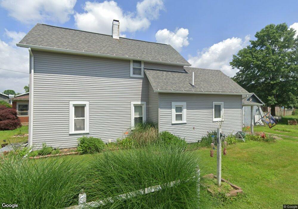
826 Bank Ln SE New Philadelphia, OH 44663
Estimated Value: $62,000 - $120,000
1
Bed
1
Bath
1,212
Sq Ft
$82/Sq Ft
Est. Value
About This Home
This home is located at 826 Bank Ln SE, New Philadelphia, OH 44663 and is currently estimated at $99,687, approximately $82 per square foot. 826 Bank Ln SE is a home located in Tuscarawas County with nearby schools including New Philadelphia High School, Quaker Preparatory Academy, and Quaker Digital Academy.
Ownership History
Date
Name
Owned For
Owner Type
Purchase Details
Closed on
Jul 1, 1996
Sold by
Kopka Andrew J
Bought by
Klingman Matthew G Hardesty and Klingman Laura B
Current Estimated Value
Home Financials for this Owner
Home Financials are based on the most recent Mortgage that was taken out on this home.
Original Mortgage
$38,600
Outstanding Balance
$2,670
Interest Rate
7.75%
Mortgage Type
New Conventional
Estimated Equity
$97,017
Purchase Details
Closed on
Jun 3, 1993
Sold by
Destefani Louis J
Bought by
Kopka Andrew J and Kopka Polly
Create a Home Valuation Report for This Property
The Home Valuation Report is an in-depth analysis detailing your home's value as well as a comparison with similar homes in the area
Home Values in the Area
Average Home Value in this Area
Purchase History
| Date | Buyer | Sale Price | Title Company |
|---|---|---|---|
| Klingman Matthew G Hardesty | $42,900 | -- | |
| Kopka Andrew J | $23,000 | -- |
Source: Public Records
Mortgage History
| Date | Status | Borrower | Loan Amount |
|---|---|---|---|
| Open | Klingman Matthew G Hardesty | $38,600 |
Source: Public Records
Tax History Compared to Growth
Tax History
| Year | Tax Paid | Tax Assessment Tax Assessment Total Assessment is a certain percentage of the fair market value that is determined by local assessors to be the total taxable value of land and additions on the property. | Land | Improvement |
|---|---|---|---|---|
| 2024 | $959 | $24,890 | $7,480 | $17,410 |
| 2023 | $959 | $71,100 | $21,360 | $49,740 |
| 2022 | $968 | $24,885 | $7,476 | $17,409 |
| 2021 | $917 | $22,187 | $5,233 | $16,954 |
| 2020 | $922 | $22,187 | $5,233 | $16,954 |
| 2019 | $921 | $22,187 | $5,233 | $16,954 |
| 2018 | $843 | $19,380 | $4,570 | $14,810 |
| 2017 | $837 | $19,380 | $4,570 | $14,810 |
| 2016 | $859 | $19,380 | $4,570 | $14,810 |
| 2014 | $829 | $18,210 | $4,150 | $14,060 |
| 2013 | $687 | $18,210 | $4,150 | $14,060 |
Source: Public Records
Map
Nearby Homes
- 221 Sea Gull Dr SE
- 231 4th St SE
- 451 Mill Ave SE
- 429 Beitler Ave NE
- 240 3rd St NE
- 1451 Ridge Rd NE
- 416 2nd Dr NE
- 132 North Ave NE
- 241 Saint Clair Ave SW
- 348 N Broadway St
- 217 Minnich Ave NE
- 247 Kent Cir NE
- 427 Sycamore Cir SE
- 377 Schoenbrunn Dr NE
- 1577 State Route 39 NE
- 405 Front Ave SW
- 360 3rd St NW
- 206 Watson Cir NE
- 1149 Jefferson St SE
- 514 Front Ave SW