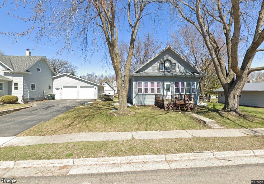
826 Division St E Brownton, MN 55312
Estimated Value: $209,945 - $238,000
3
Beds
1
Bath
2,012
Sq Ft
$111/Sq Ft
Est. Value
About This Home
This home is located at 826 Division St E, Brownton, MN 55312 and is currently estimated at $222,986, approximately $110 per square foot. 826 Division St E is a home located in McLeod County with nearby schools including Lincoln Elementary School, Lakeside Elementary School, and Glencoe-Silver Lake Jr. High School.
Ownership History
Date
Name
Owned For
Owner Type
Purchase Details
Closed on
Jul 13, 2012
Sold by
Foote Robert Warren
Bought by
Kalenberg James J and Kalenberg Christine E
Current Estimated Value
Home Financials for this Owner
Home Financials are based on the most recent Mortgage that was taken out on this home.
Original Mortgage
$56,522
Outstanding Balance
$40,147
Interest Rate
4.75%
Mortgage Type
FHA
Estimated Equity
$182,839
Create a Home Valuation Report for This Property
The Home Valuation Report is an in-depth analysis detailing your home's value as well as a comparison with similar homes in the area
Purchase History
| Date | Buyer | Sale Price | Title Company |
|---|---|---|---|
| Kalenberg James J | -- | Stewart Title Of Mn Inc Bloo |
Source: Public Records
Mortgage History
| Date | Status | Borrower | Loan Amount |
|---|---|---|---|
| Open | Kalenberg James J | $56,522 |
Source: Public Records
Tax History
| Year | Tax Paid | Tax Assessment Tax Assessment Total Assessment is a certain percentage of the fair market value that is determined by local assessors to be the total taxable value of land and additions on the property. | Land | Improvement |
|---|---|---|---|---|
| 2025 | $2,886 | $185,500 | $39,900 | $145,600 |
| 2024 | $2,756 | $159,100 | $36,200 | $122,900 |
| 2023 | $2,756 | $159,100 | $36,200 | $122,900 |
| 2022 | $2,492 | $137,100 | $31,500 | $105,600 |
| 2021 | $2,532 | $121,300 | $27,400 | $93,900 |
| 2020 | $2,446 | $121,300 | $27,400 | $93,900 |
| 2019 | $1,692 | $109,000 | $24,900 | $84,100 |
| 2018 | $1,758 | $0 | $0 | $0 |
| 2017 | $1,544 | $0 | $0 | $0 |
| 2016 | $1,486 | $0 | $0 | $0 |
| 2015 | $1,350 | $0 | $0 | $0 |
| 2014 | -- | $0 | $0 | $0 |
Source: Public Records
Map
Nearby Homes
- 1002 2nd St N
- 529 Division St
- 304 5th Ave N
- 124 3rd Ave S
- 352 4th St N
- 226 3rd Ave S
- 140 1st Ave N
- xxx Lot 3 Division St W
- Lot 2 U S Highway 212
- XXX US Hwy 212
- xxx Lot 2 Us Hwy 212
- 0 57th St
- 11742 Sunset Cir
- 7900 Lace Ave
- 7900 Lace Ave N
- Lot 2 Tagus Ave
- 12893 County Road 7
- 540 Mowbray St
- 821 North St
- 1199 E 2nd St
- 822 Division St
- 930 Division St E
- 168 168 9th-Avenue-s
- 930 930 Division St
- 818 Division St E
- 819 Division St
- 158 9th Ave N
- 812 Division St
- 936 Division St
- 931 Division St
- 973 2nd St N
- 813 Division St
- 168 9th Ave S
- 171 8th Ave N
- 860 860 2nd-Street-n
- 174 9th Ave S
- 167 167 8th Ave S
- 170 8th Ave N
- 158 158 8th-Avenue-s
- 981 2nd St N
Your Personal Tour Guide
Ask me questions while you tour the home.