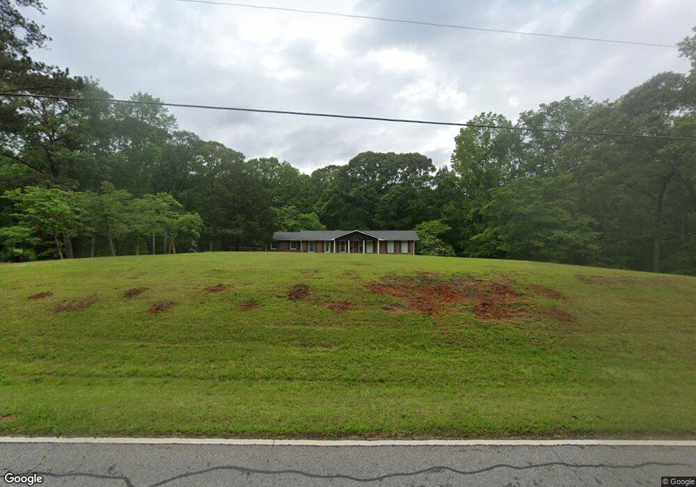
826 Jim Starr Rd Newnan, GA 30263
Estimated Value: $453,000 - $488,000
3
Beds
3
Baths
1,725
Sq Ft
$271/Sq Ft
Est. Value
About This Home
This home is located at 826 Jim Starr Rd, Newnan, GA 30263 and is currently estimated at $467,944, approximately $271 per square foot. 826 Jim Starr Rd is a home located in Coweta County with nearby schools including Brooks Elementary School, Madras Middle School, and Northgate High School.
Ownership History
Date
Name
Owned For
Owner Type
Purchase Details
Closed on
Apr 5, 2018
Sold by
Stewart William E
Bought by
Pope Ben M and Pope Laura Lane
Current Estimated Value
Home Financials for this Owner
Home Financials are based on the most recent Mortgage that was taken out on this home.
Original Mortgage
$211,000
Outstanding Balance
$181,151
Interest Rate
4.46%
Mortgage Type
New Conventional
Estimated Equity
$286,793
Purchase Details
Closed on
Jan 31, 2012
Sold by
Mcmurray Roger L
Bought by
Stewart William E and Stewart Susan C
Purchase Details
Closed on
Jan 22, 2009
Sold by
Stewart William E and Stewart Susan C
Bought by
Mcmurray Roger L
Home Financials for this Owner
Home Financials are based on the most recent Mortgage that was taken out on this home.
Original Mortgage
$249,000
Interest Rate
5.43%
Mortgage Type
Trade
Purchase Details
Closed on
Aug 4, 2006
Sold by
Stewart Earl J
Bought by
Stewart William E and Stewart Susan C
Purchase Details
Closed on
Oct 31, 1982
Bought by
Stewart Earl J
Create a Home Valuation Report for This Property
The Home Valuation Report is an in-depth analysis detailing your home's value as well as a comparison with similar homes in the area
Home Values in the Area
Average Home Value in this Area
Purchase History
| Date | Buyer | Sale Price | Title Company |
|---|---|---|---|
| Pope Ben M | $241,000 | -- | |
| Stewart William E | -- | -- | |
| Mcmurray Roger L | $250,000 | -- | |
| Stewart William E | -- | -- | |
| Stewart Earl J | -- | -- |
Source: Public Records
Mortgage History
| Date | Status | Borrower | Loan Amount |
|---|---|---|---|
| Open | Pope Ben M | $211,000 | |
| Previous Owner | Mcmurray Roger L | $249,000 |
Source: Public Records
Tax History Compared to Growth
Tax History
| Year | Tax Paid | Tax Assessment Tax Assessment Total Assessment is a certain percentage of the fair market value that is determined by local assessors to be the total taxable value of land and additions on the property. | Land | Improvement |
|---|---|---|---|---|
| 2025 | $2,425 | $147,777 | $50,762 | $97,015 |
| 2024 | $2,349 | $145,276 | $50,762 | $94,514 |
| 2023 | $2,349 | $157,860 | $65,198 | $92,662 |
| 2022 | $2,003 | $122,158 | $46,570 | $75,588 |
| 2021 | $1,822 | $108,241 | $44,353 | $63,888 |
| 2020 | $1,831 | $108,241 | $44,353 | $63,888 |
| 2019 | $1,555 | $55,292 | $4,919 | $50,374 |
| 2018 | $1,805 | $61,546 | $24,260 | $37,286 |
| 2017 | $1,804 | $61,546 | $24,259 | $37,287 |
| 2016 | $1,782 | $61,546 | $24,260 | $37,286 |
| 2015 | $1,752 | $61,546 | $24,260 | $37,286 |
| 2014 | -- | $61,546 | $24,260 | $37,286 |
Source: Public Records
Map
Nearby Homes
- 84 Starr Place Unit 21
- 36 Starr Place Unit 25
- 5 Sanders Crossing Unit 10
- 45 Sanders Crossing Unit 13
- LOT 89 Hedge Ct
- 42 Hodges St
- TISDALE Plan at Genesee
- SONOMA Plan at Genesee
- SAVANNAH II Plan at Genesee
- AMERICANA Plan at Genesee
- ASHLEY Plan at Genesee
- EDINBURGH Plan at Genesee
- 76 Hodges St
- 659 Hood Rd
- 220 Sagebrook Ln Unit LOT 21
- 30 Shadybrook Path Unit LOT 30
- 12030 Hutcheson Ferry Rd
- 48 Garden View Terrace
- 11800 Hutcheson Ferry Rd
- 1069 Lupo Loop
- 872 Jim Starr Rd
- 835 Jim Starr Rd Unit 11
- 883 Jim Starr Rd Unit 10
- 93 Starr Place Unit 20
- 777 Jim Starr Rd
- 75 Starr Place
- 65 Starr Place Unit 38410907
- 65 Starr Place Unit 38410897
- 65 Starr Place Unit 38410862
- 65 Starr Place Unit 38410593
- 65 Starr Place Unit 38410546
- 65 Starr Place Unit 2
- 915 Jim Starr Rd Unit 9
- 48 Jim Starr Rd Unit 24
- 64 Starr Place Unit 23
- 76 Starr Place Unit 22
- 61 Bethel Rd
- 1000 Jim Starr Rd
- 933 Jim Starr Rd Unit 8
- 10 Sanders Crossing Unit 7