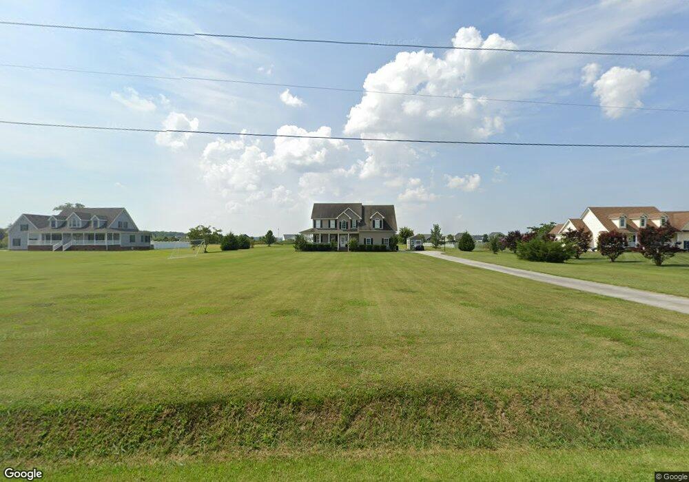
826 Tulls Creek Rd Moyock, NC 27958
Estimated Value: $681,722 - $703,000
4
Beds
3
Baths
2,601
Sq Ft
$266/Sq Ft
Est. Value
About This Home
This home is located at 826 Tulls Creek Rd, Moyock, NC 27958 and is currently estimated at $692,361, approximately $266 per square foot. 826 Tulls Creek Rd is a home located in Currituck County with nearby schools including Moyock Elementary School, Moyock Middle School, and Currituck County High School.
Ownership History
Date
Name
Owned For
Owner Type
Purchase Details
Closed on
Jul 19, 2007
Sold by
Rowland John O and Rowland Agatha L
Bought by
Hoover Dustin L and Hoover Valerie G
Current Estimated Value
Home Financials for this Owner
Home Financials are based on the most recent Mortgage that was taken out on this home.
Original Mortgage
$44,500
Outstanding Balance
$27,639
Interest Rate
6.56%
Mortgage Type
Unknown
Estimated Equity
$664,722
Create a Home Valuation Report for This Property
The Home Valuation Report is an in-depth analysis detailing your home's value as well as a comparison with similar homes in the area
Home Values in the Area
Average Home Value in this Area
Purchase History
| Date | Buyer | Sale Price | Title Company |
|---|---|---|---|
| Hoover Dustin L | $445,000 | None Available |
Source: Public Records
Mortgage History
| Date | Status | Borrower | Loan Amount |
|---|---|---|---|
| Open | Hoover Dustin L | $44,500 |
Source: Public Records
Tax History
| Year | Tax Paid | Tax Assessment Tax Assessment Total Assessment is a certain percentage of the fair market value that is determined by local assessors to be the total taxable value of land and additions on the property. | Land | Improvement |
|---|---|---|---|---|
| 2025 | $3,148 | $430,000 | $114,100 | $315,900 |
| 2024 | $3,148 | $430,000 | $114,100 | $315,900 |
| 2023 | $3,171 | $430,000 | $114,100 | $315,900 |
| 2022 | $2,407 | $430,000 | $114,100 | $315,900 |
| 2021 | $2,399 | $330,900 | $83,900 | $247,000 |
| 2020 | $1,738 | $330,900 | $83,900 | $247,000 |
| 2019 | $1,738 | $330,900 | $83,900 | $247,000 |
| 2018 | $1,738 | $330,900 | $83,900 | $247,000 |
| 2017 | $1,702 | $330,900 | $83,900 | $247,000 |
| 2016 | $1,702 | $330,900 | $83,900 | $247,000 |
| 2015 | $1,702 | $330,900 | $83,900 | $247,000 |
Source: Public Records
Map
Nearby Homes
- 107 Farmridge Way
- 203 Farmstead Loop
- 101 Chickadee St Unit Lot6
- 101 Chickadee St
- 101 Avocet Path
- 106 Gander Dr
- 211 Moorland Way
- 419 Campus Dr
- 102 Moorland Way
- 116 Arbormoor Ln
- Lot Arbormoor Ln
- 117 Arbormoor Ln
- 316 Moorland Way
- 674 Tulls Creek Rd
- 203 Arbormoor Ln
- 104 Prairie Glen
- 300 Farmstead Loop
- 206 Arbormoor Ln
- 209 Arbormoor Ln
- 214 Arbormoor Ln
- 820 Tulls Creek Rd
- 832 Tulls Creek Rd
- 812 Tulls Creek Rd
- 825 Tulls Creek Rd
- 833 Tulls Creek Rd
- 811 Tulls Creek Rd
- 105 Farmridge Way Unit Lot 153
- 113 Farmridge Way
- 109 Arbormoor Ln
- 105 Arbormoor Ln
- 107 Arbormoor Ln
- 113 Arbormoor Ln
- 119 Arbormoor Ln
- 121 Arbormoor Ln
- 103 Arbormoor Ln
- 302 Farmstead Loop
- 205 Farmstead Loop
- 103 Farmridge Way
- 211 Farmstead Loop
- 106 Brookside Path
Your Personal Tour Guide
Ask me questions while you tour the home.