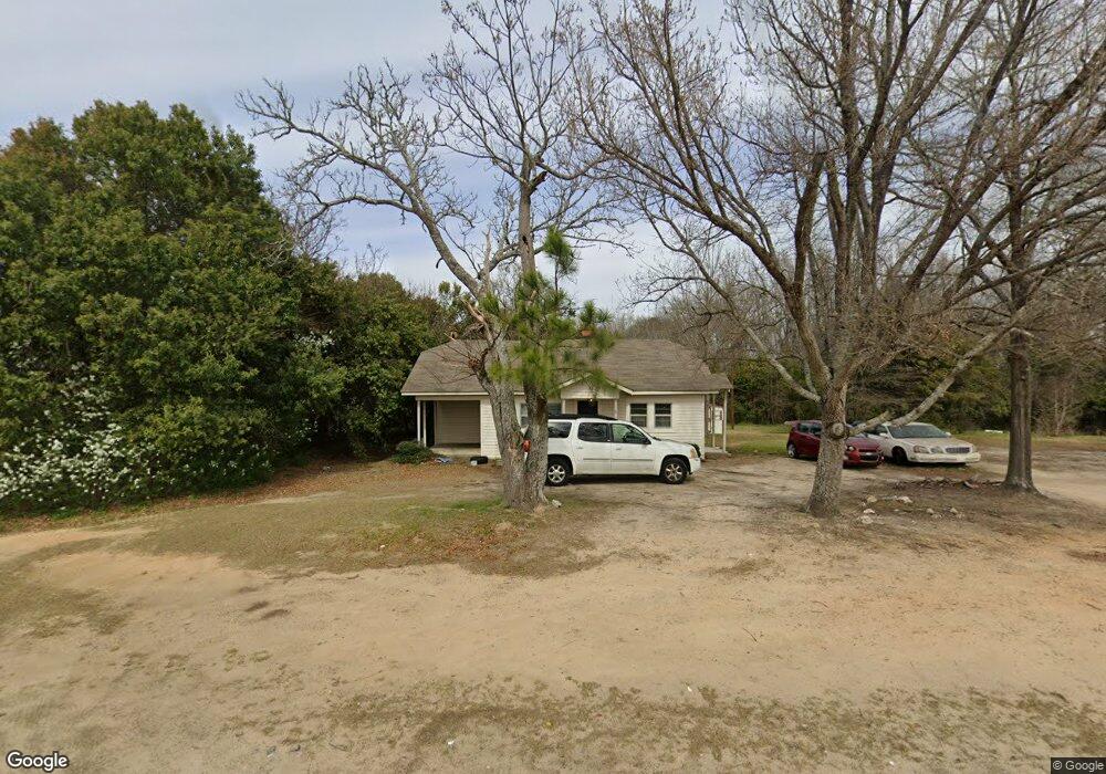
826 White Oak Rd Thomson, GA 30824
Estimated Value: $93,000 - $149,000
3
Beds
1
Bath
1,044
Sq Ft
$114/Sq Ft
Est. Value
About This Home
This home is located at 826 White Oak Rd, Thomson, GA 30824 and is currently estimated at $118,969, approximately $113 per square foot. 826 White Oak Rd is a home located in McDuffie County with nearby schools including Thomson High School.
Ownership History
Date
Name
Owned For
Owner Type
Purchase Details
Closed on
Mar 9, 2016
Sold by
F & M Bank
Bought by
Reeves Al
Current Estimated Value
Purchase Details
Closed on
Sep 2, 2014
Sold by
F & M Bank
Bought by
F & M Bank
Purchase Details
Closed on
Oct 4, 2012
Sold by
Sisson Properties Llc
Bought by
Thomas Uldine and Hampton Michael
Home Financials for this Owner
Home Financials are based on the most recent Mortgage that was taken out on this home.
Original Mortgage
$40,500
Interest Rate
3.58%
Mortgage Type
New Conventional
Purchase Details
Closed on
Jan 27, 2010
Sold by
Reese Clark Dorinda A
Bought by
Sisson Properties Llc
Home Financials for this Owner
Home Financials are based on the most recent Mortgage that was taken out on this home.
Original Mortgage
$36,223
Interest Rate
5.16%
Mortgage Type
Purchase Money Mortgage
Purchase Details
Closed on
Apr 30, 1981
Bought by
Clark Dorinda A
Create a Home Valuation Report for This Property
The Home Valuation Report is an in-depth analysis detailing your home's value as well as a comparison with similar homes in the area
Home Values in the Area
Average Home Value in this Area
Purchase History
| Date | Buyer | Sale Price | Title Company |
|---|---|---|---|
| Reeves Al | $14,000 | -- | |
| F & M Bank | $40,885 | -- | |
| Thomas Uldine | $45,000 | -- | |
| Sisson Properties Llc | $35,000 | -- | |
| Clark Dorinda A | -- | -- |
Source: Public Records
Mortgage History
| Date | Status | Borrower | Loan Amount |
|---|---|---|---|
| Previous Owner | Thomas Uldine | $40,500 | |
| Previous Owner | Thomas Uldine | $7,596 | |
| Previous Owner | Sisson Properties Llc | $36,223 |
Source: Public Records
Tax History
| Year | Tax Paid | Tax Assessment Tax Assessment Total Assessment is a certain percentage of the fair market value that is determined by local assessors to be the total taxable value of land and additions on the property. | Land | Improvement |
|---|---|---|---|---|
| 2025 | $861 | $35,161 | $3,864 | $31,297 |
| 2024 | $861 | $33,444 | $3,680 | $29,764 |
| 2023 | $832 | $31,368 | $2,760 | $28,608 |
| 2022 | $723 | $26,226 | $2,208 | $24,018 |
| 2021 | $602 | $21,482 | $2,944 | $18,538 |
| 2020 | $381 | $13,520 | $2,208 | $11,312 |
| 2019 | $385 | $13,520 | $2,208 | $11,312 |
| 2018 | $385 | $13,520 | $2,208 | $11,312 |
| 2017 | $154 | $13,520 | $2,208 | $11,312 |
| 2016 | $372 | $13,520 | $2,208 | $11,312 |
| 2015 | $339 | $13,520 | $2,208 | $11,312 |
| 2014 | $245 | $13,750 | $2,208 | $11,542 |
| 2013 | -- | $13,749 | $2,208 | $11,541 |
Source: Public Records
Map
Nearby Homes
- 2045 April Dawn Trail
- 2051 April Dawn Trail
- 2039 April Dawn Trail
- 2057 April Dawn Trail
- 2090 April Dawn Trail
- 2119 April Dawn Trail
- 2133 April Dawn Trail
- 0 Walnut St Unit 544634
- 0 Harrison Rd Unit 543150
- A-00 Harrison Rd
- 535 White Oak St
- 426 Salem Rd
- 421 Salem Rd
- 466 Edgar Cir
- 318 White Oak St
- 0 Cobbham Rd Unit 17174092
- 462 Bussey Ave
- 301 Cleveland St
- 219 White Oak St
- 125 Willow Oak Cir
- 832 White Oak Rd
- 863 White Oak Rd
- 0 Whiteoak Rd
- 822 White Oak Rd
- 111 Lincoln Dr
- 113 Lincoln Dr
- 835 White Oak Rd
- 115 Lincoln Dr
- 1033 Debutant Dr
- 121 Lincoln Dr
- 900 White Oak Rd
- 125 Lincoln Dr
- 116 Lincoln Dr
- 127 Lincoln Dr
- 120 Lincoln Dr
- 1773 White Oak Rd
- 0000 White Oak Rd
- 0 White Oak Rd
- 817 Lincoln Cir
- 124 Lincoln Dr
Your Personal Tour Guide
Ask me questions while you tour the home.