8260 Bankers Rd Reading, MI 49274
Estimated Value: $128,000 - $266,000
Studio
1
Bath
1,008
Sq Ft
$182/Sq Ft
Est. Value
About This Home
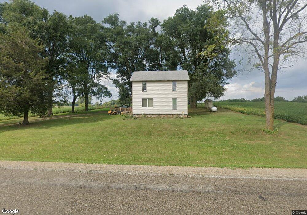
This home is located at 8260 Bankers Rd, Reading, MI 49274 and is currently estimated at $183,492, approximately $182 per square foot. 8260 Bankers Rd is a home located in Hillsdale County with nearby schools including Reynolds Elementary School and Reading High School.
Ownership History
Date
Name
Owned For
Owner Type
Purchase Details
Closed on
Aug 7, 2019
Sold by
Crafts Angela J and The Estate Of Jimmy Royce Shep
Bought by
Crafts Angela J
Current Estimated Value
Purchase Details
Closed on
Mar 4, 1992
Sold by
Thomas Arthur N and Thomas Muriel E
Bought by
Shepherd Jimmy R
Purchase Details
Closed on
Jan 28, 1980
Sold by
Shepherd Irene
Bought by
Shepherd Jimmy R
Purchase Details
Closed on
Mar 17, 1975
Sold by
Chester Frank A and Chester Margaret L
Bought by
Doiran Louis L and Doiran Juanita
Purchase Details
Closed on
Mar 11, 1975
Sold by
Doiran Louis L and Doiran Juanita
Bought by
Thomas Arthur N and Thomas Muriel E
Create a Home Valuation Report for This Property
The Home Valuation Report is an in-depth analysis detailing your home's value as well as a comparison with similar homes in the area
Purchase History
| Date | Buyer | Sale Price | Title Company |
|---|---|---|---|
| Crafts Angela J | -- | Accommodation | |
| Shepherd Jimmy R | $1,500 | -- | |
| Shepherd Jimmy R | -- | -- | |
| Doiran Louis L | $49,000 | -- | |
| Thomas Arthur N | $100,000 | -- |
Source: Public Records
Tax History
| Year | Tax Paid | Tax Assessment Tax Assessment Total Assessment is a certain percentage of the fair market value that is determined by local assessors to be the total taxable value of land and additions on the property. | Land | Improvement |
|---|---|---|---|---|
| 2025 | $224 | $45,900 | $0 | $0 |
| 2024 | $2 | $41,100 | $0 | $0 |
| 2023 | $208 | $39,200 | $0 | $0 |
| 2022 | $467 | $33,100 | $0 | $0 |
| 2021 | $454 | $29,500 | $0 | $0 |
| 2020 | $451 | $29,300 | $0 | $0 |
| 2019 | $434 | $25,000 | $0 | $0 |
| 2018 | $414 | $19,800 | $0 | $0 |
| 2017 | $399 | $20,500 | $0 | $0 |
| 2016 | $396 | $21,300 | $0 | $0 |
| 2015 | $176 | $21,300 | $0 | $0 |
| 2013 | $170 | $18,410 | $0 | $0 |
| 2012 | $166 | $17,880 | $0 | $0 |
Source: Public Records
Map
Nearby Homes
- 8875 Kellogg Dr
- 9059 Kellogg Dr
- 8941 Kellogg Dr
- 9055 Kellogg Dr
- 9222 Beech Dr
- 3870 Rus Dic Dr
- 2408 Spruce Dr
- 4380 Abbott Rd
- 1725 Hemlock Rd
- 4111 Blair Rd
- 5211 Long Lake Rd
- 5100 Long Lake Rd
- 5339 Lake Dr
- 1750 Pierce Rd
- 9180 Arkansaw Rd
- 5482 Circle Dr
- 5375 Paradise Dr
- 226 Strong St
- 0 W Silver St Unit 25044322
- 108 Lynn St
- 8378 Bankers Rd
- 8380 Bankers Rd
- 8411 Bankers Rd
- 8875 Bankers Rd
- 8480 Bankers Rd
- 8111 Bankers Rd
- 8624 Bankers Rd
- 2800 S Allen Rd Unit S
- 3191 Abbott Rd
- 7940 Bankers Rd
- 3320 Abbott Rd
- 8666 Bankers Rd
- 2600 S Allen Rd
- 7811 Bankers Rd
- 3460 Abbott Rd
- 0 S Allen Rd S
- 8848 Bankers Rd
- 7720 Bankers Rd
- 2360 S Allen Rd Unit S
- 2341 S Allen Rd
Your Personal Tour Guide
Ask me questions while you tour the home.