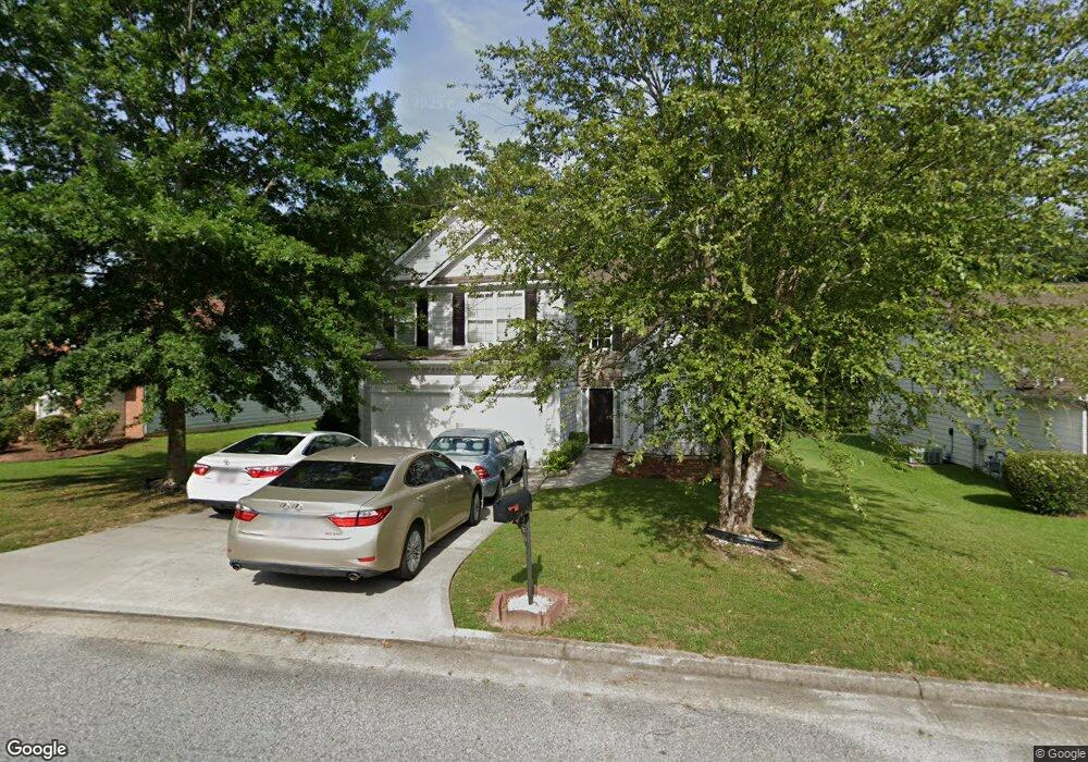
8261 Eastshore Dr Unit IB Union City, GA 30291
Estimated Value: $281,000 - $310,000
4
Beds
3
Baths
2,067
Sq Ft
$144/Sq Ft
Est. Value
About This Home
This home is located at 8261 Eastshore Dr Unit IB, Union City, GA 30291 and is currently estimated at $297,321, approximately $143 per square foot. 8261 Eastshore Dr Unit IB is a home located in Fulton County with nearby schools including Liberty Point Elementary School, Camp Creek Middle School, and Langston Hughes High School.
Ownership History
Date
Name
Owned For
Owner Type
Purchase Details
Closed on
Oct 31, 2002
Sold by
D R Horton Inc
Bought by
Chungong Belinda
Current Estimated Value
Home Financials for this Owner
Home Financials are based on the most recent Mortgage that was taken out on this home.
Original Mortgage
$166,247
Outstanding Balance
$70,299
Interest Rate
6.15%
Mortgage Type
FHA
Estimated Equity
$227,022
Create a Home Valuation Report for This Property
The Home Valuation Report is an in-depth analysis detailing your home's value as well as a comparison with similar homes in the area
Home Values in the Area
Average Home Value in this Area
Purchase History
| Date | Buyer | Sale Price | Title Company |
|---|---|---|---|
| Chungong Belinda | $167,600 | -- |
Source: Public Records
Mortgage History
| Date | Status | Borrower | Loan Amount |
|---|---|---|---|
| Open | Chungong Belinda | $166,247 |
Source: Public Records
Tax History Compared to Growth
Tax History
| Year | Tax Paid | Tax Assessment Tax Assessment Total Assessment is a certain percentage of the fair market value that is determined by local assessors to be the total taxable value of land and additions on the property. | Land | Improvement |
|---|---|---|---|---|
| 2025 | $1,353 | $113,680 | $22,080 | $91,600 |
| 2023 | $2,729 | $96,680 | $14,480 | $82,200 |
| 2022 | $1,394 | $96,680 | $14,480 | $82,200 |
| 2021 | $1,382 | $79,760 | $11,160 | $68,600 |
| 2020 | $1,293 | $66,400 | $9,000 | $57,400 |
| 2019 | $2,203 | $65,200 | $8,840 | $56,360 |
| 2018 | $1,288 | $57,720 | $8,120 | $49,600 |
| 2017 | $1,132 | $50,760 | $10,520 | $40,240 |
| 2016 | $1,131 | $50,760 | $10,520 | $40,240 |
| 2015 | $1,932 | $50,760 | $10,520 | $40,240 |
| 2014 | $677 | $34,840 | $7,040 | $27,800 |
Source: Public Records
Map
Nearby Homes
- 6320 Littleton Dr
- 0 Highpoint Rd Unit 10553938
- 000 Highpoint Rd
- 99 Highpoint Rd
- 4812 Station Dr Unit 2
- 4811 Station Dr Unit 35
- 3317 Stonewall Ln Unit 71
- Beaufort Plan at Stonewall Station
- Cecil Plan at The Enclave at Stonewall Station
- Nelson Plan at The Enclave at Stonewall Station
- Cooper Plan at Stonewall Station
- Cecil Plan at Stonewall Station
- Nelson Plan at Stonewall Station
- Kayla Plan at Stonewall Station
- 4837 Station Ln
- 4811 Station Ln
- 3318 Stonewall Ln
- 4813 Station Ln
- 4855 Station Ln
- 4818 Sandstone Ln Unit 5
- 8259 Eastshore Dr Unit 1
- 8263 Eastshore Dr
- 8257 Eastshore Dr
- E Eastshore Dr
- 8262 Eastshore Dr Unit I
- 8264 Eastshore Dr Unit I
- 8260 Eastshore Dr
- 8260 E Shore Dr
- 8255 Eastshore Dr Unit I
- 8258 Eastshore Dr
- 8256 Eastshore Dr Unit 1
- 8251 Eastshore Dr Unit I
- 8254 Eastshore Dr
- 8249 Eastshore Dr
- 8252 Eastshore Dr
- 8247 Eastshore Dr
- 5580 Valley Lake Rd
- 8250 Eastshore Dr
- 8245 Eastshore Dr
- 8248 Eastshore Dr