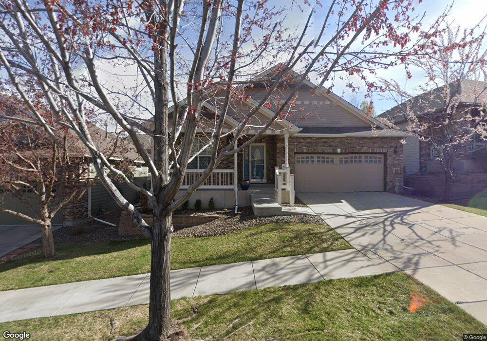
8266 W 67th Place Arvada, CO 80004
Scenic Heights NeighborhoodEstimated Value: $739,000 - $836,000
3
Beds
2
Baths
1,832
Sq Ft
$427/Sq Ft
Est. Value
About This Home
This home is located at 8266 W 67th Place, Arvada, CO 80004 and is currently estimated at $782,147, approximately $426 per square foot. 8266 W 67th Place is a home located in Jefferson County with nearby schools including Secrest Elementary School, Peck Elementary School, and Arvada K-8.
Ownership History
Date
Name
Owned For
Owner Type
Purchase Details
Closed on
Sep 15, 2022
Sold by
Mccall Trust
Bought by
Clark Peter W and Croteau Mark R
Current Estimated Value
Home Financials for this Owner
Home Financials are based on the most recent Mortgage that was taken out on this home.
Original Mortgage
$604,000
Outstanding Balance
$575,827
Interest Rate
4.99%
Mortgage Type
New Conventional
Estimated Equity
$206,320
Purchase Details
Closed on
Sep 12, 2013
Sold by
Mccall Michael R and Jean Mccall T
Bought by
Mccall Trust and Mccall Michael R
Purchase Details
Closed on
Nov 25, 2009
Sold by
Designer Homes Llc
Bought by
Mccall Michael R and Jean Mccall T
Home Financials for this Owner
Home Financials are based on the most recent Mortgage that was taken out on this home.
Original Mortgage
$260,000
Interest Rate
4.93%
Mortgage Type
New Conventional
Create a Home Valuation Report for This Property
The Home Valuation Report is an in-depth analysis detailing your home's value as well as a comparison with similar homes in the area
Home Values in the Area
Average Home Value in this Area
Purchase History
| Date | Buyer | Sale Price | Title Company |
|---|---|---|---|
| Clark Peter W | $755,000 | -- | |
| Mccall Trust | -- | None Available | |
| Mccall Michael R | $402,299 | Ticor Title |
Source: Public Records
Mortgage History
| Date | Status | Borrower | Loan Amount |
|---|---|---|---|
| Open | Clark Peter W | $604,000 | |
| Previous Owner | Mccall Michael R | $260,000 |
Source: Public Records
Tax History Compared to Growth
Tax History
| Year | Tax Paid | Tax Assessment Tax Assessment Total Assessment is a certain percentage of the fair market value that is determined by local assessors to be the total taxable value of land and additions on the property. | Land | Improvement |
|---|---|---|---|---|
| 2024 | $4,523 | $46,631 | $23,244 | $23,387 |
| 2023 | $4,523 | $46,631 | $23,244 | $23,387 |
| 2022 | $3,192 | $39,544 | $15,097 | $24,447 |
| 2021 | $3,245 | $40,682 | $15,532 | $25,150 |
| 2020 | $2,622 | $34,320 | $11,449 | $22,871 |
| 2019 | $3,267 | $34,320 | $11,449 | $22,871 |
| 2018 | $3,180 | $32,478 | $9,850 | $22,628 |
| 2017 | $2,911 | $32,478 | $9,850 | $22,628 |
| 2016 | $3,014 | $31,680 | $7,808 | $23,872 |
| 2015 | $3,153 | $31,680 | $7,808 | $23,872 |
| 2014 | $3,153 | $31,146 | $8,428 | $22,718 |
Source: Public Records
Map
Nearby Homes
- 8300 W 67th Ave
- 6801 Carr St
- 6780 Allison St
- 8090 W 68th Ave
- 6958 Brentwood Ct
- 6902 Ammons St
- 8612 W 69th Place
- 6463 Brentwood St
- 6409 Brentwood St
- 6355 Carr St
- 8306 W 71st Place
- 7769 W 70th Dr
- 7126 Dudley Dr
- 6438 Yarrow St
- 7555 W 69th Place
- 6685 Upham St
- 8571 W 71st Cir
- 9173 W 66th Place
- 8233 W 62nd Place
- 6455 Field St
- 8246 W 67th Place
- 8286 W 67th Place
- 8261 W 67th Dr
- 8241 W 67th Dr
- 8306 W 67th Place
- 8281 W 67th Dr
- 8226 W 67th Place
- 8221 W 67th Dr
- 8301 W 67th Dr
- 8265 W 67th Place
- 8245 W 67th Place
- 8206 W 67th Place
- 8225 W 67th Place
- 8305 W 67th Place
- 8201 W 67th Dr
- 8205 W 67th Place
- 8325 W 67th Place
- 8262 W 67th Dr
- 8242 W 67th Dr
- 8282 W 67th Dr