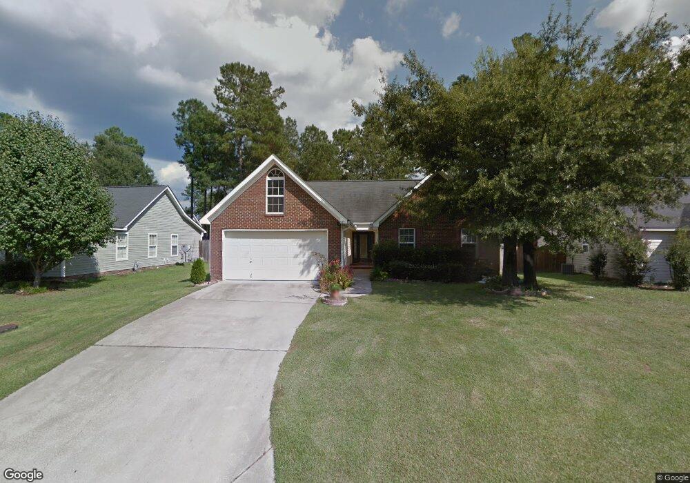
827 Burnside Dr Columbia, SC 29209
The Hamptons NeighborhoodEstimated Value: $241,000 - $259,000
3
Beds
2
Baths
1,506
Sq Ft
$167/Sq Ft
Est. Value
About This Home
This home is located at 827 Burnside Dr, Columbia, SC 29209 and is currently estimated at $251,895, approximately $167 per square foot. 827 Burnside Dr is a home located in Richland County with nearby schools including Meadowfield Elementary School, Hand Middle School, and Dreher High School.
Ownership History
Date
Name
Owned For
Owner Type
Purchase Details
Closed on
Feb 24, 2020
Sold by
Nguyen Hien Thanh T and Nguyen Bao Ngoc
Bought by
Jones James and Williams Tiffany
Current Estimated Value
Home Financials for this Owner
Home Financials are based on the most recent Mortgage that was taken out on this home.
Original Mortgage
$154,354
Outstanding Balance
$137,343
Interest Rate
3.75%
Mortgage Type
FHA
Estimated Equity
$114,552
Purchase Details
Closed on
Mar 20, 2002
Sold by
Mtm Construction Inc
Bought by
Nguyen Hien Thanh T and Nguyen Bao Ngoc
Home Financials for this Owner
Home Financials are based on the most recent Mortgage that was taken out on this home.
Original Mortgage
$109,000
Interest Rate
6.86%
Create a Home Valuation Report for This Property
The Home Valuation Report is an in-depth analysis detailing your home's value as well as a comparison with similar homes in the area
Home Values in the Area
Average Home Value in this Area
Purchase History
| Date | Buyer | Sale Price | Title Company |
|---|---|---|---|
| Jones James | $161,900 | None Available | |
| Nguyen Hien Thanh T | $121,500 | -- |
Source: Public Records
Mortgage History
| Date | Status | Borrower | Loan Amount |
|---|---|---|---|
| Open | Jones James | $154,354 | |
| Previous Owner | Nguyen Hien Thanh T | $109,000 |
Source: Public Records
Tax History Compared to Growth
Tax History
| Year | Tax Paid | Tax Assessment Tax Assessment Total Assessment is a certain percentage of the fair market value that is determined by local assessors to be the total taxable value of land and additions on the property. | Land | Improvement |
|---|---|---|---|---|
| 2024 | $1,285 | $186,200 | $0 | $0 |
| 2023 | $1,285 | $6,476 | $0 | $0 |
| 2022 | $1,175 | $161,900 | $25,000 | $136,900 |
| 2021 | $4,717 | $9,710 | $0 | $0 |
| 2020 | $1,233 | $6,240 | $0 | $0 |
| 2019 | $1,241 | $6,240 | $0 | $0 |
| 2018 | $1,102 | $5,420 | $0 | $0 |
| 2017 | $1,074 | $5,420 | $0 | $0 |
| 2016 | $1,035 | $5,420 | $0 | $0 |
| 2015 | -- | $5,420 | $0 | $0 |
| 2014 | $1,034 | $135,600 | $0 | $0 |
| 2013 | -- | $5,420 | $0 | $0 |
Source: Public Records
Map
Nearby Homes
- 509 Burnside Dr
- 755 Burnside Dr
- 811 Rockwood Rd
- 206 Hampton Forest Dr
- 404 Hampton Forest Dr
- 411 Hampton Forest Dr
- 513 Knollwood Dr
- 444 Cami Forest Ln
- 821 Walters Ln
- 1040 Coatesdale Rd
- 1284 Rockwood Rd
- 6627 Christie Rd
- 6603 Christie Rd
- 148 Cottage Lake Way
- 497 Galway Ln
- 6517 Macon Rd
- 813 Greenlawn Dr
- 174 Preston Green Dr
- 911 Fairwood Dr
- 225 E Lake Trail
- 831 Burnside Dr
- 823 Burnside Dr
- 539 Burnside Dr
- 835 Burnside Dr
- 819 Burnside Dr
- 535 Burnside Dr
- 543 Burnside Dr
- 531 Burnside Dr
- 547 Burnside Dr
- 839 Burnside Dr
- 527 Burnside Dr
- 551 Burnside Dr
- 843 Burnside Dr
- 809 Burnside Dr
- 523 Burnside Dr
- 555 Burnside Dr
- 546 Burnside Dr
- 546 Burnside Dr
- 538 Burnside Dr
- 534 Burnside Dr