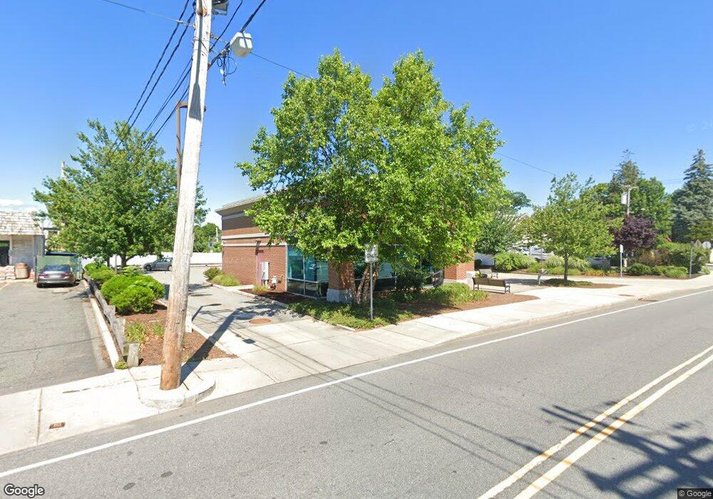
827 Highland Ave Needham, MA 02494
--
Bed
1
Bath
4,680
Sq Ft
0.47
Acres
About This Home
This home is located at 827 Highland Ave, Needham, MA 02494. 827 Highland Ave is a home located in Norfolk County with nearby schools including Eliot Elementary School, High Rock Middle School, and Pollard Middle School.
Ownership History
Date
Name
Owned For
Owner Type
Purchase Details
Closed on
Sep 9, 2004
Sold by
Mordav T T and Mordav Buckman
Bought by
Allied Capital Prop In
Purchase Details
Closed on
Oct 7, 1999
Sold by
Arra Charles
Bought by
Heights Rlty Corp
Home Financials for this Owner
Home Financials are based on the most recent Mortgage that was taken out on this home.
Original Mortgage
$0
Interest Rate
7.7%
Mortgage Type
Commercial
Create a Home Valuation Report for This Property
The Home Valuation Report is an in-depth analysis detailing your home's value as well as a comparison with similar homes in the area
Home Values in the Area
Average Home Value in this Area
Purchase History
| Date | Buyer | Sale Price | Title Company |
|---|---|---|---|
| Allied Capital Prop In | $1,382,758 | -- | |
| Allied Capital Prop In | $1,382,758 | -- | |
| Heights Rlty Corp | $430,000 | -- |
Source: Public Records
Mortgage History
| Date | Status | Borrower | Loan Amount |
|---|---|---|---|
| Open | Heights Rlty Corp | $1,260,000 | |
| Previous Owner | Heights Rlty Corp | $0 |
Source: Public Records
Tax History Compared to Growth
Tax History
| Year | Tax Paid | Tax Assessment Tax Assessment Total Assessment is a certain percentage of the fair market value that is determined by local assessors to be the total taxable value of land and additions on the property. | Land | Improvement |
|---|---|---|---|---|
| 2025 | $41,391 | $1,979,500 | $917,100 | $1,062,400 |
| 2024 | $31,167 | $1,268,500 | $760,200 | $508,300 |
| 2023 | $30,879 | $1,208,100 | $760,200 | $447,900 |
| 2022 | $31,930 | $1,208,100 | $760,200 | $447,900 |
| 2021 | $31,096 | $1,208,100 | $760,200 | $447,900 |
| 2020 | $29,656 | $1,208,000 | $169,700 | $1,038,300 |
| 2019 | $28,037 | $1,148,100 | $350,400 | $797,700 |
| 2018 | $25,747 | $1,097,500 | $350,400 | $747,100 |
| 2017 | $25,934 | $1,097,500 | $350,400 | $747,100 |
| 2016 | $23,708 | $1,029,900 | $350,400 | $679,500 |
| 2015 | $23,101 | $1,029,900 | $350,400 | $679,500 |
| 2014 | $23,677 | $1,029,900 | $358,500 | $671,400 |
Source: Public Records
Map
Nearby Homes
- 400 Hunnewell St Unit 103
- 39 Mark Lee Rd
- 379 Hunnewell St Unit 379
- 3 Crescent Rd
- 7 Avery St
- 445 Hillside Ave
- 35 Andrea Cir
- 100 Rosemary Way Unit 129
- 100 Rosemary Way Unit 324
- 36 Davenport Rd
- 34 Pershing Rd
- 556 Webster St
- 62 Evelyn Rd
- 12 Hill St
- 143 Hunting Rd
- 443 Central Ave
- 9 Jayne Rd
- 345 Central Ave
- 41 Lee Rd
- 98 Hunnewell St
- 817 Highland Ave
- 471 Hunnewell St Unit 7
- 471 Hunnewell St Unit 6
- 471 Hunnewell St Unit 5
- 471 Hunnewell St Unit 3
- 471 Hunnewell St Unit 4
- 471 Hunnewell St Unit 2nd floor
- 471 Hunnewell St Unit 1
- 471 Hunnewell St Unit 2
- 471 Hunnewell St
- 266 Hillside Ave
- 868 Highland Ave
- 868 Highland Ave Unit 201
- 868 Highland Ave Unit 202
- 17 Avery Square Unit 4
- 17 Avery Square Unit 3
- 17 Avery Square Unit D
- 17 Avery Square Unit D-1
- 17 Avery Square Unit G
- 17 Avery Square Unit 1B