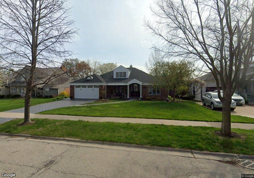
827 Windsor Rd Glenview, IL 60025
Estimated Value: $970,661 - $1,184,000
4
Beds
2
Baths
2,823
Sq Ft
$377/Sq Ft
Est. Value
About This Home
This home is located at 827 Windsor Rd, Glenview, IL 60025 and is currently estimated at $1,064,415, approximately $377 per square foot. 827 Windsor Rd is a home located in Cook County with nearby schools including Lyon Elementary School, Pleasant Ridge Elementary School, and Springman Middle School.
Ownership History
Date
Name
Owned For
Owner Type
Purchase Details
Closed on
Mar 13, 2024
Sold by
Mcmahon David J and Mcmahon Joanne
Bought by
David Mcmahon And Joanne Mcmahon Revocable Tr and Mcmahon
Current Estimated Value
Purchase Details
Closed on
Mar 25, 1994
Sold by
Nbd Bank
Bought by
Mcmahon David J and Mcmahon Joanne
Home Financials for this Owner
Home Financials are based on the most recent Mortgage that was taken out on this home.
Original Mortgage
$241,200
Interest Rate
7.27%
Create a Home Valuation Report for This Property
The Home Valuation Report is an in-depth analysis detailing your home's value as well as a comparison with similar homes in the area
Home Values in the Area
Average Home Value in this Area
Purchase History
| Date | Buyer | Sale Price | Title Company |
|---|---|---|---|
| David Mcmahon And Joanne Mcmahon Revocable Tr | -- | None Listed On Document | |
| Mcmahon David J | $179,333 | First American Title |
Source: Public Records
Mortgage History
| Date | Status | Borrower | Loan Amount |
|---|---|---|---|
| Previous Owner | Mcmahon David J | $241,200 |
Source: Public Records
Tax History
| Year | Tax Paid | Tax Assessment Tax Assessment Total Assessment is a certain percentage of the fair market value that is determined by local assessors to be the total taxable value of land and additions on the property. | Land | Improvement |
|---|---|---|---|---|
| 2025 | $16,964 | $106,000 | $19,926 | $86,074 |
| 2024 | $16,964 | $79,958 | $18,754 | $61,204 |
| 2023 | $17,117 | $79,958 | $18,754 | $61,204 |
| 2022 | $17,117 | $83,000 | $18,754 | $64,246 |
| 2021 | $14,748 | $62,585 | $14,065 | $48,520 |
| 2020 | $14,629 | $62,585 | $14,065 | $48,520 |
| 2019 | $13,630 | $68,775 | $14,065 | $54,710 |
| 2018 | $13,506 | $62,161 | $12,307 | $49,854 |
| 2017 | $13,160 | $62,161 | $12,307 | $49,854 |
| 2016 | $14,190 | $69,578 | $12,307 | $57,271 |
| 2015 | $11,788 | $52,122 | $9,962 | $42,160 |
| 2014 | $11,584 | $52,122 | $9,962 | $42,160 |
| 2013 | $11,218 | $52,122 | $9,962 | $42,160 |
Source: Public Records
Map
Nearby Homes
- 846 Wagner Rd
- 809 Lenox Rd
- 800 Glenview Rd
- 1115 Golfview Ln
- 1119 Longvalley Rd
- 411 Woodland Ct
- 821 Harms Rd
- 1041 Arbor Ln
- 1120 Raleigh Rd
- 623 Echo Ln
- 1123 Longvalley Rd
- 1121 Longvalley Rd
- 1431 Meadow Ln
- 1621 Glenview Rd Unit 225
- 1625 Glenview Rd Unit 103
- 1625 Glenview Rd Unit 207
- 711 Carriage Hill Dr
- 808 Indian Rd
- 1437 Sunset Ridge Rd
- 716 Indian Rd
Your Personal Tour Guide
Ask me questions while you tour the home.