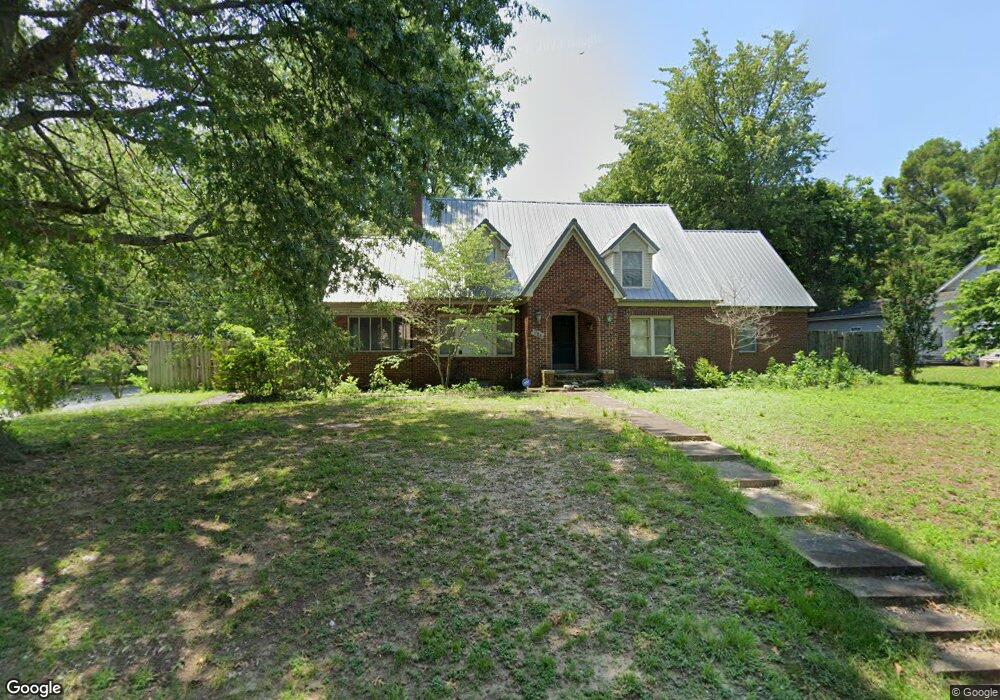
828 Mclain St Newport, AR 72112
Estimated Value: $142,000 - $193,421
--
Bed
2
Baths
2,573
Sq Ft
$64/Sq Ft
Est. Value
About This Home
This home is located at 828 Mclain St, Newport, AR 72112 and is currently estimated at $164,855, approximately $64 per square foot. 828 Mclain St is a home located in Jackson County with nearby schools including Newport Elementary School and Newport High School.
Ownership History
Date
Name
Owned For
Owner Type
Purchase Details
Closed on
Dec 4, 2013
Sold by
Montgomery James B and Montgomery Anthony Lee
Bought by
Montgomery E
Current Estimated Value
Home Financials for this Owner
Home Financials are based on the most recent Mortgage that was taken out on this home.
Original Mortgage
$105,102
Outstanding Balance
$78,557
Interest Rate
4.21%
Mortgage Type
New Conventional
Estimated Equity
$86,298
Purchase Details
Closed on
May 29, 2002
Bought by
Montgomery James B and Montgomery Lavile E
Purchase Details
Closed on
Dec 1, 1993
Bought by
Montgomery Anthony and Montgomery Frances
Create a Home Valuation Report for This Property
The Home Valuation Report is an in-depth analysis detailing your home's value as well as a comparison with similar homes in the area
Home Values in the Area
Average Home Value in this Area
Purchase History
| Date | Buyer | Sale Price | Title Company |
|---|---|---|---|
| Montgomery E | -- | -- | |
| Montgomery James B | $97,000 | -- | |
| Montgomery Anthony | $28,000 | -- |
Source: Public Records
Mortgage History
| Date | Status | Borrower | Loan Amount |
|---|---|---|---|
| Open | Montgomery E | $105,102 |
Source: Public Records
Tax History Compared to Growth
Tax History
| Year | Tax Paid | Tax Assessment Tax Assessment Total Assessment is a certain percentage of the fair market value that is determined by local assessors to be the total taxable value of land and additions on the property. | Land | Improvement |
|---|---|---|---|---|
| 2024 | $1,451 | $39,950 | $600 | $39,350 |
| 2023 | $1,319 | $25,360 | $1,000 | $24,360 |
| 2022 | $1,353 | $25,360 | $1,000 | $24,360 |
| 2021 | $1,321 | $25,360 | $1,000 | $24,360 |
| 2020 | $1,222 | $25,360 | $1,000 | $24,360 |
| 2019 | $1,123 | $25,360 | $1,000 | $24,360 |
| 2018 | $989 | $19,400 | $1,000 | $18,400 |
| 2017 | $989 | $19,400 | $1,000 | $18,400 |
| 2015 | -- | $19,400 | $1,000 | $18,400 |
| 2014 | -- | $19,400 | $1,000 | $18,400 |
| 2013 | -- | $16,770 | $1,000 | $15,770 |
| 2012 | -- | $16,770 | $1,000 | $15,770 |
Source: Public Records
Map
Nearby Homes
- 900 Josephine St
- 721 Mclain St
- 623 Holden Ave
- 604 Mclain St
- 900 Dill St
- 910 & 914 Dill St
- 208 Forrest Dr
- 000 Forrest Dr
- 318 Wilkerson Dr
- 0 Holmes St Unit 25033630
- 0 Holmes St Unit 25-486
- 1311 Dill St
- 1407 Dill St
- 2 Virginia Rd
- 4 Virginia Rd
- 203 Alice Ct
- 1714 Dill St
- 504 S State St
- 1801 Hines St
- 1900 Hines St