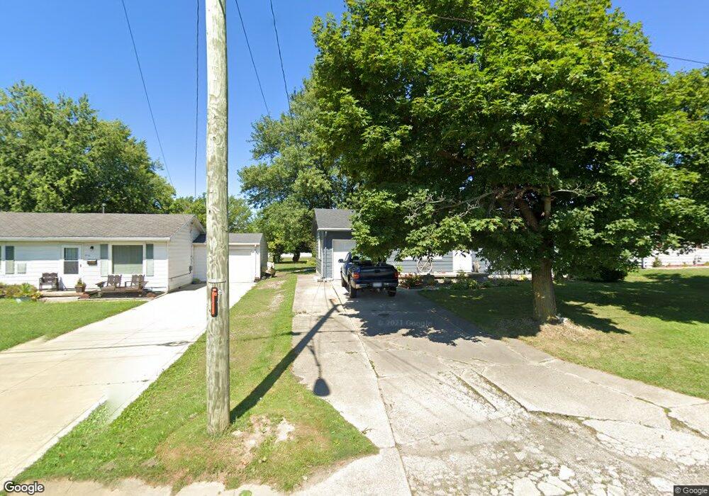
828 Mcpherson St Mansfield, OH 44903
Estimated Value: $66,000 - $112,000
2
Beds
2
Baths
960
Sq Ft
$88/Sq Ft
Est. Value
About This Home
This home is located at 828 Mcpherson St, Mansfield, OH 44903 and is currently estimated at $84,020, approximately $87 per square foot. 828 Mcpherson St is a home located in Richland County with nearby schools including Foundation Academy, Mansfield Elective Academy, and Goal Digital Academy.
Ownership History
Date
Name
Owned For
Owner Type
Purchase Details
Closed on
Sep 28, 2011
Sold by
Moorish Community Redevelopment Corporat
Bought by
Davalos Jesus E
Current Estimated Value
Purchase Details
Closed on
Aug 17, 2011
Sold by
Jpmorgan Chase Bank National Association
Bought by
The Moorish Community Redevelopment Corp
Purchase Details
Closed on
Oct 26, 2010
Sold by
Oden Alfred Eugene
Bought by
Jpmorgan Chase Bank National Association
Purchase Details
Closed on
Jul 26, 1993
Sold by
Crittenden Elzoina
Bought by
Coe James L
Purchase Details
Closed on
Apr 4, 1991
Bought by
Crittenden Elzoina
Create a Home Valuation Report for This Property
The Home Valuation Report is an in-depth analysis detailing your home's value as well as a comparison with similar homes in the area
Home Values in the Area
Average Home Value in this Area
Purchase History
| Date | Buyer | Sale Price | Title Company |
|---|---|---|---|
| Davalos Jesus E | $10,000 | Southern Title | |
| The Moorish Community Redevelopment Corp | -- | Diamond Title Co | |
| Jpmorgan Chase Bank National Association | $23,479 | None Available | |
| Coe James L | $22,000 | -- | |
| Crittenden Elzoina | -- | -- |
Source: Public Records
Tax History Compared to Growth
Tax History
| Year | Tax Paid | Tax Assessment Tax Assessment Total Assessment is a certain percentage of the fair market value that is determined by local assessors to be the total taxable value of land and additions on the property. | Land | Improvement |
|---|---|---|---|---|
| 2024 | $1,000 | $20,880 | $4,980 | $15,900 |
| 2023 | $1,000 | $20,880 | $4,980 | $15,900 |
| 2022 | $903 | $15,800 | $4,110 | $11,690 |
| 2021 | $909 | $15,800 | $4,110 | $11,690 |
| 2020 | $930 | $15,800 | $4,110 | $11,690 |
| 2019 | $1,030 | $15,800 | $4,110 | $11,690 |
| 2018 | $1,017 | $15,800 | $4,110 | $11,690 |
| 2017 | $989 | $15,800 | $4,110 | $11,690 |
| 2016 | $214 | $3,320 | $980 | $2,340 |
| 2015 | $214 | $3,320 | $980 | $2,340 |
| 2014 | $202 | $3,320 | $980 | $2,340 |
| 2012 | $197 | $3,490 | $1,030 | $2,460 |
Source: Public Records
Map
Nearby Homes
- 641 Averill Ave
- 0 State Route 314 Unit 9069650
- 0 State Route 314 Unit 9067316
- 0 State Route 314 Unit 225021979
- 741 Burger Ave
- 340 Boston Ave
- 269 Parkway Dr
- 0 W Fourth St - Trimble Lenox
- 512 Burns St
- 170 Western Ave
- 480 Mcpherson St
- 237 Helen Ave
- 1168 & 1171 Seminole Ave
- 1169 Seminole Ave
- 0 Highway 30
- 450 Tracy St
- 426 Mcpherson St
- 874 Fairfax Ave
- 876 Fairfax Ave
- 185 Rowland Ave
- 836 Mcpherson St
- 822 Mcpherson St
- 842 Mcpherson St
- 816 Mcpherson St
- 831 Burns St
- 823 Burns St
- 837 Burns St
- 812 Mcpherson St
- 848 Mcpherson St
- 835 Mcpherson St
- 815 Burns St
- 841 Mcpherson St
- 843 Burns St
- 797 Floral Ct
- 856 Mcpherson St
- 808 Mcpherson St
- 851 Burns St
- 809 Mcpherson St
- 847 Mcpherson St
- 862 Mcpherson St