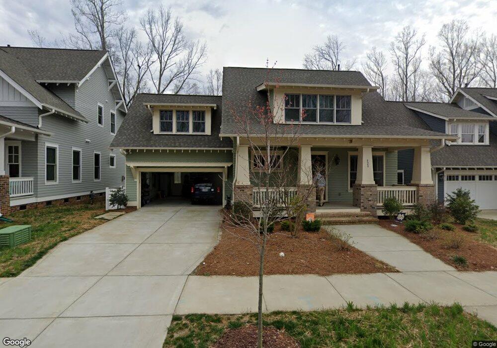
828 Patrick Johnston Ln Davidson, NC 28036
Estimated Value: $1,172,000 - $1,691,000
5
Beds
6
Baths
3,428
Sq Ft
$396/Sq Ft
Est. Value
About This Home
This home is located at 828 Patrick Johnston Ln, Davidson, NC 28036 and is currently estimated at $1,358,205, approximately $396 per square foot. 828 Patrick Johnston Ln is a home located in Mecklenburg County with nearby schools including Davidson Elementary School, William Amos Hough High School, and Davidson Green School.
Ownership History
Date
Name
Owned For
Owner Type
Purchase Details
Closed on
Jun 2, 2017
Sold by
Jcb Urban Company
Bought by
Sass Erik and Sass Margaret T
Current Estimated Value
Home Financials for this Owner
Home Financials are based on the most recent Mortgage that was taken out on this home.
Original Mortgage
$699,000
Outstanding Balance
$580,624
Interest Rate
3.97%
Mortgage Type
New Conventional
Estimated Equity
$777,581
Create a Home Valuation Report for This Property
The Home Valuation Report is an in-depth analysis detailing your home's value as well as a comparison with similar homes in the area
Home Values in the Area
Average Home Value in this Area
Purchase History
| Date | Buyer | Sale Price | Title Company |
|---|---|---|---|
| Sass Erik | $699,000 | None Available |
Source: Public Records
Mortgage History
| Date | Status | Borrower | Loan Amount |
|---|---|---|---|
| Open | Sass Erik | $699,000 |
Source: Public Records
Tax History
| Year | Tax Paid | Tax Assessment Tax Assessment Total Assessment is a certain percentage of the fair market value that is determined by local assessors to be the total taxable value of land and additions on the property. | Land | Improvement |
|---|---|---|---|---|
| 2025 | $6,387 | $978,800 | $250,000 | $728,800 |
| 2024 | $6,387 | $846,000 | $250,000 | $596,000 |
| 2023 | $6,297 | $846,000 | $250,000 | $596,000 |
| 2022 | $6,411 | $676,500 | $300,000 | $376,500 |
| 2021 | $6,376 | $676,500 | $300,000 | $376,500 |
| 2020 | $6,376 | $676,500 | $300,000 | $376,500 |
| 2019 | $6,370 | $676,500 | $300,000 | $376,500 |
| 2018 | $6,186 | $393,800 | $120,000 | $273,800 |
| 2017 | $4,591 | $393,800 | $120,000 | $273,800 |
Source: Public Records
Map
Nearby Homes
- 606 Ardrey Cir
- 239 Kimberly Rd
- 1016 Concord Rd
- 12309 Westbranch Pkwy
- 1425 Samuel Spencer Pkwy Unit 5
- 866 Concord Rd
- 1400 Samuel Spencer Pkwy
- 1413 Samuel Spencer Pkwy Unit 3
- 131 Morrison Hill Rd
- 130 Copper Pine Ln Unit 1
- 129 Hunt Camp Trail Unit 15
- 136 Spencer St
- 11916 Westbranch Pkwy
- 1418 Samuel Spencer Pkwy
- 11826 Westbranch Pkwy
- 1430 Samuel Spencer Pkwy Unit 13
- 100 Martin St
- 233 Twain Ave
- 757 Concord Rd
- 306 Ashby Dr
- 824 Patrick Johnston Ln
- 824 Patrick Johnston Ln Unit 30
- 832 Patrick Johnston Ln Unit 32
- 820 Patrick Johnston Ln Unit 29
- 836 Patrick Johnston Ln Unit 33
- 836 Patrick Johnston Ln
- 817 Patrick Johnston Ln Unit 1
- 816 Patrick Johnston Ln
- 809 Patrick Johnston Ln Unit 2
- 812 Patrick Johnston Ln
- 560 Pine Rd
- 906 Patrick Johnston Ln
- 801 Patrick Johnston Ln Unit 3
- 808 Patrick Johnston Ln
- 901 Patrick Johnston Ln
- 548 Pine Rd
- 804 Patrick Johnston Ln Unit 25
- 727 Patrick Johnston Ln
- 727 Patrick Johnston Ln Unit 4
- 800 Patrick Johnston Ln Unit 24
Your Personal Tour Guide
Ask me questions while you tour the home.