Estimated Value: $493,000 - $654,000
5
Beds
5
Baths
3,602
Sq Ft
$158/Sq Ft
Est. Value
About This Home
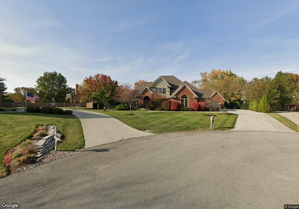
This home is located at 828 Tiqua Trail, Lima, OH 45805 and is currently estimated at $567,932, approximately $157 per square foot. 828 Tiqua Trail is a home located in Allen County with nearby schools including Maplewood Elementary School, Elmwood Elementary School, and Shawnee Middle School.
Ownership History
Date
Name
Owned For
Owner Type
Purchase Details
Closed on
Jan 7, 1999
Sold by
Pugin Carl
Bought by
Briggs Robin
Current Estimated Value
Home Financials for this Owner
Home Financials are based on the most recent Mortgage that was taken out on this home.
Original Mortgage
$288,000
Interest Rate
6.83%
Mortgage Type
New Conventional
Purchase Details
Closed on
Mar 17, 1998
Sold by
Indianbrook West Co
Bought by
Pugin Carl and Pugin Jennifer
Purchase Details
Closed on
Jan 1, 1990
Bought by
Indianbrook West Company
Create a Home Valuation Report for This Property
The Home Valuation Report is an in-depth analysis detailing your home's value as well as a comparison with similar homes in the area
Purchase History
We collect this data history from publicly available records. To have your information removed, we recommend requesting removal directly through your county’s website.
| Date | Buyer | Sale Price | Title Company |
|---|---|---|---|
| Briggs Robin | $308,912 | -- | |
| Pugin Carl | $23,850 | -- | |
| Indianbrook West Company | -- | -- |
Source: Public Records
Mortgage History
We collect this data history from publicly available records. To have your information removed, we recommend requesting removal directly through your county’s website.
| Date | Status | Borrower | Loan Amount |
|---|---|---|---|
| Previous Owner | Briggs Robin | $288,000 |
Source: Public Records
Tax History
| Year | Tax Paid | Tax Assessment Tax Assessment Total Assessment is a certain percentage of the fair market value that is determined by local assessors to be the total taxable value of land and additions on the property. | Land | Improvement |
|---|---|---|---|---|
| 2025 | $9,552 | $189,040 | $16,520 | $172,520 |
| 2024 | $9,425 | $189,040 | $16,520 | $172,520 |
| 2023 | $8,767 | $154,950 | $13,550 | $141,400 |
| 2022 | $8,814 | $154,950 | $13,550 | $141,400 |
| 2021 | $8,671 | $154,950 | $13,550 | $141,400 |
| 2020 | $6,167 | $127,510 | $12,990 | $114,520 |
| 2019 | $6,167 | $127,510 | $12,990 | $114,520 |
| 2018 | $6,159 | $127,510 | $12,990 | $114,520 |
| 2017 | $6,071 | $122,050 | $12,990 | $109,060 |
| 2016 | $6,006 | $122,160 | $12,990 | $109,170 |
| 2015 | $6,605 | $122,160 | $12,990 | $109,170 |
| 2014 | $6,605 | $132,660 | $11,940 | $120,720 |
| 2013 | $6,478 | $132,660 | $11,940 | $120,720 |
Source: Public Records
Map
Nearby Homes
- 849 Yakima Trail
- 4875 Wenatchi Trail
- 845 Atalan Trail
- 128 Tolowa Trail
- 4095 Spencerville Rd
- 4848 W Elm St
- 00 Seriff
- 1455 Riverview Dr
- 1515 Riverview Dr
- 123 Eagles Point W
- 110 Eagles Point St W
- 1540 Adak Ave
- 0 Springview Dr
- 3462 Makley Dr
- 1452 W Shore Dr
- 2350 S Wapakoneta Rd
- 2910 Koop Rd
- 3071 Canterbury Dr
- 3055 Clinton Way
- 000 N Stevick Rd
- 850 Tiqua Trail
- 4632 Abnaki Trail
- 843 Hokan Trail
- 819 Hokan Trail
- 4654 Abnaki Trail
- 849 Tiqua Trail
- 827 Tiqua Trail
- 4604 Abnaki Trail
- 4625 Wenatchie Trail
- 4651 Wenatchie Trail
- 4635 Abnaki Trail
- 4625 Wenatchi Trail
- 4651 Wenatchi Trail
- 4613 Abnaki Trail
- 876 Hokan Trail
- 4649 Abnaki Trail
- 844 Hokan Trail
- 4609 Wenatchie Trail
- 4609 Wenatchie Trail
- 820 Hokan Trail
Your Personal Tour Guide
Ask me questions while you tour the home.