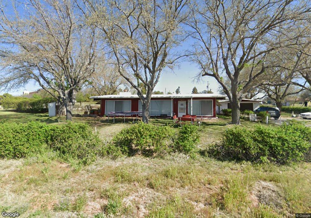
828 W Apache Trail Camp Verde, AZ 86322
Estimated Value: $418,117 - $535,000
Studio
--
Bath
2,061
Sq Ft
$232/Sq Ft
Est. Value
About This Home
This home is located at 828 W Apache Trail, Camp Verde, AZ 86322 and is currently estimated at $479,029, approximately $232 per square foot. 828 W Apache Trail is a home located in Yavapai County with nearby schools including Camp Verde Elementary School, Camp Verde Middle School, and Camp Verde High School.
Ownership History
Date
Name
Owned For
Owner Type
Purchase Details
Closed on
Dec 11, 2025
Sold by
Peterson George Marcus and George Marcus Peterson Family Revocable
Bought by
Peterson George Marcus
Current Estimated Value
Home Financials for this Owner
Home Financials are based on the most recent Mortgage that was taken out on this home.
Original Mortgage
$100,000
Outstanding Balance
$99,809
Interest Rate
6.22%
Mortgage Type
Credit Line Revolving
Estimated Equity
$379,220
Purchase Details
Closed on
Nov 30, 2006
Sold by
Peterson Linda L and Peterson George Marcus
Bought by
Peterson Linda Louise and Peterson George Marcus
Create a Home Valuation Report for This Property
The Home Valuation Report is an in-depth analysis detailing your home's value as well as a comparison with similar homes in the area
Home Values in the Area
Average Home Value in this Area
Purchase History
| Date | Buyer | Sale Price | Title Company |
|---|---|---|---|
| Peterson George Marcus | -- | Pioneer Title | |
| Peterson Linda Louise | -- | None Available |
Source: Public Records
Mortgage History
| Date | Status | Borrower | Loan Amount |
|---|---|---|---|
| Open | Peterson George Marcus | $100,000 |
Source: Public Records
Tax History
| Year | Tax Paid | Tax Assessment Tax Assessment Total Assessment is a certain percentage of the fair market value that is determined by local assessors to be the total taxable value of land and additions on the property. | Land | Improvement |
|---|---|---|---|---|
| 2026 | $1,775 | $36,221 | -- | -- |
| 2024 | $1,716 | $35,389 | -- | -- |
| 2023 | $1,716 | $30,285 | $8,130 | $22,155 |
| 2022 | $1,617 | $23,734 | $5,206 | $18,528 |
| 2021 | $1,681 | $23,621 | $6,757 | $16,864 |
| 2020 | $1,622 | $0 | $0 | $0 |
| 2019 | $1,587 | $0 | $0 | $0 |
| 2018 | $1,533 | $0 | $0 | $0 |
| 2017 | $1,453 | $0 | $0 | $0 |
| 2016 | $1,397 | $0 | $0 | $0 |
| 2015 | -- | $0 | $0 | $0 |
| 2014 | -- | $0 | $0 | $0 |
Source: Public Records
Map
Nearby Homes
- 740 W Buffalo Trail Unit 99
- 1012 W Apache Trail
- 1652 Montezuma Heights Rd
- 425 W Mesa Ln
- 1153 N Esther Pkwy
- 1733 N Arena Del Loma Rd
- 1645 N Rustler Trail Unit 45
- 874 Industrial Dr
- 2200 N Mooney Ln
- 1183 W White Hawk Dr
- 0 S Spencer Trail Unit 6928264
- 0000 Industrial Dr
- 547 N Montezuma Castle Hwy
- 2480 N Arena Del Loma
- 1835 W State Route 260 --
- 803 Industrial Dr
- 1496 W Horseshoe Bend Dr
- 0 Homestead Pkwy
- 1487 W Horseshoe Bend Dr Unit 47
- 1487 W Horseshoe Bend Dr Unit 4
Your Personal Tour Guide
Ask me questions while you tour the home.