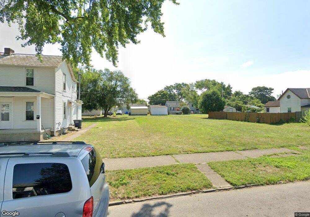
828 Washington Ave Lancaster, OH 43130
Estimated Value: $36,000
2
Beds
1
Bath
1,188
Sq Ft
$30/Sq Ft
Est. Value
About This Home
This home is located at 828 Washington Ave, Lancaster, OH 43130 and is currently estimated at $36,000, approximately $30 per square foot. 828 Washington Ave is a home located in Fairfield County with nearby schools including General Sherman Junior High School, Lancaster High School, and St Mary Elementary School.
Ownership History
Date
Name
Owned For
Owner Type
Purchase Details
Closed on
Sep 27, 2024
Sold by
Lancaster Port Authority
Bought by
Cks Real Estate Group Llc
Current Estimated Value
Purchase Details
Closed on
Jul 22, 2024
Sold by
V Daniel Bright Revocable Trust and Daniel Bright V
Bought by
Lancaster Port Authority
Purchase Details
Closed on
Aug 11, 2023
Sold by
4Tc Properties Lancaster Llc
Bought by
V Daniel Bright Revocable Trust and Bright
Purchase Details
Closed on
Feb 23, 2023
Sold by
Lancaster Port Authority
Bought by
4Tc Properties Lancaster Llc
Purchase Details
Closed on
Oct 31, 2022
Sold by
Fairfield County Land Reutilization Corp
Bought by
Lancaster Port Authority
Purchase Details
Closed on
Nov 14, 2018
Sold by
Saunders Danny
Bought by
The Fairfield County Land Reutilization
Purchase Details
Closed on
Mar 1, 1991
Create a Home Valuation Report for This Property
The Home Valuation Report is an in-depth analysis detailing your home's value as well as a comparison with similar homes in the area
Home Values in the Area
Average Home Value in this Area
Purchase History
| Date | Buyer | Sale Price | Title Company |
|---|---|---|---|
| Cks Real Estate Group Llc | -- | None Listed On Document | |
| Cks Real Estate Group Llc | -- | None Listed On Document | |
| Lancaster Port Authority | -- | None Listed On Document | |
| V Daniel Bright Revocable Trust | $10,000 | None Listed On Document | |
| 4Tc Properties Lancaster Llc | -- | -- | |
| Lancaster Port Authority | -- | -- | |
| The Fairfield County Land Reutilization | -- | None Available | |
| -- | $30,300 | -- |
Source: Public Records
Tax History Compared to Growth
Tax History
| Year | Tax Paid | Tax Assessment Tax Assessment Total Assessment is a certain percentage of the fair market value that is determined by local assessors to be the total taxable value of land and additions on the property. | Land | Improvement |
|---|---|---|---|---|
| 2024 | $523 | $5,820 | $5,820 | -- |
| 2023 | $270 | $5,820 | $5,820 | -- |
| 2022 | $46 | $5,820 | $5,820 | $0 |
| 2021 | $46 | $5,820 | $5,820 | $0 |
| 2020 | $46 | $5,820 | $5,820 | $0 |
| 2019 | $46 | $5,820 | $5,820 | $0 |
| 2018 | $239 | $5,820 | $5,820 | $0 |
| 2017 | $239 | $5,820 | $5,820 | $0 |
| 2016 | $227 | $5,820 | $5,820 | $0 |
| 2015 | $218 | $5,820 | $5,820 | $0 |
| 2014 | $208 | $5,820 | $5,820 | $0 |
| 2013 | $208 | $8,780 | $5,820 | $2,960 |
Source: Public Records
Map
Nearby Homes
- 844 Washington Ave
- 815 Beacon St
- 953 Garfield Ave
- 1000 Goodwin Ave
- 1410 W Fair Ave
- 525 N Zane Ave
- 429 Harrison Ave
- 404 Garfield Ave
- 1125 Olds Ave
- 1318 Graf St
- 315 Park St
- 0 Marks Ave Unit 225036443
- 517 Busby Ave
- 224 Harrison Ave
- 215 Harrison Ave
- 222 Park St
- 238 N George St
- 539 N Ohio Ave
- 552 Summitview Dr
- 0 Wacker Dr Unit 225036189
- 824 Washington Ave
- 830 Washington Ave
- 840 Washington Ave
- 820 Washington Ave
- 842 Washington Ave
- 816 Washington Ave
- 827 Washington Ave
- 831 Washington Ave
- 823 Washington Ave
- 817 Washington Ave
- 812 Washington Ave
- 825 Harrison Ave
- 823 Harrison Ave
- 835 Harrison Ave
- 813 Washington Ave
- 819 Harrison Ave
- 839 Harrison Ave
- 806 Washington Ave
- 815 Harrison Ave
- 831 Harrison Ave