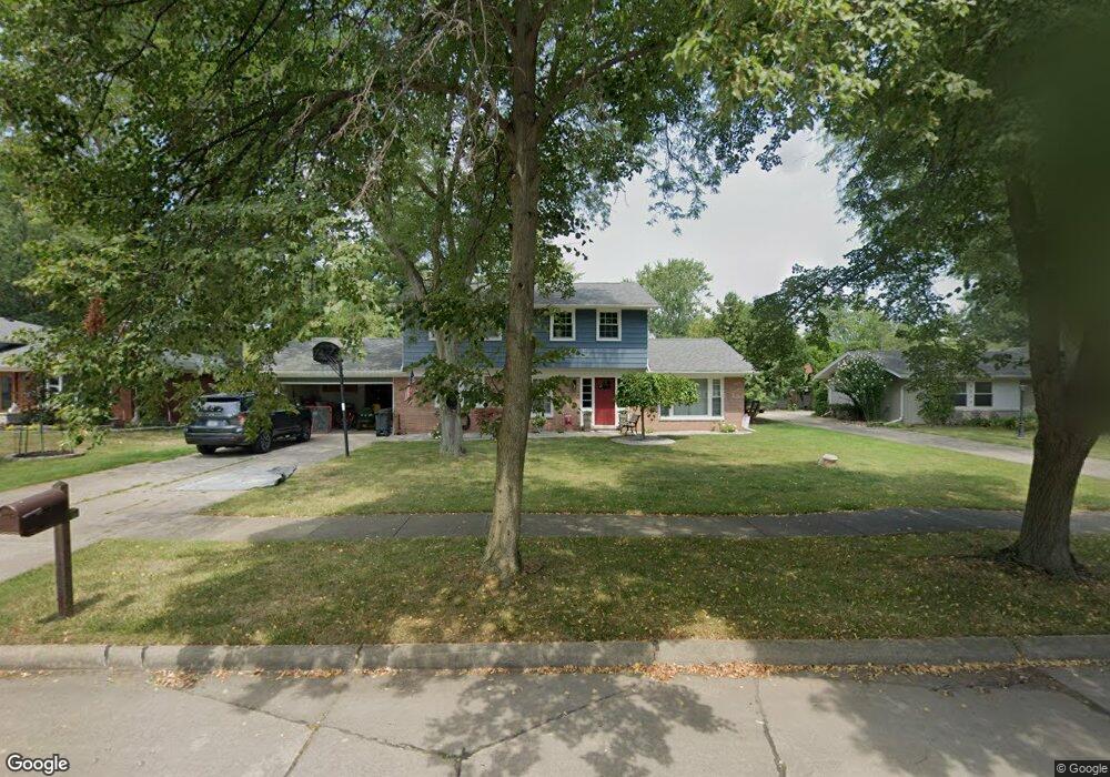
8284 Burning Bush Rd Unit Bldg-Unit Grosse Ile, MI 48138
Estimated Value: $338,000 - $403,000
Studio
3
Baths
2,229
Sq Ft
$166/Sq Ft
Est. Value
About This Home
This home is located at 8284 Burning Bush Rd Unit Bldg-Unit, Grosse Ile, MI 48138 and is currently estimated at $371,110, approximately $166 per square foot. 8284 Burning Bush Rd Unit Bldg-Unit is a home located in Wayne County.
Ownership History
Date
Name
Owned For
Owner Type
Purchase Details
Closed on
Jul 2, 2018
Sold by
Marques Dias Martha and Guglielmetti Miguel
Bought by
Chappel Kimberley K
Current Estimated Value
Purchase Details
Closed on
Nov 15, 2007
Sold by
Mortgage Electronic Registration Systems
Bought by
Wachovia Bank Na
Purchase Details
Closed on
Sep 26, 2007
Sold by
Zion Sharif Abdo and Zion Sharif
Bought by
Mortgage Electronic Registration Systems
Purchase Details
Closed on
Dec 20, 2006
Sold by
Sobh Nada and Bazzi Kassem
Bought by
Zion Sharif Abdo
Home Financials for this Owner
Home Financials are based on the most recent Mortgage that was taken out on this home.
Original Mortgage
$77,000
Interest Rate
6.24%
Mortgage Type
Stand Alone Second
Create a Home Valuation Report for This Property
The Home Valuation Report is an in-depth analysis detailing your home's value as well as a comparison with similar homes in the area
Home Values in the Area
Average Home Value in this Area
Purchase History
| Date | Buyer | Sale Price | Title Company |
|---|---|---|---|
| Chappel Kimberley K | $177,600 | Michigan Title Ins Agency In | |
| Wachovia Bank Na | -- | Michigan Title Insurance Age | |
| Mortgage Electronic Registration Systems | $323,655 | None Available | |
| Zion Sharif Abdo | $385,000 | Express Title Agency Inc |
Source: Public Records
Mortgage History
| Date | Status | Borrower | Loan Amount |
|---|---|---|---|
| Previous Owner | Zion Sharif Abdo | $77,000 | |
| Previous Owner | Zion Sharif Abdo | $308,000 |
Source: Public Records
Tax History
| Year | Tax Paid | Tax Assessment Tax Assessment Total Assessment is a certain percentage of the fair market value that is determined by local assessors to be the total taxable value of land and additions on the property. | Land | Improvement |
|---|---|---|---|---|
| 2025 | $1,868 | $161,400 | $0 | $0 |
| 2024 | $1,819 | $142,100 | $0 | $0 |
| 2023 | $2,080 | $130,300 | $0 | $0 |
| 2022 | $4,841 | $120,300 | $0 | $0 |
| 2021 | $4,631 | $118,500 | $0 | $0 |
| 2019 | $4,593 | $101,700 | $0 | $0 |
| 2018 | $2,415 | $100,800 | $0 | $0 |
| 2017 | $5,797 | $96,900 | $0 | $0 |
| 2016 | $5,256 | $96,500 | $0 | $0 |
| 2015 | $8,372 | $87,900 | $0 | $0 |
| 2013 | $8,110 | $84,500 | $0 | $0 |
| 2012 | $2,393 | $79,900 | $21,300 | $58,600 |
Source: Public Records
Map
Nearby Homes
- 21767 Knudsen Dr
- 21599 Parke Ln
- 7949 Church Rd
- 21527 Parke Ln
- 21524 Thorofare Rd
- 7806 Island Blvd
- 7761 Stout Ave
- 21774 E River Rd
- 21071 Thorofare Rd
- 22220 E River Rd
- 9281 Island Dr
- 20766 Hcl Jackson
- 9355 Highland Dr
- 9000 Ferry Rd
- 00000 Magnolia Ln
- VACANT Oriole Ave
- Lot 2 Bridge
- 9447 Whitall Ln
- 0 Ferry Rd Unit 20250033371
- 22238 Harlan Dr
- 8284 Burning Bush Rd
- 8268 Burning Bush Rd
- 8324 Burning Bush Rd
- 8252 Burning Bush Rd
- 8297 Hampton Rd
- 8283 Hampton Rd
- 8295 Burning Bush Rd
- 8411 Hampton Rd
- 8338 Burning Bush Rd
- 8273 Burning Bush Rd
- 8269 Hampton Rd
- 8236 Burning Bush Rd
- 8315 Burning Bush Rd
- 8253 Hampton Rd
- 8352 Burning Bush Rd
- 8439 Hampton Rd
- 21818 Canterbury Ave
- 21834 Canterbury Ave
- 8241 Hampton Rd
- 21798 Canterbury Ave
Your Personal Tour Guide
Ask me questions while you tour the home.