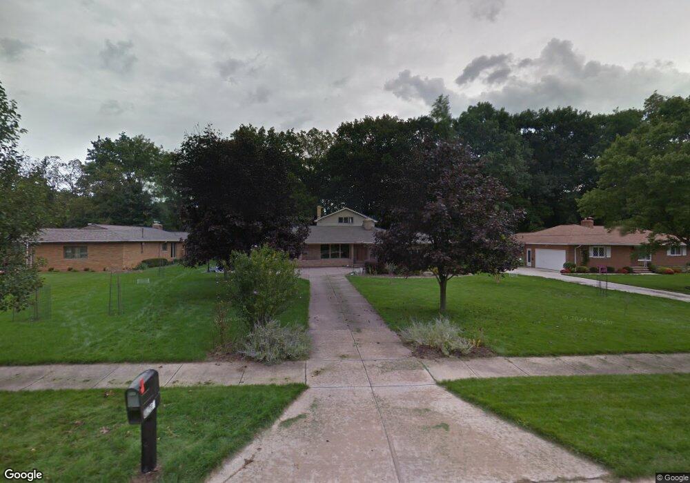
8285 Dalepoint Rd Independence, OH 44131
Estimated Value: $474,000 - $603,000
3
Beds
3
Baths
3,141
Sq Ft
$169/Sq Ft
Est. Value
About This Home
This home is located at 8285 Dalepoint Rd, Independence, OH 44131 and is currently estimated at $529,475, approximately $168 per square foot. 8285 Dalepoint Rd is a home located in Cuyahoga County with nearby schools including Independence Primary School, Independence Middle School, and Independence High School.
Ownership History
Date
Name
Owned For
Owner Type
Purchase Details
Closed on
May 24, 2000
Sold by
Giegel Harold R and Giegel Patricia A
Bought by
Welsh James and Welsh Eileen
Current Estimated Value
Home Financials for this Owner
Home Financials are based on the most recent Mortgage that was taken out on this home.
Original Mortgage
$212,500
Outstanding Balance
$73,624
Interest Rate
8.18%
Estimated Equity
$455,851
Purchase Details
Closed on
Mar 25, 1985
Sold by
Giegel Patricia A
Bought by
Harold R Giegel
Purchase Details
Closed on
Jan 1, 1975
Bought by
Giegel Patricia A
Create a Home Valuation Report for This Property
The Home Valuation Report is an in-depth analysis detailing your home's value as well as a comparison with similar homes in the area
Home Values in the Area
Average Home Value in this Area
Purchase History
| Date | Buyer | Sale Price | Title Company |
|---|---|---|---|
| Welsh James | $267,500 | -- | |
| Harold R Giegel | -- | -- | |
| Giegel Patricia A | -- | -- |
Source: Public Records
Mortgage History
| Date | Status | Borrower | Loan Amount |
|---|---|---|---|
| Open | Welsh James | $212,500 |
Source: Public Records
Tax History
| Year | Tax Paid | Tax Assessment Tax Assessment Total Assessment is a certain percentage of the fair market value that is determined by local assessors to be the total taxable value of land and additions on the property. | Land | Improvement |
|---|---|---|---|---|
| 2024 | $7,683 | $160,650 | $29,540 | $131,110 |
| 2023 | $5,530 | $105,070 | $20,650 | $84,420 |
| 2022 | $5,500 | $105,070 | $20,650 | $84,420 |
| 2021 | $5,420 | $105,070 | $20,650 | $84,420 |
| 2020 | $5,300 | $96,390 | $18,940 | $77,460 |
| 2019 | $5,116 | $275,400 | $54,100 | $221,300 |
| 2018 | $5,162 | $96,390 | $18,940 | $77,460 |
| 2017 | $5,313 | $95,620 | $17,290 | $78,330 |
| 2016 | $5,259 | $95,620 | $17,290 | $78,330 |
| 2015 | $4,867 | $95,620 | $17,290 | $78,330 |
| 2014 | $4,867 | $88,560 | $16,000 | $72,560 |
Source: Public Records
Map
Nearby Homes
- 6752 Rivercrest Dr
- 8001 Robin Ln
- SL 23 Kingscote Park
- 6626 Hawthorne Dr
- 7003 Brecksville Rd
- 7311 Brecksville Rd
- 6895 Carriage Hill Dr Unit E77
- 6930 Carriage Hill Dr Unit 101
- 6910 Carriage Hill Dr Unit 104
- 11004 Greenhaven Pkwy
- 6312 E Pleasant Valley Rd
- 6119 E Sprague Rd
- 8556 Brecksville Rd
- 8630 Hollis Ln
- 0 Winding Way
- 8712 Bradford Ln
- 9800 Gleeson Dr
- 8420 Stone Rd
- 6990 S Great Oaks Pkwy
- 8747 Fox Rest Dr
- 8265 Dalepoint Rd
- 8155 Dalepoint Rd
- 8180 Dalebrook Rd
- 8290 Dalepoint Rd
- 8130 Dalebrook Rd
- 8280 Dalepoint Rd
- 8226 Dalebrook Rd
- 8399 Dalepoint Rd
- 8117 Dalepoint Rd
- 8268 Dalepoint Rd
- 8274 Dalebrook Rd
- 8160 Dalepoint Rd
- 8411 Dalepoint Rd
- 8284 Dalebrook Rd
- 8128 Dalepoint Rd
- 8417 Dalepoint Rd
- 8324 Dalebrook Rd
- 8173 Dalebrook Rd
Your Personal Tour Guide
Ask me questions while you tour the home.