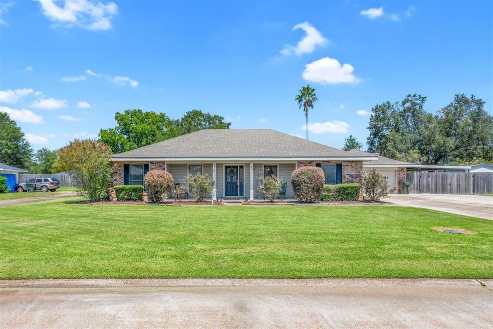
829 Rampart St Lake Charles, LA 70607
Estimated payment $1,598/month
Highlights
- Filtered Pool
- Updated Kitchen
- Lawn
- Dolby Elementary School Rated A-
- Granite Countertops
- No HOA
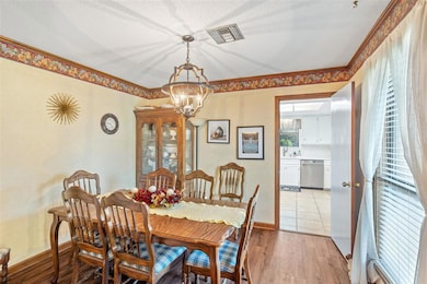
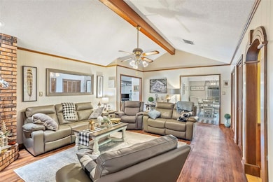
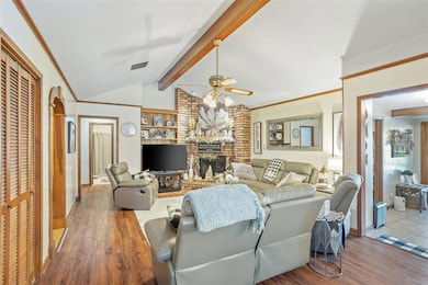
About This Home
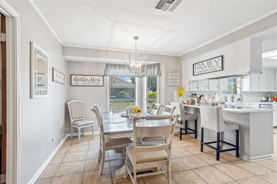
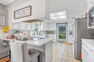
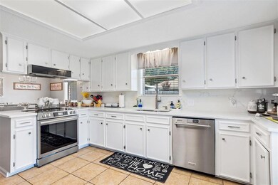
Welcome to this beautifully maintained single-family home offering 2,350 sq ft of comfortable living inside the city limits. Step inside to find an updated kitchen and bathrooms with modern finishes, a warm and inviting floor plan, and a cozy atmosphere that shows true pride of ownership. The recently renovated pool creates an ideal backyard retreat, ready for relaxation or entertaining. A massive driveway with multiple covered parking options, including a garage, provides exceptional convenience and space. This well-cared-for property combines location, updates, and lifestyle in one inviting package.
Home Details
Home Type
- Single Family
Est. Annual Taxes
- $917
Year Built
- 1983
Lot Details
- Lot Dimensions are 96.4 x 146.3 x 131.2 x 154
- Landscaped
- Rectangular Lot
- Lawn
- Garden
Home Design
- Slab Foundation
- Composition Roof
Interior Spaces
- 1-Story Property
- Crown Molding
- Beamed Ceilings
- Ceiling Fan
- Free Standing Fireplace
- Gas Fireplace
Kitchen
- Updated Kitchen
- Granite Countertops
Pool
- Filtered Pool
- In Ground Pool
- Fence Around Pool
Location
- City Lot
Utilities
- Forced Air Heating and Cooling System
- Natural Gas Connected
- Private Sewer
Community Details
- No Home Owners Association
- Subdivision Gulfgate
Listing and Financial Details
- Tax Block 2
Map
Home Values in the Area
Average Home Value in this Area
Tax History
| Year | Tax Paid | Tax Assessment Tax Assessment Total Assessment is a certain percentage of the fair market value that is determined by local assessors to be the total taxable value of land and additions on the property. | Land | Improvement |
|---|---|---|---|---|
| 2024 | $917 | $15,800 | $2,700 | $13,100 |
| 2023 | $917 | $15,800 | $2,700 | $13,100 |
| 2022 | $948 | $15,800 | $2,700 | $13,100 |
| 2021 | $730 | $15,800 | $2,700 | $13,100 |
| 2020 | $1,476 | $14,380 | $2,590 | $11,790 |
| 2019 | $1,635 | $15,600 | $2,500 | $13,100 |
| 2018 | $973 | $15,600 | $2,500 | $13,100 |
| 2017 | $1,648 | $15,600 | $2,500 | $13,100 |
| 2016 | $1,441 | $15,600 | $2,500 | $13,100 |
| 2015 | $1,441 | $13,730 | $4,220 | $9,510 |
Property History
| Date | Event | Price | List to Sale | Price per Sq Ft |
|---|---|---|---|---|
| 11/19/2025 11/19/25 | Pending | -- | -- | -- |
| 11/05/2025 11/05/25 | Price Changed | $289,000 | -3.5% | $123 / Sq Ft |
| 10/20/2025 10/20/25 | Price Changed | $299,500 | -0.8% | $127 / Sq Ft |
| 10/13/2025 10/13/25 | For Sale | $302,000 | 0.0% | $129 / Sq Ft |
| 10/01/2025 10/01/25 | Pending | -- | -- | -- |
| 09/12/2025 09/12/25 | Price Changed | $302,000 | -3.4% | $129 / Sq Ft |
| 08/27/2025 08/27/25 | For Sale | $312,500 | -- | $133 / Sq Ft |
Purchase History
| Date | Type | Sale Price | Title Company |
|---|---|---|---|
| Deed | $149,000 | None Available |
Mortgage History
| Date | Status | Loan Amount | Loan Type |
|---|---|---|---|
| Closed | $39,400 | New Conventional |
Source: Southwest Louisiana Association of REALTORS®
MLS Number: SWL25100809
APN: 00987298
- 730 Rampart St
- 856 Desoto St
- 805 Royal St
- 4823 Gentilly St
- 832 Desoto St
- 714 Rampart St
- 720 Royal St
- 4701 Desoto St
- 645 Esplanade St
- 0 Petro Point Dr
- 1750 Park Place Dr
- 0 Link Rd Unit SWL24005611
- 878 Link Rd
- 0 McNeese St Unit SWL22002762
- 0 Common St Unit SWL23007421
- 0 Common St Unit SWL25101034
- 0 Common St Unit SWL24003400
- 0 Common St Unit SWL25101838
- 0 Tallow Rd Unit SWL24005610
- 904 Mccall St
