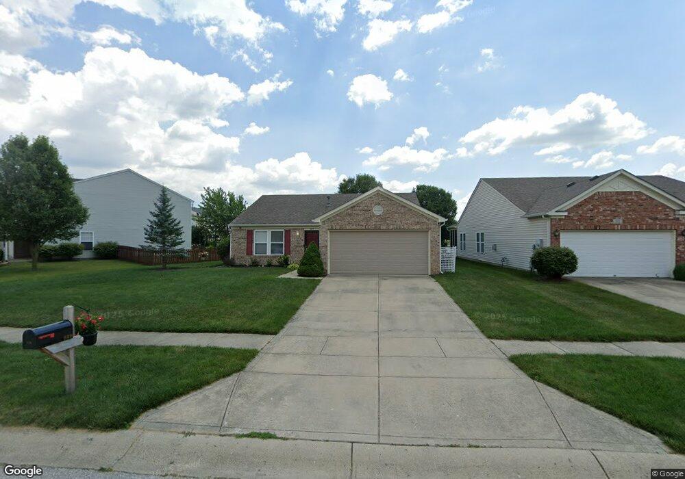
829 Sylvan St Whiteland, IN 46184
Estimated Value: $259,098 - $269,000
3
Beds
2
Baths
1,505
Sq Ft
$176/Sq Ft
Est. Value
About This Home
This home is located at 829 Sylvan St, Whiteland, IN 46184 and is currently estimated at $265,525, approximately $176 per square foot. 829 Sylvan St is a home located in Johnson County with nearby schools including Pleasant Crossing Elementary School, Clark-Pleasant Middle School, and Whiteland Community High School.
Ownership History
Date
Name
Owned For
Owner Type
Purchase Details
Closed on
Dec 30, 2010
Sold by
Speas Rob and Perkins Jeff
Bought by
Hawkins Robin D
Current Estimated Value
Home Financials for this Owner
Home Financials are based on the most recent Mortgage that was taken out on this home.
Original Mortgage
$96,002
Outstanding Balance
$66,902
Interest Rate
5.25%
Mortgage Type
FHA
Estimated Equity
$198,623
Purchase Details
Closed on
Aug 19, 2010
Sold by
Gilbert Kathy and Gilbert Tony
Bought by
Speas Rob and Perkins Jeff
Purchase Details
Closed on
Sep 29, 2005
Sold by
C P Morgan Communities L P
Bought by
Gilbert Kathy and Gilbert Tony
Home Financials for this Owner
Home Financials are based on the most recent Mortgage that was taken out on this home.
Original Mortgage
$125,700
Interest Rate
8.12%
Mortgage Type
Adjustable Rate Mortgage/ARM
Create a Home Valuation Report for This Property
The Home Valuation Report is an in-depth analysis detailing your home's value as well as a comparison with similar homes in the area
Home Values in the Area
Average Home Value in this Area
Purchase History
| Date | Buyer | Sale Price | Title Company |
|---|---|---|---|
| Hawkins Robin D | -- | Chicago Title | |
| Speas Rob | $67,000 | None Available | |
| Gilbert Kathy | -- | None Available |
Source: Public Records
Mortgage History
| Date | Status | Borrower | Loan Amount |
|---|---|---|---|
| Open | Hawkins Robin D | $96,002 | |
| Previous Owner | Gilbert Kathy | $125,700 |
Source: Public Records
Tax History Compared to Growth
Tax History
| Year | Tax Paid | Tax Assessment Tax Assessment Total Assessment is a certain percentage of the fair market value that is determined by local assessors to be the total taxable value of land and additions on the property. | Land | Improvement |
|---|---|---|---|---|
| 2025 | $2,350 | $228,800 | $56,000 | $172,800 |
| 2024 | $2,350 | $225,200 | $56,000 | $169,200 |
| 2023 | $2,298 | $220,900 | $56,000 | $164,900 |
| 2022 | $1,940 | $187,100 | $29,900 | $157,200 |
| 2021 | $1,658 | $159,700 | $29,900 | $129,800 |
| 2020 | $1,481 | $142,100 | $29,900 | $112,200 |
| 2019 | $1,364 | $131,100 | $29,900 | $101,200 |
| 2018 | $1,294 | $125,500 | $18,000 | $107,500 |
| 2017 | $1,295 | $128,500 | $18,000 | $110,500 |
| 2016 | $1,236 | $123,600 | $18,000 | $105,600 |
| 2014 | $1,051 | $106,500 | $22,000 | $84,500 |
| 2013 | $1,051 | $105,100 | $22,000 | $83,100 |
Source: Public Records
Map
Nearby Homes
- 577 Stobus Dr
- 3142 Hurst St
- 2916 Lodgepole Dr
- 2545 Wildflower Ln
- 3196 Underwood Dr
- 2489 Wildflower Ln
- 767 Mountain Pine Dr
- 2400 Grand Fir Dr
- 700 Mountain Pine Dr
- 2357 Grand Fir Dr
- 2418 Ashton Ln
- 2284 Blossom Dr
- 814 Cherry Tree Ln
- 2277 Maple Stone Ln
- 389 Springfield Cir
- 0 W Worthsville Rd
- 955 Garrison Dr
- 1986 Mccormick Dr
- 920 Talbert Rd
- 1059 Cherry Tree Ln