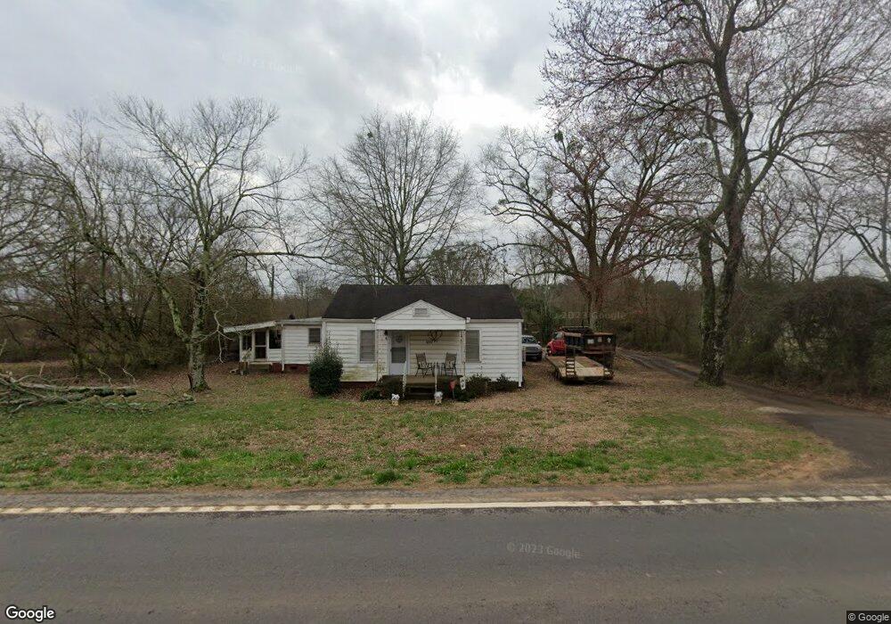
8293 Maysville Rd Maysville, GA 30558
Estimated Value: $329,000 - $397,000
--
Bed
2
Baths
1,440
Sq Ft
$252/Sq Ft
Est. Value
About This Home
This home is located at 8293 Maysville Rd, Maysville, GA 30558 and is currently estimated at $362,671, approximately $251 per square foot. 8293 Maysville Rd is a home located in Jackson County with nearby schools including Maysville Elementary School, East Jackson Middle School, and East Jackson Comprehensive High School.
Ownership History
Date
Name
Owned For
Owner Type
Purchase Details
Closed on
May 11, 2021
Sold by
Dunn Jd
Bought by
Dyer Paula Dianne and Dyer Robin Joel
Current Estimated Value
Purchase Details
Closed on
Aug 7, 2012
Sold by
Dyer Paula Dianne
Bought by
Dunn J D
Purchase Details
Closed on
Jan 21, 2005
Sold by
Dyer Robin
Bought by
Georgia Power Company
Purchase Details
Closed on
Nov 9, 2001
Sold by
Best Bruce F
Bought by
Dyer Robin
Create a Home Valuation Report for This Property
The Home Valuation Report is an in-depth analysis detailing your home's value as well as a comparison with similar homes in the area
Home Values in the Area
Average Home Value in this Area
Purchase History
| Date | Buyer | Sale Price | Title Company |
|---|---|---|---|
| Dyer Paula Dianne | -- | -- | |
| Dunn J D | $19,251 | -- | |
| Georgia Power Company | -- | -- | |
| Dyer Robin | $89,000 | -- |
Source: Public Records
Tax History Compared to Growth
Tax History
| Year | Tax Paid | Tax Assessment Tax Assessment Total Assessment is a certain percentage of the fair market value that is determined by local assessors to be the total taxable value of land and additions on the property. | Land | Improvement |
|---|---|---|---|---|
| 2024 | $2,317 | $133,160 | $84,920 | $48,240 |
| 2023 | $2,317 | $127,720 | $84,920 | $42,800 |
| 2022 | $883 | $62,800 | $28,880 | $33,920 |
| 2021 | $872 | $62,800 | $28,880 | $33,920 |
| 2020 | $738 | $56,280 | $28,880 | $27,400 |
| 2019 | $750 | $56,280 | $28,880 | $27,400 |
| 2018 | $721 | $55,000 | $28,880 | $26,120 |
| 2017 | $512 | $46,770 | $23,108 | $23,662 |
| 2016 | $518 | $46,770 | $23,108 | $23,662 |
| 2015 | $522 | $46,771 | $23,108 | $23,662 |
| 2014 | $513 | $45,952 | $23,108 | $22,844 |
| 2013 | -- | $45,952 | $23,108 | $22,844 |
Source: Public Records
Map
Nearby Homes
- 37 Meeks Rd
- 241 Sims St
- 16 Cora Way
- 129 Crane St
- 362 Sims St
- 0 Hunters Glen Unit 7657277
- 0 Hunters Glen Unit 10614427
- 127 Brevard St
- 108 Lillie Ln
- 82 Maywood Ct
- 382 Freeman Dr
- 56 W Ridgeway Rd
- 111 Park St
- 393 W Freeman St
- 500 W Freeman St
- 941 Eagle Heights Dr
- 942 Eagle Heights Dr
- 939 Eagle Heights Dr
- 8287 Maysville Rd
- 8325 Maysville Rd
- 8308 Maysville Rd
- 8373 Maysville Rd
- 8482 Maysville Rd
- 8430 Maysville Rd
- 9270 Highway 82 Spur
- 48 Meeks Rd
- 8847 Maysville Rd
- 9070 Highway 82 Spur
- 0 Meeks Rd
- 0 Meeks Rd Unit 7423321
- 0 Meeks Rd Unit 7048343
- 0 Meeks Rd Unit 7153173
- 0 Meeks Rd Unit 3019345
- 0 Meeks Rd Unit 8068163
- 8595 Maysville Rd
- 331 Meadow Lark Way
- 99 Chandler Cemetery Rd
- 8633 Maysville Rd