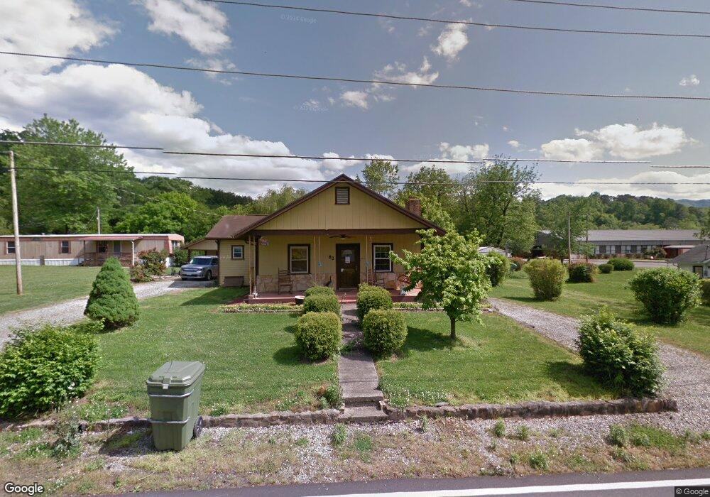
83 6th St Andrews, NC 28901
Estimated Value: $159,000 - $231,000
2
Beds
2
Baths
1,294
Sq Ft
$154/Sq Ft
Est. Value
About This Home
This home is located at 83 6th St, Andrews, NC 28901 and is currently estimated at $199,772, approximately $154 per square foot. 83 6th St is a home located in Cherokee County with nearby schools including Andrews Elementary School, Andrews Middle School, and Andrews High School.
Ownership History
Date
Name
Owned For
Owner Type
Purchase Details
Closed on
Jun 15, 2022
Sold by
Danielle Mccabe and Danielle Crystal
Bought by
Mccabe Gineva and Mccabe Crystal Danielle
Current Estimated Value
Home Financials for this Owner
Home Financials are based on the most recent Mortgage that was taken out on this home.
Original Mortgage
$96,662
Outstanding Balance
$91,958
Interest Rate
5.25%
Mortgage Type
FHA
Estimated Equity
$107,814
Purchase Details
Closed on
Dec 5, 2011
Sold by
Mccabe Constance K
Bought by
Mccabe George L and Mccabe Crystal Danielle
Create a Home Valuation Report for This Property
The Home Valuation Report is an in-depth analysis detailing your home's value as well as a comparison with similar homes in the area
Home Values in the Area
Average Home Value in this Area
Purchase History
| Date | Buyer | Sale Price | Title Company |
|---|---|---|---|
| Mccabe Gineva | -- | Cowan & Cowan Pa | |
| Mccabe George L | -- | None Available |
Source: Public Records
Mortgage History
| Date | Status | Borrower | Loan Amount |
|---|---|---|---|
| Open | Mccabe Gineva | $96,662 |
Source: Public Records
Tax History
| Year | Tax Paid | Tax Assessment Tax Assessment Total Assessment is a certain percentage of the fair market value that is determined by local assessors to be the total taxable value of land and additions on the property. | Land | Improvement |
|---|---|---|---|---|
| 2025 | $599 | $84,180 | $0 | $0 |
| 2024 | $6 | $84,180 | $0 | $0 |
| 2023 | $589 | $84,180 | $0 | $0 |
| 2022 | $589 | $84,180 | $0 | $0 |
| 2021 | $496 | $84,180 | $10,000 | $74,180 |
| 2020 | $462 | $84,180 | $0 | $0 |
| 2019 | $576 | $96,330 | $0 | $0 |
| 2018 | $576 | $96,330 | $0 | $0 |
| 2017 | $576 | $96,330 | $0 | $0 |
| 2016 | $576 | $96,330 | $0 | $0 |
| 2015 | $576 | $96,330 | $25,200 | $71,130 |
| 2012 | -- | $96,330 | $25,200 | $71,130 |
Source: Public Records
Map
Nearby Homes
- 215 Bristol Ave
- 000 Chestnut St
- 114 Sioux St
- 196 Johnson Ridge
- 45 Sulphur Ln
- 4.27 Upper Valley Ln
- 93 Collette St
- 96 Connaheta Ave
- 1194 Main St
- 270 Cover Ave
- 1229 Main St
- 60 Tarrent St
- 385 Aquone Rd
- 45 Caboose Creek Ln
- 00 U S 19
- 10.11 Valleytown Rd
- 0 Pisgah Rd
- 110 Fisher St
- 000 Holland Farm Rd
- 172 Eden Acres
Your Personal Tour Guide
Ask me questions while you tour the home.