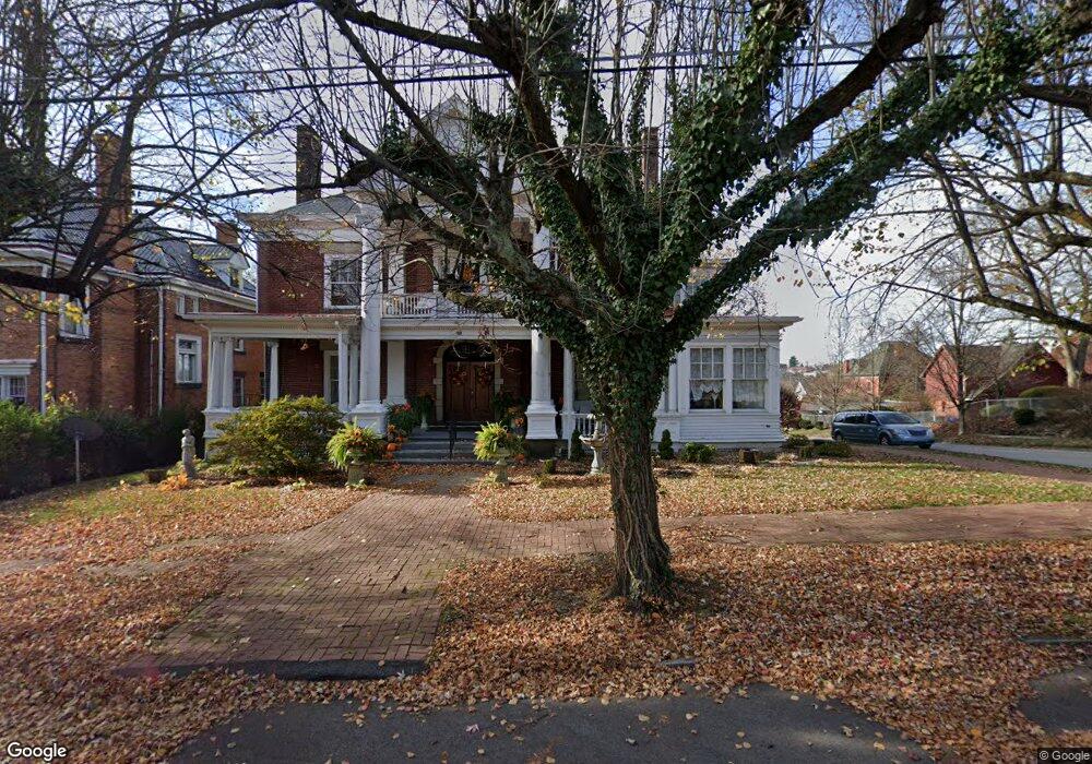
83 Ben Lomond St Uniontown, PA 15401
Estimated Value: $125,000 - $319,000
5
Beds
4
Baths
3,888
Sq Ft
$66/Sq Ft
Est. Value
About This Home
This home is located at 83 Ben Lomond St, Uniontown, PA 15401 and is currently estimated at $258,273, approximately $66 per square foot. 83 Ben Lomond St is a home located in Fayette County with nearby schools including Uniontown Area Senior High School, Chestnut Ridge Christian Academy, and St. John the Evangelist School.
Ownership History
Date
Name
Owned For
Owner Type
Purchase Details
Closed on
Aug 21, 2009
Sold by
First Federal Savings And Loan Associati
Bought by
Swaney Wayne G and Swaney Mary H
Current Estimated Value
Home Financials for this Owner
Home Financials are based on the most recent Mortgage that was taken out on this home.
Original Mortgage
$65,500
Outstanding Balance
$42,663
Interest Rate
5.19%
Mortgage Type
Purchase Money Mortgage
Estimated Equity
$215,610
Create a Home Valuation Report for This Property
The Home Valuation Report is an in-depth analysis detailing your home's value as well as a comparison with similar homes in the area
Home Values in the Area
Average Home Value in this Area
Purchase History
| Date | Buyer | Sale Price | Title Company |
|---|---|---|---|
| Swaney Wayne G | $69,000 | None Available |
Source: Public Records
Mortgage History
| Date | Status | Borrower | Loan Amount |
|---|---|---|---|
| Open | Swaney Wayne G | $65,500 |
Source: Public Records
Tax History Compared to Growth
Tax History
| Year | Tax Paid | Tax Assessment Tax Assessment Total Assessment is a certain percentage of the fair market value that is determined by local assessors to be the total taxable value of land and additions on the property. | Land | Improvement |
|---|---|---|---|---|
| 2025 | $3,063 | $81,495 | $7,620 | $73,875 |
| 2024 | $2,967 | $81,495 | $7,620 | $73,875 |
| 2023 | $5,934 | $81,495 | $7,620 | $73,875 |
| 2022 | $5,809 | $81,495 | $7,620 | $73,875 |
| 2021 | $5,809 | $81,495 | $7,620 | $73,875 |
| 2020 | $5,718 | $81,495 | $7,620 | $73,875 |
| 2019 | $5,436 | $81,495 | $7,620 | $73,875 |
| 2018 | $5,245 | $81,495 | $7,620 | $73,875 |
| 2017 | $5,245 | $81,495 | $7,620 | $73,875 |
| 2016 | -- | $81,495 | $7,620 | $73,875 |
| 2015 | -- | $81,495 | $7,620 | $73,875 |
| 2014 | -- | $162,990 | $15,240 | $147,750 |
Source: Public Records
Map
Nearby Homes
- 73 Ben Lomond St
- 25 Kay St
- 330 W Berkeley St
- 156 Stockton Ave
- 69 Princeton Ave
- 83 S Mount Vernon Ave
- 110 Moore Ave
- 75 Nutt Ave
- 92 Nutt Ave
- 0 Pittsburgh St
- 33 Mccormick Ave
- 120 Pittsburgh St
- 54 Downer Ave
- 2 Mccormick Ave
- 35 Phillipi Ave
- 43 Union St
- 206 Fairview St
- 39 Dunkard Ave
- 17 Summit Ave
- 40 Miller Ave
- 77 Ben Lomond St
- 95 Ben Lomond St
- 84 Ben Lomond St
- 67 Ben Lomond St
- 76 Ben Lomond St
- 101 Ben Lomond St
- 61 Ben Lomond St
- 72 Ben Lomond St
- 100 Ben Lomond St
- 107 Ben Lomond St
- 68 Ben Lomond St
- 232 W Main St
- 234 W Main St
- 55 Ben Lomond St
- 58 Nassau St
- 272 W Main St
- 111 Ben Lomond St
- 64 Ben Lomond St
- 284 W Main St
- 53 Ben Lomond St